

What are Isogonic Lines?
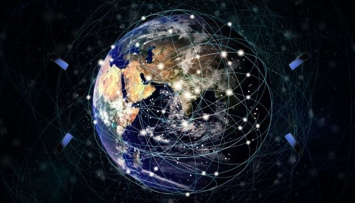
One of the most crucial cornerstones of the maritime sector is the realm of navigation. Irrespective of the vessel’s type, size, service, and so on, any marine traffic is rendered incomplete without the very important aspect of navigation and directionality.
In endless swathes of open seas or oceans, a very strong foundation of direction and real-time location of the vessel is indispensable to a seafarer.
In the aviation sector, it is equally important for a pilot to control the flight in the vast skies. Unlike roads, you do not have the advantage of looking at all the familiar landmarks and roads, or in today’s times, you solely rely on mobile application-based apps on your smartphones!
As ships are much older than planes, directionality in the earlier days was challenging. The very first mariners and sailors relied on the position of celestial bodies like the sun, moon, and stars to navigate their way through the vast and hostile seas in primitive wooden vessels.
However, soon after, the incredible advent of compasses came into the picture around the 11th and 12th centuries in both Eastern world and Western world countries; and this changed the maritime industry forever.
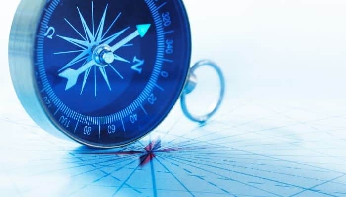
We are all familiar with magnetism and compasses since our school days. The compass utilises the Earth’s basic magnetism theory, where the Earth itself has an inherent magnetic field.
Currently, the earth’s magnetic field lines are from the southern hemisphere to the northern hemisphere. So, whenever you hold a compass, the end of the needle marked magnetic north point essentially in a direction opposite to the earth’s actual magnetic field, from south to north.

Thus, we can also say that the compass’s magnetic needle (north magnetic pole) points more or less towards the geographic north of the earth, which is nothing but the extreme tip of the North Pole, and the other end towards the geographic south (South Pole). Now, carefully note the term more or less.
The earth’s geographic north-south orientation is aligned with the geocentric meridian, and the centre of rotation of the earth’s axis lies approximately 10 degrees away or askew or offset from the north-south alignment of the earth’s magnetic field. This is because of the geomagnetism dynamics, leading to this small shift every thousand years or so.
According to scientists and experts, from a time of about over a thousand years ago, roughly the same time the early compasses became handy of mankind, to the present day, the earth’s magnetic field orientation HAS indeed undergone a small change or diversion more away from the geographic north-south orientation. However, once again, this change is not very dramatic. As of the current day, the magnetic north pole lies somewhere in the Canadian Arctic region.
Please note that the change in magnetic north-south orientation is not to be confused with a change in magnetic polarity or magnetic reversal. This is where the entire magnetic field changes its polarity; that is when the current direction of the magnetic field will become north to south from north to south.
According to scientific data, this happens at an average time of at least a few lakh years. So, even if on a pessimistic note, when we consider the next magnetic reversal to happen, humans, in all probabilities, may not see it!
Magnetic declination
Now, when we hold a magnetic compass at any random place on the earth’s surface, does the magnetic north pointer of the needle show the same deflection as someplace else?
The answer is a no, even if we strangely expect it to be yes.
This difference and angle between the magnetic north and the geographic north are known as the magnetic declination.
The reason behind this effect can be explained in the following points and descriptions:
- The direction of the magnetic north is aligned with the horizontal component of the field intensity. So, for level places like the sea surface, the angle is less as the intensity vector of the magnetic field is more planar. However, for very high altitudes like high mountain angles and so on, the value of this declination is different. Hence, the altitude and topography of the place is crucial.
- The secular variation of the magnetic field. This is a time-variant change in the magnetic field over a given area. This depends from location to location. In some places, the intensity is more, and in some, the intensity of this change is less. So, the variation of the magnetic field over London in the last few centuries may be different from that of Mumbai.
- The crucial point in the introductory section about the difference in magnetic and geographic orientation also contributes to this declination.
- Spatial variation in earth’s magnetic field and rapid dynamics in places due to changes in geology and underground mineral distributions.
- The complicated and erratic nature of the earth’s magnetic field is highly unpredictable and changing, encompassing various complex geological and physical phenomena beyond the scope of discussion.
However, multiple places or locations may have the same degree of magnetic declination. The locus or the imaginary line joining these locations is known as an isogonic line. See the figure below.
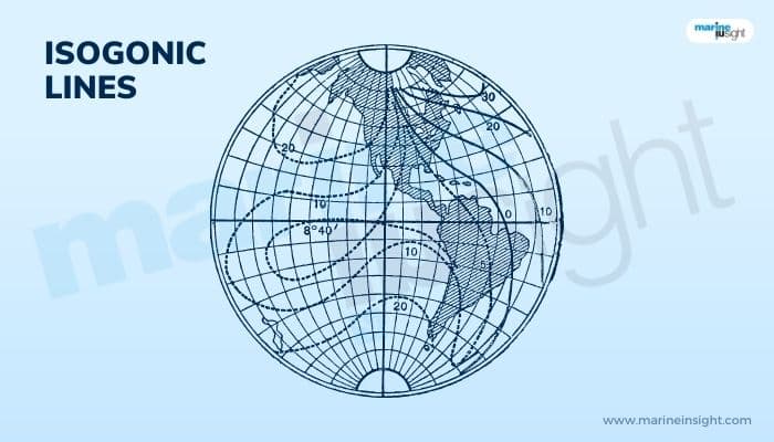
They have a lot of importance in the marine field regarding navigation. Mariners mostly use isogonic charts that have a collection of several isogonic lines.
You might also like to read-
- What is GDP Multiplier Ratio in Shipping?
- Understanding Supply Chain Resilience
- Advantages And Disadvantages Of Bigger Vessels For Exporters, Shippers & Cargo Owners
- 10 Trends Expected To Define Supply Chains And Shipping In 2023
- What Are Container Tracking Systems?
Do you have info to share with us ? Suggest a correction

About Author
Subhodeep is a Naval Architecture and Ocean Engineering graduate. Interested in the intricacies of marine structures and goal-based design aspects, he is dedicated to sharing and propagation of common technical knowledge within this sector, which, at this very moment, requires a turnabout to flourish back to its old glory.
Latest Marine Navigation Articles You Would Like:


Subscribe To Our Newsletters
By subscribing, you agree to our Privacy Policy and may receive occasional deal communications; you can unsubscribe anytime.