

What are Sea Water Marks And Safe Water Marks?
At the beginning of this article, it is important to first learn about the term ‘sea marks’.
So what are sea marks?
Sea marks are physical indicators for navigational aid and reference. These indicators or references can be used for a wide range of purposes, as follows:
- Marking passages, channels, canals, or other water bodies of specific interest or reason. Examples include enemy or restricted territories, defence or administrative or governmental areas.
- Marking coasts, shorelines, islands, rocky formations, or some form of obstructions, both natural and artificial.
- Demarcation and identification of hazardous areas or water-based regions associated with danger or potential risks. For example, shoals, reefs, barriers, or other geographical or topological features. Other examples may include artificial causes like enemy regions planted with underwater mines, shipwrecks, or submerged structures.
- Indicating areas of high maritime traffic and congestion, like near large ports or terminals or artificial channels, for the passage of many vessels regularly.
- Marking water bodies based on high or low drafts, tidal conditions, icing, or land restrictions.
- Identification of safe, risk-free, and navigable areas.
Sea marks can be best compared to road signs that we encounter now and then. They are of paramount importance for sailors and navigators. There can be many kinds of sea marks. However, we can broadly categorise them into the following:
- Fixed
- Floating
Fixed structures are those that are fixed on the ground. They may either be fixed onto the seabed or to the landmass if it is on a shore or anywhere in the vicinity of a water body. The lighthouses, about which we had been enthused since childhood, are itself nothing but a classic sea mark!
Its primary purpose is to convey the presence of a landmass or coast to a seafarer and, conversely, keep track of the oncoming maritime traffic.
For those attached to the seafloor, they may range from a small, tubular, single-leg structure attached to the seafloor that is used to mark a specific point or location to larger structures similar to offshore oil structures that may include an intricate combination of lighting, as well as radio or sonic signals for some specific purpose like defence or to mark and safeguard a major coastal facility.
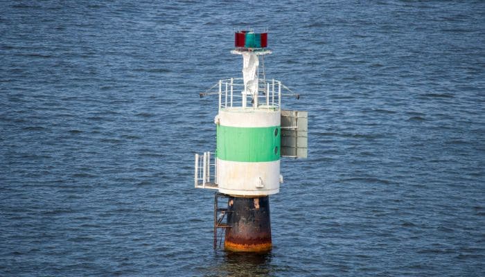
Floating structures are usually buoys that remain afloat in a specific location and are typically tethered or anchored such that it does not drift away. These smaller structures serve a similar purpose as being discussed.
They are often used in multiple numbers for purposes like forming a guided route for a vessel near a coast or port, demarcating an unnavigable zone, or acting as separators for safe navigation in busy areas of high maritime traffic.
Now, other than these, there can be seamarks based on the following features or combinations of them:
- Having lighting and illumination
- Having acoustic features
- Having specialised features like radio signals
- Having no significant features
The first type is the most common. It can be detected because of its illuminative features. It is usually equipped with lighting features like beacons, floodlights, foglamps, flashers, etc.
However, they may also be passively illuminating, like having reflectors. In the second category, there is an audio or an acoustic feature like horns. They are meant to be detected based on their sound signals instead of visual presence.
A lighthouse or other fixed structures like towers are usually equipped with audio and visual detection features in the form of large light beacons and foghorns.
Modern sea markers, including some latest constructions of lighthouses, are often equipped with advanced technologies like radio transmission and satellite or telecommunication capabilities.
Some seamarks are devoid of features. These include buoys or structures only meant to be visually detected during the daytime, and they are known as daymarks.
They cannot be detected during night-time. The International Association of Lighthouse Authorities, or the IALA, is the main governing body that gives regulations and guidelines about the design, disposal, usage, and operation of these sea marks. The application of these regulations can be broadly classified into two regional categories:
- Region A: For every other region in the world other than North and South America, Japan, Korea, and the Philippines.
- Region B: North and South America, Japan, Korea, and the Philippines.
Safe Water Marks
Now, seamarks can be of various types and kinds. They can be of varying designs, looks, colours, shapes, forms, and configurations coded for their respective purpose as designated by IALA existing guidelines.
Safe water marks are one such kind. They are seamarks used to indicate navigable waters in and about their place of disposition. These safe watermarks are used to identify the following: fairway, midchannel, end of the channel, and landfall.
Fairways are usually used to denote the entrance or approach of a navigable path and often for channels, ports, or estuaries. Midchannel indicates a middle region of a safe navigable channel, an unhindered waterway thoroughfare for the given route, in simple terms.
Similarly, safe watermarks are also used to mark the end of a navigable waterway or channel. Landfall marks basically indicate the presence of a landmass in the approaching vicinity from the point of view of a seafarer or navigator.
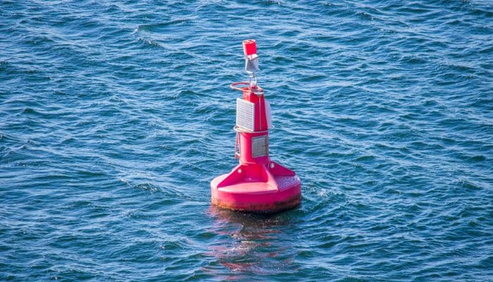
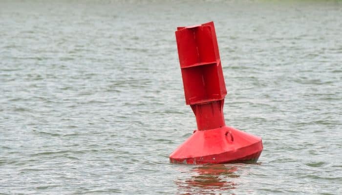
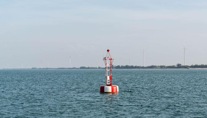
Safe water marks are usually colour-coded in red and white. For all practical purposes, they are floating marks like buoys, but fixed structures are also there. They are either spherical (for buoys), spar/ tapering pillar-like (floating or fixed), or slender tubular structures (mainly fixed ones). Spherical shape-like marks are usually used in midchannel indicators.
Safe water marks are also notably distinguished by the presence of a red ball-like sphere at the top apex, similar to one on Christmas trees or Santa’s red cap.
The lighting pattern for these types of marks is also unique. At night, safe water marks emit long flashes at every 10 seconds.
Safe water marks are also often used in underpass waterways beneath bridges as a mark to indicate the safe passage of vessels with a certain maximum height as deemed for that particular waterway.
In the next article, we are going to have a brief look into cardinal marks.
You might also like to read-
- What is a mooring buoy?
- 8 Important Points For Efficiently Taking Over a Bridge Navigational Watch
- When Should Officer on Watch (OOW) Call the Ship’s Master?
- How maintenance of navigation lights is done on ships?
- What Are Cardinal Marks?
Do you have info to share with us ? Suggest a correction

About Author
Subhodeep is a Naval Architecture and Ocean Engineering graduate. Interested in the intricacies of marine structures and goal-based design aspects, he is dedicated to sharing and propagation of common technical knowledge within this sector, which, at this very moment, requires a turnabout to flourish back to its old glory.
Latest Marine Navigation Articles You Would Like:


Subscribe To Our Newsletters
By subscribing, you agree to our Privacy Policy and may receive occasional deal communications; you can unsubscribe anytime.