

Understanding the Principles of Passage Planning
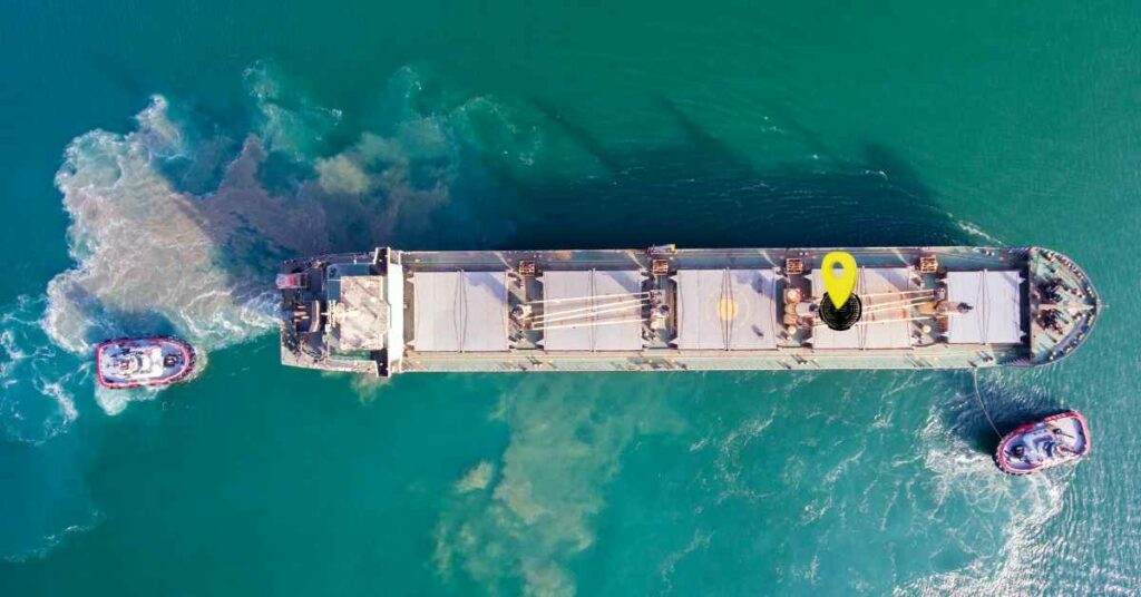
Shipping cargo from one port to another involves coordinated working of several operations of both land and ship staff. One of the most integral parts of a shipping operations is the cargo or voyage planning, which is mainly undertaken by a navigational officer of a ship.
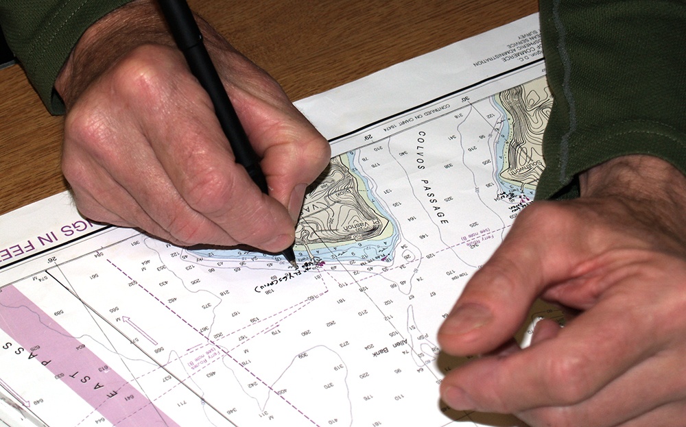
A passage plan is a comprehensive, berth to berth guide, developed and used by a vessel’s bridge team to determine the most favourable route, to identify potential problems or hazards along the route, and to adopt Bridge Management Practices to ensure the vessel’s safe passage. SOLAS Chapter 5, Annexes 24 & 25 titled “Voyage Planning” and “Guidelines for voyage planning” respectively, give specific regulatory information with regard to the passage plan.
Passage planning includes a complete description of the ship’s passage which is prepared by an experienced deck officer of the ship. This is done to ensure that the ship sticks to the required routes for reaching the port of destination.
While making a passage plan, the officer must keep in mind that the ship must reach the destination safe by abiding to both local and international rules and regulations.
In this article, we will discuss the basic and essential stages of ship’s passage planning.
Ship Passage Planning – Essential Steps
A ship’s passage planning involves 4 major steps/stages. They are as follows:
1. Appraisal
2. Planning
3. Execution
4. Monitoring
Each stage in the passage planning has its own importance and it is extremely important to carry out each one of them with utmost care and up-to-date seamanship to ensure a safe sail.
In the start, a rough estimate is made of the whole sailing process. Once the rough plan is ready, it is further tweaked and modified/refined considering various details obtained from charts, pilot book, weather routing etc. These processes are carried out throughout the appraisal and planning stages.
In the next two stages i.e., execution and monitoring, the plan is used as a guideline, and the sailing is executed taking into consideration various factors, both observed and predicted.
Each aspect of passage planning has been explained in detail below:
Appraisal
In this stage, the master of the ship discusses with the chief navigating officer (usually the Second Mate), as to how he intends to sail to the destination port. (In some cases it may be required for the master to plan the passage). This is the process of gathering all information relevant to the proposed passage, including ascertaining risks and assessing its critical areas. This involves information extracted from publications as well as those within the chart. The appraisal will include details from:
- Chart Catalogue
- Charts
- Ocean Passages of The World
- Routeing Charts
- Admiralty Sailing Directions
- Admiralty List of Lights and Fog Signals
- Admiralty List of Radio Signals
- Tide Tables
- Tidal Stream Atlas
- Notices to Mariners
- Admiralty Distance Tables
- Ships Routeing
- Navigational Warnings
- Mariner’s Handbook
- Load Line Chart
- Draft of Ship
- Owners and other sources
- Personal Experience
Taking into consideration master’s guidelines, company’s guidelines, ship’s cargo, marine environment, and all other factors that may affect the ship, the navigating officer draws upon a general track, which the ship shall follow.
For the ease of planning, this plan is first laid out on a small scale chart, which is later transferred to larger scale charts, and then minor modifications are made as and when deemed necessary.
Planning
Having made a full appraisal using all information at hand pertaining to the passage, the OOW, under the authority of the Master is to prepare a detailed plan for the passage. In this stage, the intended courses of the ships are actually laid out on the charts of suitable scale and all additional information is marked. The plan is laid out from pier to pier, including the pilotage waters.
It is a good practice to mark dangerous areas such as nearby wrecks, shallow water, reefs, small islands, emergency anchorage positions, and any other information that might aid safe navigation.

In addition to the above-mentioned things, is it advisable to layout the rate of turn for waypoints and laying out of PI ranges for suitable objects, if any.
Reporting areas should also be clearly marked on the charts. Elements of the Planning phase include:
- No-Go areas
- Margins of safety
- Charted Tracks
- Course alterations and wheel over points
- Parallel Indexing
- Aborts and Contingencies
- Clearing line and bearings
- Leading lines
- Tides and current
- Change in engine status
- Minimum UKC
- Use of Echo Sounder
- Head Mark
- Natural Transit
Aborts: When approaching constrained waters, the vessel might be in a position beyond which there is no possible action but to proceed. For example, the vessel enters an area so narrow that there is no room to return. It is for this purpose that a position is drawn on the chart showing the last point wherein the passage can be aborted.
Contingencies: The bridge team must always be aware that the events might not go as planned and that emergency action might be required. Contingency plans account for such situations, clearly shown on the chart so that the OOW can take swift action in such a jam. Contingency planning will include alternative routes, safe anchorages, waiting areas, emergency berths.
Execution
In this stage, the navigating officers execute the plan that has been prepared. After departure, the speed is adjusted based on the ETA and the expected weather and oceanographic conditions. The speed should be adjusted such that the ship is not either too early or late at its port of destination. The Master should find out how long his intended voyage is, accounting for water and fuel available. Also to be taken into account are any expected weather changes along the way. In case and ECDIS is being used, appropriate limits must be set with regard to the safety settings.
Monitoring
Monitoring is that aspect which takes into account checking of the position of the vessel, such that it remains within the safe distance from any danger areas. Parallel Indexing can be used to maintain safe distance alongside any hazards to navigation. A safe and successful voyage can only be achieved by close and continuous monitoring of the ship’s progress along the pre-planned tracks. Situations may arise wherein the navigating officer might feel it prudent to deviate from the plan. In such case, he shall inform the master and take any action that he may deem necessary for the safety of the ship and its crew. This stage is a very important stage wherein all the deck officers contribute their part to execute the plan. This calls for personal judgement, good seamanship and experience.
Disclaimer: The authors’ views expressed in this article do not necessarily reflect the views of Marine Insight. Data and charts, if used, in the article have been sourced from available information and have not been authenticated by any statutory authority. The author and Marine Insight do not claim it to be accurate nor accept any responsibility for the same. The views constitute only the opinions and do not constitute any guidelines or recommendation on any course of action to be followed by the reader.
The article or images cannot be reproduced, copied, shared or used in any form without the permission of the author and Marine Insight.
Do you have info to share with us ? Suggest a correction

About Author
Shilavadra Bhattacharjee is a shipbroker with a background in commercial operations after having sailed onboard as a Third Officer. His interests primarily lie in the energy sector, books and travelling.
Latest Marine Navigation Articles You Would Like:


Subscribe To Our Newsletters
By subscribing, you agree to our Privacy Policy and may receive occasional deal communications; you can unsubscribe anytime.
i just want to say, these books is really important and heplfull for seafarers around the world.
important of voyage planning
Great only for who are working in ship.
Can anyone help me to acheve my goal of being in merchant navy.
Please use our forums for career related queries – https://forums.marineinsight.com