

10 Things About Banda Sea You Must Know
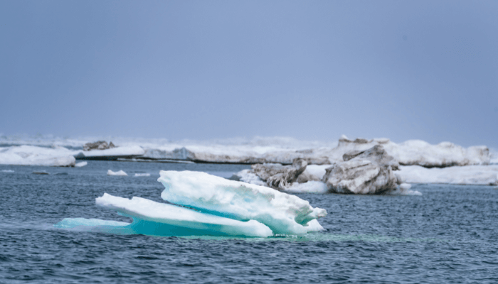
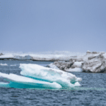
The Banda Sea is one of the most visited water bodies. Known for its clear waters, it is ideal for swimming and scuba-diving. The sea is surrounded by many islands and coral reefs too.
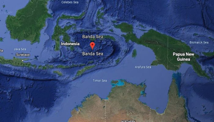
Coming to geography, the Banda Sea lies near the Maluku islands, Indonesia. It is also considered to be a portion of the western South Pacific Ocean. It is surrounded by the southern islands of the Moluccas, which include the Timor, Tanimbar, Kai, Ceram, Sulu etc.
The Sea covers an area spanning 180,000 square miles and stretches for about a thousand kilometres from east to west and 500 km or 300 miles from north to south.
The International Hydrographic Organization considers the Banda Sea as part of the waters of the East Indian Archipelago.
In this article, let us explore some facts about the Banda Sea.
1. Divided into Two separate basins
An underwater ridge divides the basins of the Banda Sea. The ridge is also covered with beautiful coral reefs in some places. The northern basin of the Banda Sea is around 19,000 ft or 5800 m deep. The Southern Basin has a depth of 17,700 ft or 5400 m.
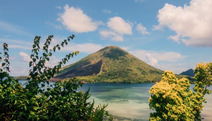
The southern Banda basin is further divided by a volcanic ridge. A seismically active volcano, Mount Api rises from the ocean floor of the southern basin at roughly 4500 m to 670 m above sea level.
2. Earth’s deepest underwater exposed fault- The Webber Deep lies in the Banda Sea.
The Banda Sea is quite fascinating. Under its waters is one of the deepest water bodies, called the Weber Deep. It also forms the biggest and deepest fault. The oceanic abyss, situated off the eastern Indonesian coast, has puzzled researchers for many years. Although it has been known for 90 years, scientists are still unsure how it got so deep.
It measures 7.2 kilometres or 4.47 miles from top to bottom and is the deepest place of the planet’s oceans which does not fall within a trench.
Its unusual depth has been attributed to certain geological occurrences. The first is the Banda Slab rollback, and the second is due to the creation of a detachment fault.
Banda sea maps showed scars on the seabed rocks. These highlight the possibility that the abyss was formed when a piece of crust, possibly bigger than Belgium, was torn apart along a low-angle crack.
The crack or the fault, known as the Banda detachment, shows a rip on the ocean bed exposed to more than 60,000 square kilometres. The extension was quite extreme in some places, so much so that there is no oceanic crust.
Studying the Webber Deep is important because it lies within the Pacific Ring Of Fire and would aid researchers in studying the earthquakes and seismic activities in the region.
3. The Banda Sea was first explored and mapped by the Dutch
It was during the Dutch colonial rule in the 1920s and 30s that the Banda Sea was explored. The research was done using the military vessel HMS Willebrord Snellius.
This expedition estimated the sea’s depth and also the deepest part of the Banda Trench, which is 7440 m using an echo sounder. They also discovered the Weber trench and other trenches, including the basins, which are like underwater valleys.
The Banda trench lies southeast of Banda island and was created when the Eurasian, Pacific and Indo-Australian plates collided with each other.
Even now, there is no detailed research about this trench since it is quite dark and difficult to penetrate.
Another team of researchers from Denmark came to study the Banda Sea in 1951. They came on a vessel called Galathea and wanted to find out the seabed conditions, temperature, and currents and determine the deepest trench in Indonesia.
They found that the sea floor has fine clay and a water temperature of 30 degrees Celsius. The waters had low oxygen levels. They also recorded the organisms they encountered, which included the sea cucumber, isopods, worms, several fish etc.
Some of the animals were preserved and kept at Copenhagen’s Zoological Museum.
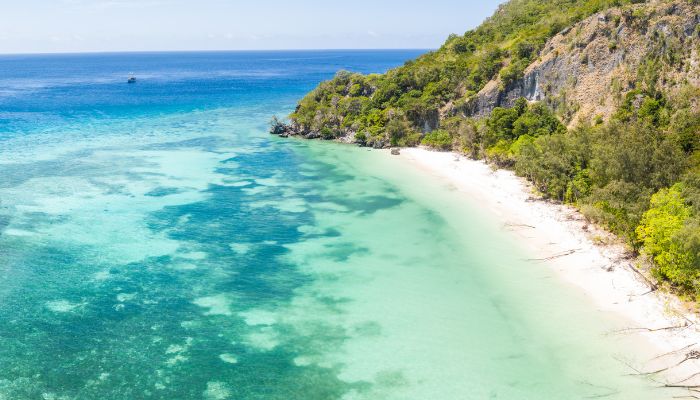
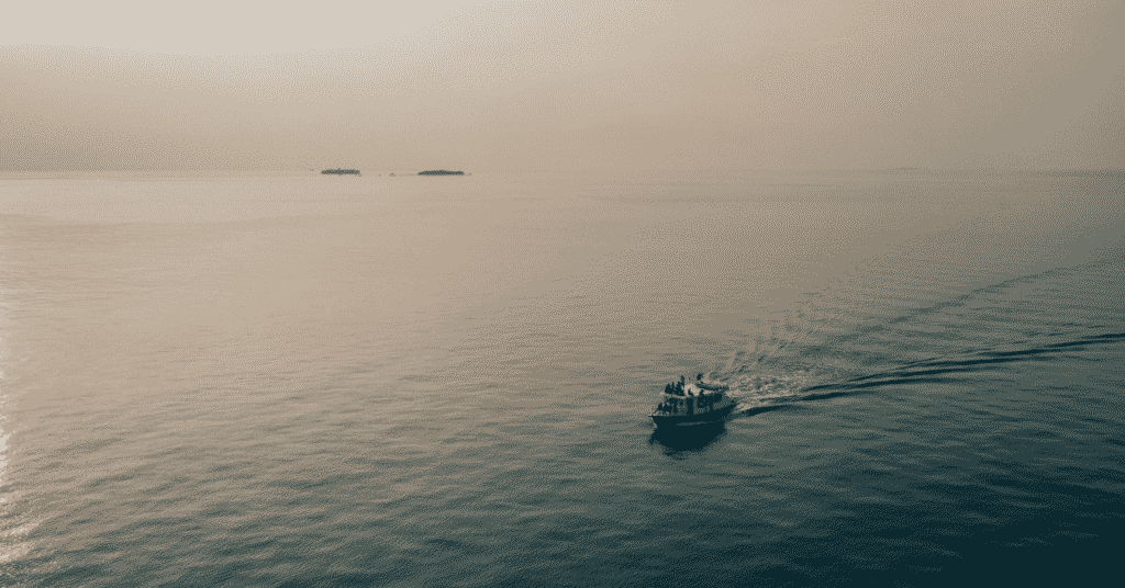
4. Perfect for scuba diving, snorkelling and swimming
A diving trip to the Banda Sea is a once-in-a-lifetime experience since the waters have remained largely untouched by human activities. The region has one of the most exciting diving sites, perfect for live-aboard trips.
One of the reasons is the varying terrain of the Banda Sea. It has many reefs, seamounts, valleys, and also plankton blooms which are brimming with rare marine animals and plants.
Some popular diving sites include the Pulau Ai, where one can swim with sharks. However, only experienced divers are advised to dive here. One can see hammerhead sharks and also thresher sharks near this dive site. These sharks are usually shy but witnessing them emerge from above the reefs is a sight to behold.
Another site worth exploring is the Gunung Api. Its reef was significantly destroyed during a volcanic eruption and the flow of lava over it. However, it has made quite a recovery, leaving scientists astonished. Stronger currents pass through this site, and so do Mobula rays.
If you like sea snakes, you must visit Manuk island, which has many rare ones as well. This is due to the presence of warm waters from nearby volcanic vents.
Researchers and videographers can see the Chinese snakes and various fish species, including the barracudas.
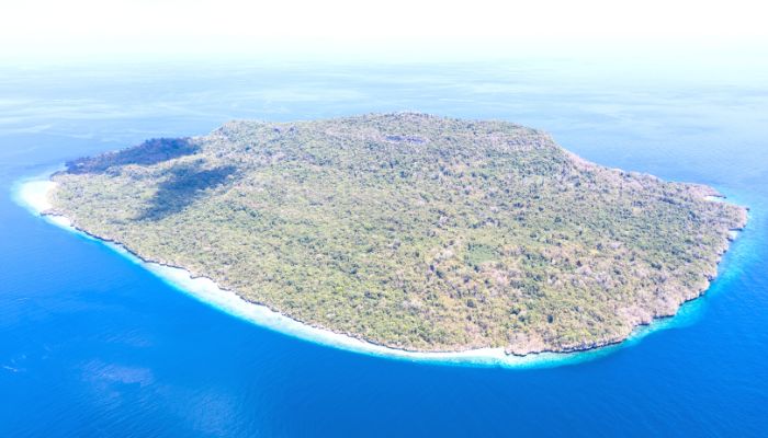
5. Banda Sea islands are known for nutmeg production
The cluster of islands in the Banda Sea facing the eastern coast of Indonesia has nine islands. The largest island of the group is Great Banda.
The islands are divided into two groups. There are volcanic islands in the eastern part and also limestone islands. Many volcanoes on these islands are still erupting.
The Banda Sea has clear waters that offer a perfect habitat for coral populations. The sea has a cluster of islands popular among travellers, explorers and water sports enthusiasts.
They are also known for their top-quality nutmeg, which was also a key driver in promoting the growth of the spice trade during the colonial period. Europeans visited these islands for their high-priced spices.
Today, these islands sustain themselves through the production of nutmeg, tourism and fishing. However, the inhabitants of these islands live a dangerous life as they are prone to earthquakes, consequent tsunamis and storms.
6. Banda Sea is prone to earthquakes.
The Banda Sea region is quite prone to earthquakes. This is because three tectonic plates, namely the Pacific, Indo-Australian and Eurasian plates, converge in this region.
The Banda Arc covers a significant part of the Banda Sea plate. The arc, known was for its 180 degrees curve, is said to have created when a volcanic arc struck the Australian continental margin close to Timor.
The sea’s southern margin comprises island arcs above the subduction zones. One of the most disastrous earthquakes in the Banda Sea occurred in 2006.
One of the disastrous earthquakes in the region occurred on 27th January 2006. The exact location was 200 kilometres south of Ambon island.
7. Banda Sea is rich in flora and fauna
Many pelagics, crustaceans, corals and marine plants are found here. Most notable include hammerhead sharks and many kinds of whales such as the humpback, blue and pygmy blue whales, orcas, spinner and pilot dolphins. Most of these can be easily seen in specific dive sites.
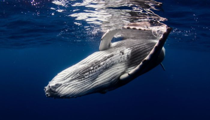
The Banda Sea is also home to Mobula rays, tunas, and Mobula Rays. Giant groupers, schools of fish, sea snakes, tortoises, seahorses, scorpionfish, frogfish and nudibranchs adorn many famous diving areas.
8. Three Banda Sea islands form a unique moist deciduous ecoregion
Three islands, the Tanimbar, Kai and Barat Daya, except Weter, are part of the Wallacea ecosystem. They contain Australian and Asian animals and plants apart from tall trees and are lush green with some lagoons.
Lying in the southeastern part of the sea, they are covered in rainforests and have diverse plant and animal species.
They have 22 endemic mammals that are found nowhere else in the world. Some famous ones include the dusky pademelon, the tomb cat and the Kei myotis bat, an endangered species.
The islands are threatened by the activities of people who collect the eggs of birds. Lately, with increased tourism, new species of insects and rodents have come to the islands, which could hamper their ecosystem.
One unspoiled spot is Yamdena. It is located on the Tanimbar islands and comes under a protected area.
9. Banda Sea region has a warm and pleasant climate
The regions and nations around the Banda Sea have varied weather patterns dictated by the dry and wet seasons. For instance, this is evident in Indonesia.
As one travels through the west and central part of the country, it is damp, and the air is laden with moisture between December till March. The eastern part is arid during this time.
As winds and rains make a downfall in the country’s eastern region, from June till September, the islands in the middle and the west experience dry weather.
During this time, the Banda sea coasts also experience a similar climate. The sea is usually calm in March and April.
If we talk about the water temperature in the Banda sea, it is usually stable and does not fluctuate much. It is pretty warm than other seas or water bodies of Indonesia and has a temperature ranging from 27 to 29 degrees Celsius.
Most precipitation or rain occurs from the first week of November till the end of April. The drier season usually starts in May and lasts till the end of October.
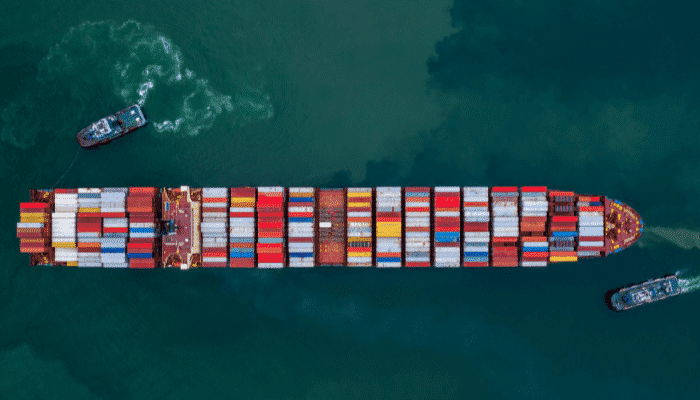
10. There are 17 ports on the coast of the Banda Sea
One of the biggest and busiest ports on the Banda Sea is Ambon. It is situated on the southern coast of Seram. It is the main facility in Maluku and handles breakbulk, liquids and dry bulk.
It can easily accommodate general cargo ships at anchorage and also berths. An oil terminal is also located at Nipa.
The principal exports include spices, including clovers, nutmeg and also mace and forest goods. It imports clothes, canned and packaged food, machines and petroleum goods.
Around 2500 frequent the port every year.
Other ports include Palopo, which lies in a bay on the northwestern side of the mouth of Bone Bay on the western shores of Sulawesi. It mainly handles breakbulk.
Kolondale port is also situated in a bay on the eastern coast of the island of Sulawesi. It is a small harbour with a cargo pier, an oil terminal and an offshore anchorage handling ships carrying nickel and ores. It also deals with liquid bulk.
You might also like to read-
- 10 Southern Ocean Facts You Might Not Know
- 12 Interesting Facts About The Pacific Ocean
- Are There Any Freshwater Seas Or Oceans In The World?
- 12 Siberian Sea Facts You Must Know
Disclaimer: The authors’ views expressed in this article do not necessarily reflect the views of Marine Insight. Data and charts, if used, in the article have been sourced from available information and have not been authenticated by any statutory authority. The author and Marine Insight do not claim it to be accurate nor accept any responsibility for the same. The views constitute only the opinions and do not constitute any guidelines or recommendations on any course of action to be followed by the reader.
The article or images cannot be reproduced, copied, shared, or used in any form without the permission of the author and Marine Insight.
Do you have info to share with us ? Suggest a correction
Latest Maritime Knowledge Articles You Would Like:


Subscribe To Our Newsletters
By subscribing, you agree to our Privacy Policy and may receive occasional deal communications; you can unsubscribe anytime.
Web Stories


About Author
Zahra is an alumna of Miranda House, University of Delhi. She is an avid writer, possessing immaculate research and editing skills. Author of several academic papers, she has also worked as a freelance writer, producing many technical, creative and marketing pieces. A true aesthete at heart, she loves books a little more than anything else.