

9 Major Ports In Cape Verde
The island nation of Cape Verde is a developing country with one of the highest GDPs in Africa. It consists of ten islands lying in the central Atlantic Ocean. They cover 4034 km2, and each island has a commercial port to conduct inter-island and international maritime trade and commerce.
The country has very few natural resources however its economy has grown by leaps and bounds. It has a strong service and tourism sector and the contribution of agriculture and manufacturing to development is minuscule. It imports food and manufactured goods from the outside world. Shellfish and seafood are important commodities of export.
Check out the major ports of Cape Verde in this article.
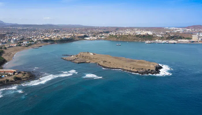
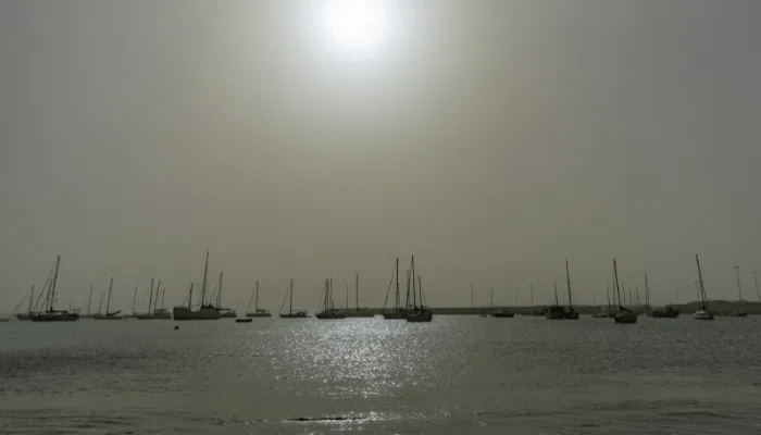
1. Port of Praia
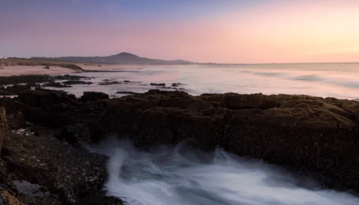
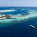
Praia harbour is the main commercial port of Cape Verde and an important financial and business hub, contributing to the socio-economic growth of the country. It lies on the southern shores of Santiago island and serves the capital city. A natural port facing the Atlantic Ocean, Praia handles approximately 818,900 tonnes of cargo and 90,000 passengers annually.
Port Characteristics
Praia harbour is well-protected and contains multipurpose wharves for accommodating all kinds of ships ranging from bulkers to container carriers. It was refurbished in 2014 for installing modern equipment and the latest operating systems.
Praia has two docks, three small cargo piers and two RORO ramps. It also has an 80-metre long and 4 metres wide fishing wharf with a depth of 3 m. Adjacent to this pier is a seafood processing plant and a packaging unit. The total available quayage is 865 m with a maximum water depth of 14 m.
The passenger terminal consists of a 350-metre-long wharf for accommodating ferries with connections to nearby islands like Brava and Sao Vicente. The container freight station has more than 20 reefer connections and covers 8 hectares. It has additional space for storing empty containers and dangerous items.
The port has several warehouses covering 10,500 m2, equipment storage yards and a terminal building. Adjacent to the port is the container park and a logistics depot.
Port History
Praia was developed by the Portuguese who colonised Africa and the nearby islands in the late 14th century. With the arrival of the famous explorer Vasco da Gama and the establishment of a Portuguese settlement in 1514, the port grew manifold. By the 16th century, it had developed into an important stopover for ships sailing toward Brazil and the Americas. Though it suffered many pirate attacks, it emerged as the main port and the capital of Cape Verde in the late 17th century.
The port is renowned for the famous battle of Porto Praya which was fought between the two powers, Britain and France, for gaining control of the strategic port. The French were victorious in the naval battle fought inside the harbour. After the treaty of Versailles was signed, the port was expanded and a wooden pier and a storehouse were constructed in the 1880s. An additional concrete berth was built in the 1930s and the harbour entrance was also widened. In the mid-1950s, modern infrastructure was put in place on the eastern part of the erstwhile Praia harbour.
2. Porto Novo Port
A coastal trade terminal, the port of Porto Novo has trade connections with the island of Sao Vicente. It handles consumer products, perishable items and bulk cargo. The harbour was opened in 1962 and was modernised in 2013. The berths were expanded and a marine station building covering 2500 m2 was also constructed on the premises.
The port has three berths covering more than 450 m2 and a depth of 8.5 metres. It also has two container parks, two RORO ramps and a small pier for accommodating boats and fishing vessels. Two covered warehouses for storing loose cargo are situated on the western side of the berths. In 2018, the port handled 140,000 tonnes of cargo and over 50,000 passengers.
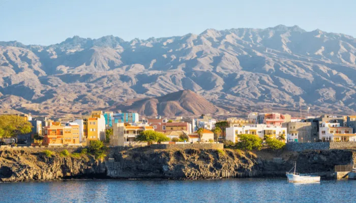
The southern coast experiences less rainfall and an arid climate. Hence, it was not settled until the late 1800s. Before 1961, marine vessels had to anchor in the Alto Peixinho bay. Passengers and cargo were transported to the harbour through small barges or boats. Porto Novo attained the status of a municipality in 1962 and slowly transformed into the biggest urban city on Cape Verde island.
3. Porto Grande
Located on the northeastern coastline of Sao Vicente, Porto Grande is a part of the Cape Verde archipelago. It has a semi-circular and well-sheltered harbour with calm waters reaching depths of 12 to 30 metres. The port has 11 wharves offering a total quay length of 1590 m. It also has three ferry berths covering 210 m and a 5 m water depth.
The port deals with shipments of fuel, refined oil, gravel and cement. Major export commodities include canned fish, animal skins, timber, citrus fruits and bananas. It is also an important refuelling and service station for ships, given its geographical location.
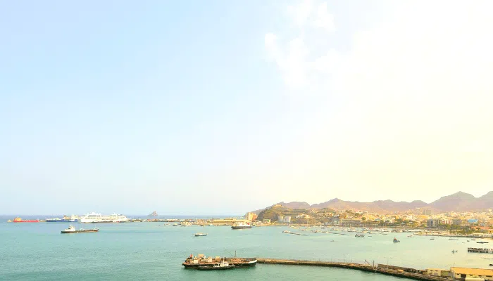
Approximately 2305 vessels, 670,000 tonnes of cargo, 18,000 TEUs and over 2 million passengers are handled at the port annually.
Port Layout
The port was created in the 1960s however it was refurbished in 2014, by adding additional quays, expanding the embankment to 9 hectares and constructing storage spaces.
Porto Novo has cold storage covering 1.5 hectares with a total capacity of 6000 tonnes. It is mainly used for keeping seafood and other perishable items. Dry cargo is kept in 7000 square metres of covered warehouse space.
Solid and liquid bulk is handled at the 300 m long pier with a depth of 11 m. Containers are unloaded at the two 200 m long berths capable of accommodating two container ships simultaneously.
Close to the commercial facility is the coastline terminal having 240 metres of quayage divided into three wharves; one for cabotage ships and the other two for accommodating RORO carriers.
4. Port of Tarrafal
Tarrafal is located on Sao Nicolau island and is an important regional port, connecting San Nicolau with nearby islands of the archipelago. It deals with essential items, consumer products, fuel etc required by the inhabitants. Exports are limited to forestry products such as wood, resin and pulp.
It was constructed in 1991 and contains two berths covering 130 metres with water depths of 5.5 m. Goods are stored in four warehouses located in the vicinity before they are distributed via trucks. More than 30,000 tonnes of cargo and 250 vessels visit the port annually.
A fishing port is situated close to the cargo facility with installations processing crabs, shrimp and small fish. The coastal town was settled in 1745 and houses about 8000 people.
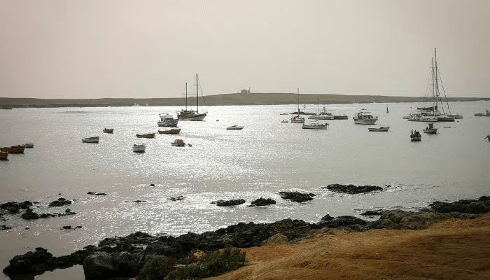
5. Port of Palmeira
One of the busiest ports of Cape Verde, Palmeira is situated on Sal Island. The island’s economy rests on maritime trade, fisheries and tourism. It has many sandy beaches and resorts offering activities like sailing, snorkelling, cliff diving etc.
Palmeira port became operational in 1986 and was modernised and expanded in 2010 and 2015. An additional 35 m long wharf was also constructed for accommodating the increasing cargo traffic. It has a 90 m multipurpose berth, a concrete RORO ramp and a two-hectare container park with a terminal building equipped with the latest container scanning machines. It also has a 7000 m2 RORO yard for keeping imported vehicles, before sending them out for distribution.
It has four quay cranes, a mobile crane, three forklifts, two trailers and five port trucks.
A 30 m long and 5 m deep berth accommodates fishing vessels. It is adjacent to the cold storage covering 455 m2. The port was designed to handle more than 70,000 tonnes of cargo annually.
6. Port of Sal-Rei
Positioned on the third-largest island of the Cape Verde Archipelago, Sal Rei port has ample scope for tourism, which was recognised by the authorities. Hence, the 17th-century harbour was widened, modernised and completely rebuilt in 2015 to transform Sal Rei into a major facility. Approximately 150 ships and 15,000 tonnes of cargo are handled at the port annually.
Currently, the port has a 170 m long wharf and a 900 m long main breakwater with an average depth of 8.5 m. It also contains a RORO ramp, a general cargo berth and a 2.5-hectare embankment area lined with concrete blocks.
It has an open, paved yard for storing raw material and three sheltered warehouses for keeping containers and general cargo. The port also contains a ferry terminal linking the islands of Santiago and Cidade do Maio. It was expanded recently to handle more passengers. About 35,000 people pass through this facility every year.
The port serves the urban settlement of Sal Rei lying on the northwestern part of Boa Vista Island. When the Portuguese colonised the island, a flourishing salt industry developed near the harbour.
Hence the name Sal-Rei or Salt king was chosen for the port, which dates back to the 1670s. The town suffered excessive damage from 1815 to 1818, due to repeated pirate attacks. Thus, the Portuguese navy constructed a fort near the Sal-Rei to defend the harbour from further invasions.
7. Porto Ingles
Ingles port is situated on the southwestern side of Maio island, home to over 6500 inhabitants. The landmass covers roughly 271 square kilometres and is considered a historical town. The port has trade links with Praia harbour which ships essential items to Maio. A rudimentary facility, the port consists of a 350 m long and 14 m wide pier with depths ranging from 4 to 11 metres.
The coastal city of Ingles is known for its traditions, culture and salt production industry which closed in the latter half of the 19th century. The island was discovered in 1640 and had an economy based on sustenance agriculture and livestock rearing. However, it changed with Portuguese and later British colonisation which exploited its natural resources and established a commercial harbour for transporting salt to Europe. A battle between the French and British was fought in 1814 for gaining control of the tiny yet lucrative island.
Today, the city has many historic buildings, a remnant of its colonial past. Ferries connect the port to Santiago island. It also has a domestic airport, just two kilometres from the port. Most famous landmarks include the fort of Sao Jose and its lighthouse and the Anglican Church constructed in 1872.
8. Port of Vale de Cavaleiros
Situated on one of the most densely populated islands of the archipelago, Vale de Cavaleiros port is known for its high mountain peaks, waterfalls and an active volcano. The port was constructed in 2013 and comprises two wharves parallel to each other, covering 75 m and 100 m respectively. The average water depth is 6.5 metres. It accommodates small cargo carriers and fishing vessels.
The island spans 477 square kilometres and includes fish processing plants. Hence, the fishing wharf was expanded in 2018. It also has a 500 m2 warehouse area. A marine station equipped with escalators was constructed for the ease of passengers.
9. Port of Furna
Furna lies on the southernmost island of Brava, showcasing traditional infrastructure. The port is situated at the mouth of a natural harbour and comprises an open roadstead covering 190 metres with a water depth of 7.5 m. A ferry service operates from the port, linking other islands. Compared to other settlements, Furna is not visited by tourists given its local landscape but it has enormous potential for development.
Do you have info to share with us ? Suggest a correction
About Author
Marine Insight News Network is a premier source for up-to-date, comprehensive, and insightful coverage of the maritime industry. Dedicated to offering the latest news, trends, and analyses in shipping, marine technology, regulations, and global maritime affairs, Marine Insight News Network prides itself on delivering accurate, engaging, and relevant information.
Latest Maritime Knowledge Articles You Would Like:


Subscribe To Our Newsletters
By subscribing, you agree to our Privacy Policy and may receive occasional deal communications; you can unsubscribe anytime.