

10 Interesting Facts About The Straits Of Gibraltar
Until the discovery of the Americas to the West, the common notion was that Europe formed the edge of the world. Other than the Northern Scandinavian nations and the Southern African countries, there was a unique geographical feature that also marked the boundary. This was the Rock of Gibraltar, also known as the Pillars of Hercules.
Included in Greek mythology, the straits that flow near the Rock have played a major role in human civilization from before 500 BCE.
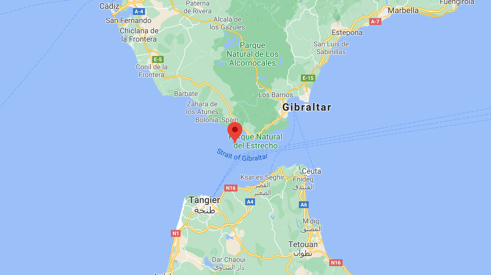
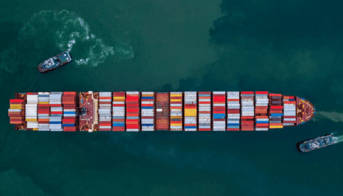
Considered to be one of the busiest and most crowded waterways in the world, it has a direct impact on global trade. The straits connect the Atlantic Ocean to the West with the Mediterranean Sea in the East.
Beyond the Ocean lies the Americas while the Sea has numerous nations on its coastline. Morocco in the South and Spain to the North surround the majority of the straits.
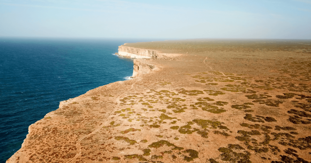
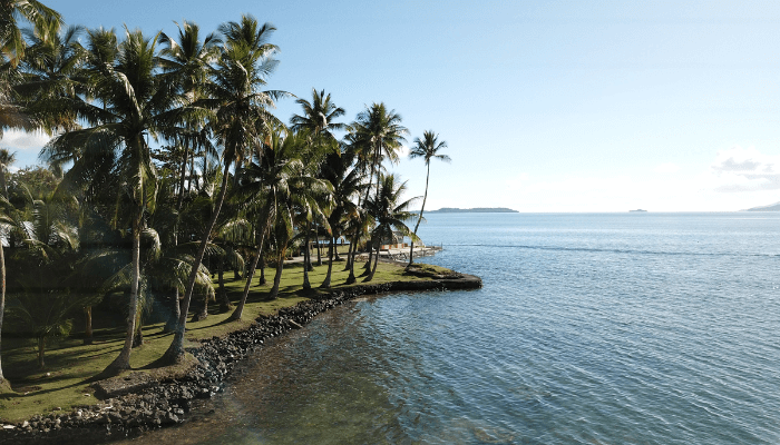
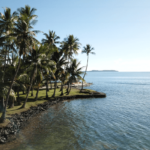
Besides being an important shipping and trade route, the straits also have much to offer. There are numerous interesting facts associated with its long history. There are tourist spots and famous sites, including the imposing promontory- the Rock of Gibraltar, that sticks hundreds of meters out of the ground.
In this article, we take a look at the top 10 facts you must know about the straits. From the strange etymology to the geographical and economic significance it has, this is your go-to guide for anything related to the Straits of Gibraltar.
1. The word “Gibraltar” comes from the Arabic phrase “Jabal al Tariq”
One of the most prominent features near the straits of Gibraltar is the large rock that protrudes into the air. Over 460 meters high, it is the feature from which the name Gibraltar actually stems.
In Arabic, the world “Jabal” or “Jebel” means a mountain. Tariq refers to a Berber commander from Northern Africa who once led a large military expedition to the straits. The commander- Tariq ibn Ziyad, crossed the straits over to the promontory during the early 8th century AD, and it has been known as “Jabal al Tariq” or the “Mountain of Tariq” since then.
Gibraltar is the Spanish derivation of the Arabic phrase, given that the region is close to the Spanish mainland. The ruler of Ceuta, which is now an autonomous Spanish territory, had arranged for the Berber army to cross from their North African kingdoms over to Spain.
A large fleet of vessels was used to ferry them, and this marks one of the first historically recorded crossings across the strait. When they landed on the coast, they consolidated at the foot of the large rock, and it was named in honour of the commander who had led them there. Tariq and another Berber leader Musa ibn Nusayr later went on to capture a large portion of Spain with nearly 20,000 soldiers.
The port of Tarifa to the West of Gibraltar is not named after Tariq ibn Ziyad, but rather another Muslim leader named Tarif who landed on the coast several years earlier.
2. Despite being close to Spain, Gibraltar is a British territory
When viewing a map of Gibraltar, it is easy to mistake it for a Spanish city. However, Gibraltar is actually a special overseas territory of Great Britain. Although part of Spain, it was ceded to Britain following the War of the Spanish Succession. A peace treaty signed in the Dutch city of Utrecht (known as the Treaty of Utrecht) granted Britain the permanent rights to govern Gibraltar. However, there have been numerous attempts by the Spanish to seize back the region including armed conquests in the 18th and 19th centuries.
Spain has maintained that it wishes to reunite Gibraltar with the rest of the mainland and has raised the issue with the United Nations repeatedly in recent times. However, Britain has steadily refuted the Spanish claims. There were numerous referendums and public votes carried out in Gibraltar to allow the people themselves to choose the country they wished to join. The votes in these were overwhelming towards staying with Great Britain, with the latest referendum being 98% for staying British.
Today, the issue has taken on greater relevance with the growing importance on trade, income and revenue, and the military significance of the straits. The UN recognizes Gibraltar as a Non-Self-Governing Territory. The stalemate has continued for the previous 3 centuries, although there have been no armed skirmishes in recent times. According to Great Britain’s position on the issue and international maritime law, Britain cannot directly control the passage of vessels across the straits unless there is illegal transport or smuggling. While used lawfully, there is no restriction to the use of the straits by other countries, navies, or commercial vessels.
3. The Rock of Gibraltar and a North African peak together form the “Pillars of Hercules”
The straits of Gibraltar are spanned by the mythical Pillars of Hercules, in reference to the Greek mythical hero- Hercules. The myth states that during the 12 Labors, Hercules smashed through the mount Atlas to create the straits. The pillar on the European coastline is the Rock of Gibraltar, while the opposite pillar is still a matter of contention. The Gibraltarian Rock is known as Calpe Mons, while the opposite peak is known as Abila Mons. There are 2 main mountains that have historically been considered as the second pillar- Monte Hacho (in Ceuta) and Jebel Musa (Morocco).
The area is also special to the Greeks, with them considering this to be the location where the Titan Atlas supported the weight of the sky on his shoulders. When Hercules crossed over, he is said to have inscribed on the pillars- “Non-Plus Ultra” meaning “nothing further beyond”. The Spanish coat of arms bears this inscription, although it has now been changed to “Plus Ultra” following the discovery of the Americas. It has held importance in Greek mythology, with Greeks offering prayers to Hercules here. The Rock is also a famous tourist destination, with many people flocking to Gibraltar for all it offers.
4. Gibraltar is famed for the “Europa Point”
The waters of the Mediterranean Sea and the Atlantic Ocean could not be more different. The sea has a very high saline content, while the ocean presents a milder environment for different creatures to survive in. The exact point at which these 2 waterbodies meet is known as the “Europa Point” or “Punta de Europa”. Europa is the Southernmost point of the Iberian Peninsula and lies in Gibraltar. Another point at Punta de Tarifa is located further West and lies parallel to Europa Point.
The area is a famous tourist spot, with noted buildings such as Harding’s Battery, Ibrahim-al-Ibrahim Mosque, the Europa Lighthouse, and the Sikorski Memorial. Harding’s Battery was a British fortification that was constructed in the 19th century and could launch missiles across the straits. The Ibrahim Mosque was constructed as a gift from the King of Saudi Arabia- HE Fahd bin Abdulaziz Al Saud, in 1997. It caters to the several Muslims in the region. The Europa lighthouse is a famous spot where Morocco can be seen on a clear day. Lastly, the Sikorski Memorial was built to commemorate the victims of the B-24 accident that claimed the life of Commander Wladyslaw Sikorski (exiled Polish Prime Minister) when it crashed in Gibraltar.
5. Gibraltar has an underground labyrinth that has played a part in major wars
Gibraltar has been the site of countless wars since the 2nd century AD. From the Berber invasions that gave the area its unique name, to the numerous Spanish attempts to return Gibraltar to their dominion, the area has played a major role in the battle. One of the main reasons for this is the location of the straits. It is a passage between the Atlantic Ocean and the Mediterranean Sea- one of the most crowded shipping routes across the globe. For this reason, the nation that has control over Gibraltar will be able to blockade and prevent ships from sailing in the event of a war. The current laws under the British government permit any vessel to sail so long as it is registered, carries no illegal cargo or passengers, and follows the regulations of the sea.
The land battles to conquer Gibraltar have left the area with numerous lasting features. From the Harding’s Battery on Europa Point to a labyrinth of tunnels below the surface, there are several attractions for history buffs. These tunnels were built during the American Revolutionary War by the British. As the French and Spanish troops stormed the surrounding area, the British anchored their long-range firing cannons into the ground. This led to the formation of a series of tunnels that could be used for ferrying messages and troops secretly and safely along the island. Visitors to the island today can take a tour of most sections of the tunnel that are open for viewing.
6. There are regular inter-continental ferries and services
The straits of Gibraltar are famed for being the closest maritime link between the African and European continents. At just 13 kilometres at the narrowest point, it is possible to see the other end of the strait on a clear day. Moreover, it has a low depth in certain places and can be easily navigated. While there is maritime trade across the Mediterranean Sea and the Atlantic Ocean, it also allows for journeys across the width of the strait.
There are numerous ferry services that regularly ply between various ports on each coast, not taking more than a few hours to reach an entirely different continent. Some of the major ports on the European coast are Tarifa (Spain) and Gibraltar itself (England). The primary ports on the African coast are in Morocco, of which Tangiers is a destination. The shortest route is Gibraltar-Tangiers that can be completed within 30 mins.
One of the main concerns and points to watch out for when crossing is that this route is a main maritime waterway through which vessels of all sizes and types sail. The largest tankers in the world often sail down this route, and it can be difficult for smaller vessels to safely navigate alongside them or across their path. For this reason, there are certain windows within which boats must leave the dock at one end, and reach the other end. It is scheduled so that it correctly coincides with the period when there is no other ship traffic along the straits.
7. There is a plan for an undersea inter-continental tunnel
Gibraltar on the European coastline is one of the closest points of contact between the African and European continents. At the narrowest point, it is only 8 miles (or 13 kilometres) wide. There are several ferries and maritime services that run between both points. However, there is a plan for the construction of an undersea tunnel to directly link both the continents. The plan began in 1979 when the Spanish and Moroccan governments conducted an initial feasibility study of the plan. The plan was to have an undersea tunnel that could either be formed by drilling through subterraneous rock, or by laying a tunnel on the seafloor.
However, the material that formed the bed of the straits was extremely difficult to drill through, while the underwater tunnel would be far too expensive to consider. The geology and ocean conditions are very different from the Channel Tunnel that connects Great Britain and France. Estimates have placed the costs at over 5 billion Euros for the initial phases alone. The proposal plans to have road and rail tracks that will be directly linked to the major highways of each continent.
At present, the project is still in the planning phase. The current design is to install a 23-kilometre bridge that crosses the straits. There have been various proposals for the design and contracting of these bridges, but no conclusive decision has come out. The project generated renewed interest in 2018 following another round of discussions at the EU. Today, the plan is known as the Euromed Transport project.
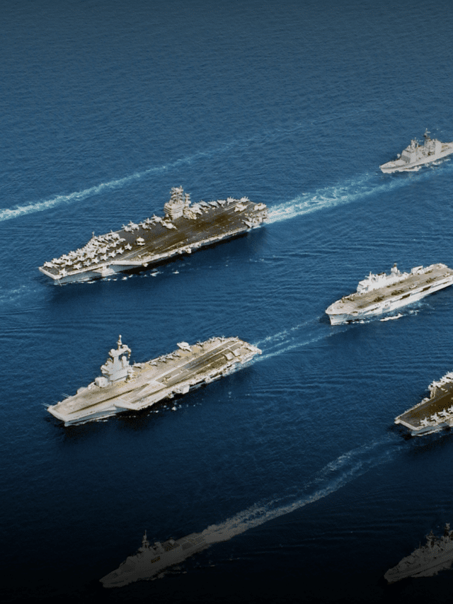
8. Gibraltar is one of the most crowded straits in the world
As the link between the Atlantic and Mediterranean, Gibraltar is considered to be one of the busiest waterways across the globe. There is a major vessel passing through the straits once every five minutes, with countless smaller boats and yachts passing through frequently. Here, a major vessel is any ship that can carry over 10,000 DWT in cargo or an equivalent number of passengers.
The main reason for being so crowded is the geographical and economic significance of its location. From a geographical standpoint, access to the important trade areas along the Mediterranean Sea and interior European and Asian nations is through the straits. If it was blockaded, the global maritime trade would come to a grinding halt. Alternative routes divert and take too much time to cover, while other routes may not be safe owing to weather conditions or piracy. As these are not viable options, the straits continue to be extremely busy throughout the year. Economically, the straits directly provide access to several nations that play a significant role in commerce. They also permit these countries to directly trade with the Americas instead of having to use ports in other nations.
9. The ocean currents bring in different species of marine life
The straits of Gibraltar mark the mixing of the waters from the Mediterranean Sea and the Atlantic Ocean. These vary in natural characteristics, such as density, salinity etc. As the Sea is generally much saltier than ocean waters, water in the Mediterranean is very saline and dense. So, when water pours from the Atlantic into the straits, they push the seawater further down below. There is an almost distinct difference between the 2 waters as they form a chemical transition boundary known as a halocline.
The halocline is a protected gradient between 2 varying saline zones, which prevents creatures from crossing over due to the drastic saline variation. So, a large amount of marine fauna is allowed to live away from the surface by staying within the denser lower halocline region. As the currents from the Atlantic flow into the Mediterranean, various species of whales and dolphins are also brought into the sea. Gibraltar is famed for being a spotting zone for rare species of whales that are in the area during particular periods of the year. Another reason for this varied marine life is internal circulation. Due to the rapid ocean flow, internal waves are created at the mouth of the straits, forming a sort of recirculatory current that brings different species from other regions to Gibraltar.
10. How the straits actually came to be formed
Despite the myths of Hercules cleaving the fabled Mount Atlas in 2 to form the straits of Gibraltar, the actual geology behind the formation of the straits is no less fascinating. The portion of the Mediterranean Sea near the straits was formed by 2 meteoric impacts that created a deep but gradual crater in the region. It spans around 80 kilometres in radius from the centre of impact and has a maximum depth of 2 kilometres in some regions.
When sailing down this stretch, you can make out the gradual slope of the straits and even some of the seabed ripples formed by the seismic shockwaves of the crater impacts.
This impact site created a raised portion of land on the Western front that bordered the Atlantic Ocean. It was steep but low in elevation, near the present-day crossing between Tangiers and Gibraltar. Over time, the flowing water gradually eroded and wore out this narrow protrusion till it became lower than the mean sea level.
As water poured into the crater, it also picked up on sediments and debris to reach its present level of density and salinity. The current size of the Mediterranean is due to the action of flowing water over tens of thousands of years. The internal wave circulation that we discussed above played a major role in shaping the coastlines of the various nations that lie on the Mediterranean coast.
You might also like to read:
- 5 Strait of Magellan Facts You Must Know
- 6 Bosphorus Strait Facts You Must Know
- 10 Important Panama Canals Facts Everyone Should Know
- The Suez Canal: A Man-Made Marvel Connecting the Mediterranean and Red Sea
- The Corinth Canal: A Narrow Man-Made Shipping Canal
- 10 Facts About Northwest Passage
Disclaimer: The authors’ views expressed in this article do not necessarily reflect the views of Marine Insight. Data and charts, if used, in the article have been sourced from available information and have not been authenticated by any statutory authority. The author and Marine Insight do not claim it to be accurate nor accept any responsibility for the same. The views constitute only the opinions and do not constitute any guidelines or recommendation on any course of action to be followed by the reader.
The article or images cannot be reproduced, copied, shared or used in any form without the permission of the author and Marine Insight.
Do you have info to share with us ? Suggest a correction
Latest Maritime Knowledge Articles You Would Like:


Subscribe To Our Newsletters
By subscribing, you agree to our Privacy Policy and may receive occasional deal communications; you can unsubscribe anytime.
Web Stories

About Author
Ajay Menon is a graduate of the Indian Institute of Technology, Kharagpur, with an integrated major in Ocean Engineering and Naval Architecture. Besides writing, he balances chess and works out tunes on his keyboard during his free time.