

10 Flores Sea Facts You Should Know
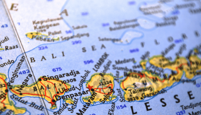
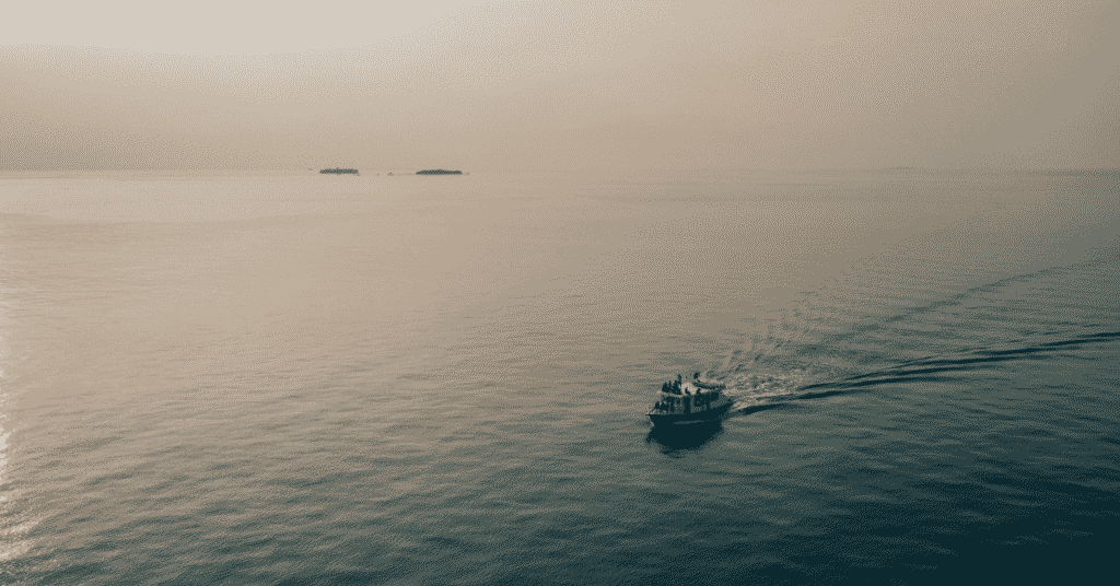
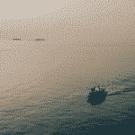
The Flores Sea is surrounded by the Banda Sea in the east and northeast, the Bali Sea in the west and the Java Sea in the northwest. It spans 240,000 square kilometres and is known for its pristine marine habitats, beaches and islands.
It is connected with the Celebes Sea in the northwest through the Makassar Strait. Many islands separate the Flores Sea from the Indian Ocean and the Savu Sea.
Read this article to learn 10 interesting facts about the Flores Sea.
1. Divided into four physiographic areas or zones
The Flores Sea has 4 physiographic regions, including a 500-metre-wide plateau lying in its west, the Flores Basin with a maximum depth of 5140 m lying in the south, a shallow trough with a depth of 3370 m going all the way to Celebes Island in the north and the last region in the east bordering the Banda Sea at the south of Teluk Bone.
2. Site of the famous shipwreck of O Arbiru
The Flores Sea is prone to tropical cyclones, and one such cyclone capsized the freighter named O Arbiru, which was carrying rice shipment from Bangkok. Of the 24-member crew, just one person lived. On the Palu’e island, around 1500 fishermen were killed by the 1973 Flores Cyclone, the deadliest cyclone in the Southern Hemisphere.
O Arbiru was a Portuguese-flagged cargo vessel weighing 400 tonnes. In 1973, when Timor Leste was an Overseas Province controlled by the Portuguese, the colonial government used this vessel to ship necessities to the island’s people via Bangkok.
The wreck of this ship is still in the Flores Sea, near the town of Maumere, 32 nm from Pemana Island. Inhabitants of Maumere and the northern coast of Flores Island call it the Takalayar Ship.
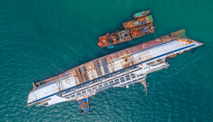
A fisherman named Herman said that the people of Pemana island thought it was a Hong Kong Ship as it had the Chinese alphabet engraved. He said that it sank in 1973 when he was just 15. He also narrated how the people of Pemana, Maumere, and Selayar took all its cargo.
For many years, the shipwreck became a fish house where people caught red snapper. The ship O Arbiru or Takalayar, as people called it, was the most important mode of transport for the Timor Portuguese colonial government at that time.
3. Climate of the Flores Sea
The waters of the Flores Sea have an average temperature of 28.6℃. Maximum temperatures during summer can go as high as 29.0℃, while the minimum temperatures during winter do not fall below 27.9℃. Hence, Flores sea remains warm throughout the year, making it an ideal tourist destination.
Many visit the sea to experience water sports like diving, snorkelling, swimming, or simply relaxing on the beaches. The region gets around 1600 mm of annual rainfall, which is the highest from December to March. The dry season begins in June and lasts till September.
4. Earthquakes and tsunamis are common here
The latest major earthquake in the region happened on December 14, 2021, with a reading of 7.3 on the Richter scale. The Flores region is seismically active as it lies at the complex tectonic boundary between the Australian and Sunda plates and many other microplates. Many major active faults lie here, like the Flores Back Arc Thrust Fault and the Sunda megathrust.
In the 14 December earthquake, one person died, and 173 were injured. Warnings were issued to the coastal communities, causing panic. Videos on social media showed inhabitants running to high ground to avoid the high waves due to the earthquake. The tsunami was minor, measuring seven centimetres.
The Selayar and Flores islands were badly affected, with over 5000 people displaced. Three school buildings, a village office and 2 places of worship were damaged. At least 357 homes collapsed, and some roofs were torn apart. Over 800 buildings were damaged.
5. Formed during the Miocene Period
The Flores Sea came into existence because of the tectonic forces which have shaped the Indonesian Archipelago. The interaction of tectonic plates has also formed a diverse topographic marine landscape, including deep trenches, islands, islets and underwater volcanoes.
The basin of the Flores Sea began to take shape during the Miocene Period, from 5 to 23 million years ago. This was caused by subduction and volcanism along the Sunda-Banda Arc system. Crystal deformation and volcanic activities increased with the subduction of the Australian plate under the Eurasian plate.
Underwater volcanoes erupted and deposited thick lava layers and sediments over the course of time, filling in and submerging the region between the islands creating a shallow basin.
Seismic activities still continue to shape the seabed. Earthquakes and uplift events can alter the coastlines and depths of the Flores Sea.
The sea has a depth of 50 to 100 m, and its shallow waters are separated from the Banda Sea, which lies to the east by the Lintang Fault Zone under Lembata Island.
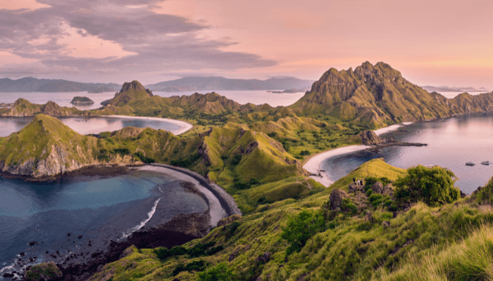
6. Flores Sea is a biodiversity hotspot
The Flores Sea boasts stunning coral reefs, which look like underwater gardens bustling with marine life. They are homes, breeding and feeding grounds for several marine species. From hard, vibrant corals to delicate sea swans moving with the current, these underwater structures create a beautiful environment for scuba diving enthusiasts, many of whom come from afar to experience the beauty of the Flores Sea.

Colourful fish like elusive seahorses, parrotfish, and reef fish are found here, along with larger species, including snappers, groupers and barracudas.
One of the major attractions of the Flores Sea is the manta rays. These majestic creatures glide through the waters with their graceful wingspans. One can also swim with sea turtles, dolphins and whale sharks here.
7. Major threats
Overfishing and unsustainable fishing methods pose a major challenge to the fragile ecosystem of the Flores Sea. Unregulated practices like blast fishing and the use of cyanide deplete fish populations and destroy coral reefs. It leads to a disbalance in the ecosystem and also impacts the livelihood of local communities that depend on fishing.
Pollution from land-based sources poses another threat. Runoffs containing chemicals, plastic waste, pesticides, etc, contaminate the waters and choke marine life, especially near the coast. Plastic is the most evil since it entangles turtles and fish and causes death.
Climate Change and rising sea temperatures, coupled with ocean acidification, have led to the bleaching of corals. It has not only diminished the beauty of coral reefs but disrupted the entire ecosystem.
8. Notable Conservation efforts
Several initiatives have been taken to preserve the Flores Sea’s marine ecosystem, such as establishing marine protected areas. This helps preserve the region’s natural resources and critical habitats and to limit human activities by promoting sustainable practices. The protected areas are omes to endangered marine species.
Sustainable fishing techniques are being promoted to safeguard the Flores Sea’s fish stocks and support the livelihoods of local fishing communities. These regulations restrict fishing in some seasons and define catch limits and gear to be used to maintain a balance between fishing and conservation. Selective fishing and avoiding destructive techniques are encouraged to preserve the ecosystem’s health.
Raising awareness among stakeholders, tourists, and locals to foster a sense of responsibility towards the Flores Sea environment through education programs, workshops, and outreach also plays a key role in conservation efforts.
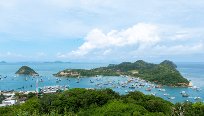
9. Many islands lie in the Flores Sea
Flores Island is one of the Lesser Sunda Islands, a group of islands lying in the eastern part of Indonesia. It lies east of Sumbawa and Komodo islands, west of Solor islands and Alor Archipelago and to the southeast is Timor.
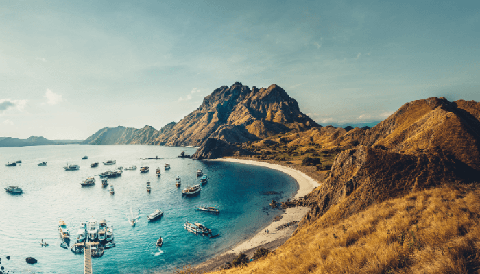
Kelimutu Volcano, which forms three coloured lakes, is the most famous tourist attraction here. There are many snorkelling and diving locations along the island’s north coast, such as Maumere and Riung. Labuan Bajo is used as a base to reach Komodo and Rinca islands. It also attracts scuba divers because whale sharks are found in waters around Labuan Baju. Luba and Bena villages have traditional houses, and the latter also has stone age megaliths.
Other prominent islands include Sumbawa, Komodo, Rinca, Lembata, Adonara, Solar and Alor.
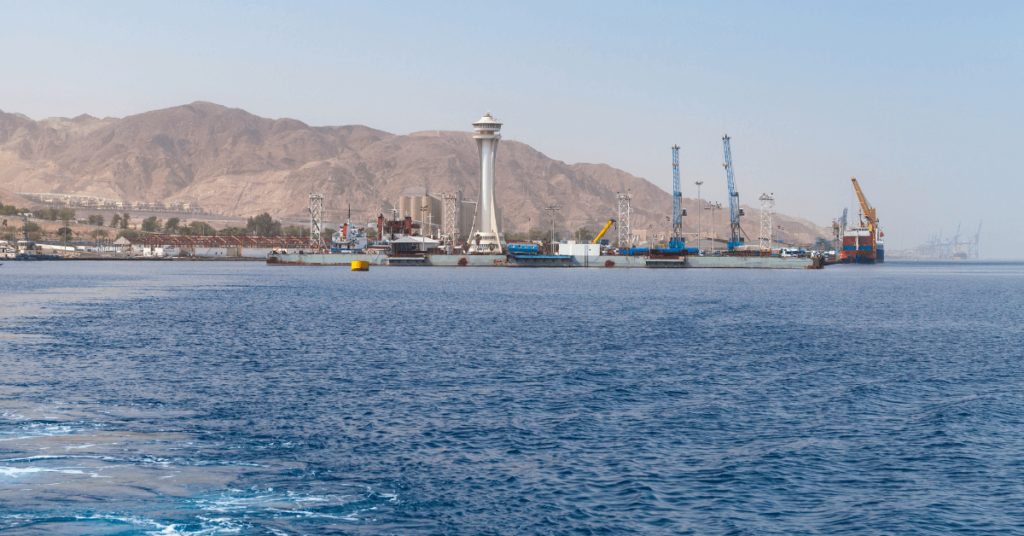
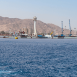
10. Has several major ports and coastal towns
Maumere is situated in the Bay of Maumere on the north coast of Flores Island. It serves the eastern region of Flores as a commercial facility handling domestic and international vessels along with inter-island ferries. The Pertamina oil terminal is 6 km east of this port.
Larantuka, on the northeastern shores of Flores Island, is owned by Pertamina and handles oil and gas. Kupang lies on the west coast of Timor Island and is also a major port town in west Timor. Its facilities lie 4 km southwest at Tenau. Major commodities handled are coal, coffee, sandalwood, anthracite and cattle.
Waingapu lies on the northeastern part of the Sumba Island. It is a major port and is open to international trade. There are many other ports in the Flores Sea, including Aimere, a small fishing port, Bajawa, Tambolaka, Baa, Adonara, Atambua, Kefamenanu, Waingapu, etc.
You might also like to read-
- 10 Interesting SS American Star Facts
- 10 Interesting Facts About the Gulf of Finland
- 11 Busiest Shipping Lanes In The World
- Remembering U.S Navy’s First Black Officers During Black History Month 2024
- 10 Major Gulf of Oman Facts
Disclaimer :
The information contained in this website is for general information purposes only. While we endeavour to keep the information up to date and correct, we make no representations or warranties of any kind, express or implied, about the completeness, accuracy, reliability, suitability or availability with respect to the website or the information, products, services, or related graphics contained on the website for any purpose. Any reliance you place on such information is therefore strictly at your own risk.
In no event will we be liable for any loss or damage including without limitation, indirect or consequential loss or damage, or any loss or damage whatsoever arising from loss of data or profits arising out of, or in connection with, the use of this website.
Do you have info to share with us ? Suggest a correction
Disclaimer :
The information contained in this website is for general information purposes only. While we endeavour to keep the information up to date and correct, we make no representations or warranties of any kind, express or implied, about the completeness, accuracy, reliability, suitability or availability with respect to the website or the information, products, services, or related graphics contained on the website for any purpose. Any reliance you place on such information is therefore strictly at your own risk.
In no event will we be liable for any loss or damage including without limitation, indirect or consequential loss or damage, or any loss or damage whatsoever arising from loss of data or profits arising out of, or in connection with, the use of this website.

About Author
Zahra is an alumna of Miranda House, University of Delhi. She is an avid writer, possessing immaculate research and editing skills. Author of several academic papers, she has also worked as a freelance writer, producing many technical, creative and marketing pieces. A true aesthete at heart, she loves books a little more than anything else.
Latest Maritime Knowledge Articles You Would Like:


Subscribe To Our Newsletters
By subscribing, you agree to our Privacy Policy and may receive occasional deal communications; you can unsubscribe anytime.