7 Amazing Facts About The Bungo Straits
Situated in East Asia, the island nation of Japan comprises an archipelago of more than 6000 small islands spanning roughly 377,980 square kilometres. However, most of the land area is occupied by the country’s five major islands forming a northeast-southwest arc that spans 1550 miles from north to south in the northwestern Pacific Ocean.
The biggest of these is Honshu, the mainland, followed by Hokkaido, Kyushu, Shikoku and Okinawa. Other prominent strings of islands are the Ryukyu islands, Bonin Islands and Volcano or Kazan islands.
The Sea of Japan surrounds Japan on the western side, the Okhotsk Sea on the northern side and the East China Sea and Taiwan border in the south. The capital city is Tokyo, the most significant metropolitan hub and one of the most densely populated cities in the world. Other major cities include Yokohama, Kobe, Nagoya, Kyoto etc.
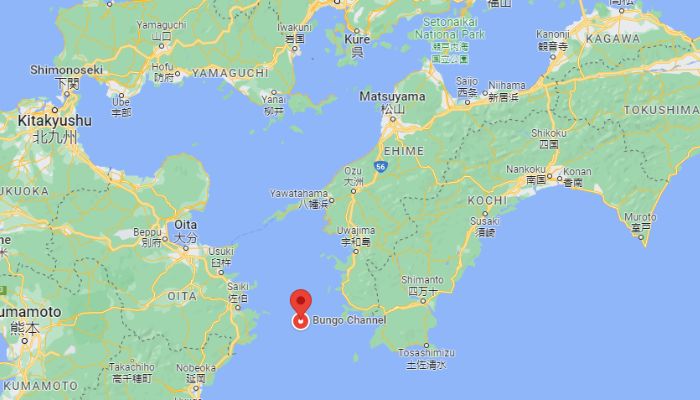
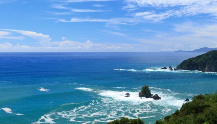
The Bungo Channel, or the Bungo Strait, is a waterway located in Japan. It separates the two islands of Kyushu and Shikoku while linking the Seto Inland Sea with the Pacific Ocean.
The Seto Inland Sea separates the islands of Honshu, Shikoku and Kyushu and is an essential marine gateway, linking the Pacific Ocean with the Sea of Japan. It is close to the bay of Osaka, and several industrial regions are located along its coasts, such as the Kansai, Kobe and Osaka. It is famous for its vast red tides caused by the death of many shellfish due to the presence of dinoflagellates and phytoplankton.
Bungo Straits are crucial for navigation, and important port cities are situated along the Bungo Channel coast. Let us explore some amazing facts and features of the Bungo Straits.
1. The Bungo Channel was formed in the Post Glacial period or the Holocene Epoch
The Bungo channel, or the Bungo Strait, was formed in three phases, the first being erosional, in which a sequence boundary with sandbanks took shape. Secondly, as the sea levels rose with increasing global temperatures and the melting of glaciers, the waters filled the Suo-nada sea. At the same time, the occurrence of powerful tidal currents led to the erosion of the sea bed and the formation of scour holes.
Scour holes can be defined as the geological formations caused due to the removal of underwater seabed material, such as sediment, sand or rocks, due to tidal currents or powerful wave activities.
Tidal sandbanks were created near these holes in the second phase, giving the seabed an uneven surface in the second post-glacial phase. In the third phase, which began during the Silurian period, the tidal energy reduced with increasing water depth and rising water levels in the Bungo Channel.
Hence, dunes and varied seabed formations came up in the Bungo Channel as submarine topography changed from erosional to depositional due to the fluctuating levels of tidal currents. These currents have eroded the narrowest point of the Channel and led to the coming up of a massive flooding surface. Irregular and largely inactive subaqueous dunes are found aplenty in the central and southern parts of the Channel.
2. Hoyo Strait forms the narrowest part of the Bungo Channel
Hoyo Strait has deep waters that serve as spawning grounds for the Japanese jack mackerels and Pacific Cutlassfish, two critical fisheries of the region. The Strait is relatively narrow and just 14 kilometres wide. It is steeply inclined on both sides and receives water from the Seto Inland sea and the Pacific Ocean via the Bungo Channel.
Near the Hoyo Strait are the 700 m wide Kanmon Straits, also known as the Shimonoseki straits. These waterways distinguish the islands of Kyushu and Honshu. These straits can be crossed by either ferries or the kanmon tunnels. They are of extreme navigational value as they connect the Sea of Japan with the Inland sea. Cargo ships from Korean and Chinese ports pass through these straits to reach the coast of Osaka and Tokyo.
Kanmon Strait has been operational since ancient times and is a significant point in the maritime transportation of goods. After establishing the ports of Shimonoseki and Moji during the Tokugawa Shogunate in the late 18th century, two lighthouses were installed at the entrance of Kanmon and many historical buildings are located along its coast.
3. Two kinds of Ocean currents- the Kyucho and Kuroshio circulate in the Bungo Channel
The eastern and western coasts of the Bungo Channel have complex and irregular coastlines. However, a rich culture of yellowtail and pearls prosper in the bays along the east shore. Japanese fishermen have used a term called Sumishio to refer to the unique phenomenon wherein the waters of the Channel’s bays always remain clear and transparent.
It is also attributed to the Kyucho, a swift ocean current leading to a sudden rise in water temperature. Geologists and climatologists observed the warm waters entering Uwajima Bay from the Pacific Ocean and penetrating through the eastern part of the Channel. Since the Pacific Ocean is oligotrophic with little aquatic vegetation and clear waters, it is concluded that the Kyucho current causes Sumishio.
Kyucho also influences the marine environment of the eastern Bungo Channel and the Uwajima bay. For instance, it was found that a sudden rise in water temperature can lead to the death of cultured fish and mixing clear ocean water with the coastal waters of the channel could reduce the productivity of numerous phytoplankton species and pearl oysters which depend on the former for nourishment. Despite its negative impacts, this current is crucial as it maintains the water quality of the eastern Bungo Strait and supports the production of marine culture in Japan.
The Kuroshio current circulates in the southern part of the Bungo Strait. Also known as the Black Current or the Japan Current, it is a powerful surface ocean current originating in the Pacific Ocean.
It carries highly saline water and travels at a speed of 50 to 300 cm per second. It circulates in the waters around Taiwan and Ryukyu islands during summers and reaches the western shores of the Honshu as the Tsushima current.
The Kuroshio current undergoes seasonal fluctuations. It is the most powerful from May till August and recedes with the onset of autumn. It gathers momentum from January and weakens in spring. It has a warming impact on the south and the southeastern coastal areas of Japan and even on Tokyo.
European explorers and sailors identified the Kuroshio current in the early 16th century. Cartographers like Bernhardus Varenius even represented it quite accurately in his maps. It was also recognised by one of the crew members of the British expedition led by Captain James Cook in 1776.
4. Bungo Straits have a humid subtropical climate
The coastal regions bordering the Bungo Channel are characterised by a humid subtropical climate with hot summers. The average maximum temperatures in the cities of Shikoku range from 50°F during winter months to 86°F in monsoons. The weather of Fukuoka, situated on the northern shores of Kyushu, is classified as temperate and humid. It witnesses mild winters and hot and humid summers.
However, in general, Japan has a monsoonal or temperate climate. The northern island of Hokkaido sees a continental environment with prolonged cold winters and cool summers. On the other hand, Honshu experiences heavy winter snow and sweltering summers.
The Pacific Coast also has a subtropical climate with mild winters and hot summers due to the southeastern winds. Ryukyu and Nanpo islands have tropical weather with warm winters and heavy rainfall during the monsoon season, which begins in late May. Heavy rains and typhoons are caused in early autumn. According to the Japanese Environmental department, rising temperatures due to global warming have severely impacted the nation’s agricultural sector in recent years.
5. Home to diverse marine flora and fauna
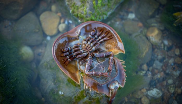
More than 400 species of aquatic plants and animals are found in the waters of the Bungo channel. Ayu, an amphidromous fish, horseshoe crabs, finless porpoises, etc., are common. Sometimes whales and small sharks enter the channel to breed, but whaling and increased levels of marine pollution have led to a decline in their population. Also, excessive fishing in the coastal areas and bays of the channel has led to habitat loss. It might result in an ecological imbalance in future, ultimately leading to the collapse of major fisheries.
Ocean fish such as saury, mackerel, sardines, herring, sea bream, squids, trouts and over 50 species of giant octopus and squid are found in the Bungo Straits. Numerous species of salmon comprise the majority of catch and are relished throughout the country.
The waters of the Bungo straits also contain precious oyster pearls and the most beautiful yet dangerous jellyfish species, Lion’s mane jellyfish and white spotted jellyfish. Mammalian species can also be seen, including seals, whales and crustaceans like shrimps.
6. Many critical coastal towns and commercial centres are located along the Bungo Channel
One of the major towns on the coast of Shikoku is Uwajima. It is situated amidst the Seto sea and the Pacific Ocean, facing the Bungo Straits. Uwajima rose to prominence as a fortress town in the 17th century and grew further with the coming of railways in the 1900s. Today, it is a flourishing fishing port and has a well-developed industrial region specialising in shipbuilding, food processing and making automobile parts. The city’s historical buildings, such as the Atago park and Uwatsuhiko shrine, are famous tourist attractions. Terrace farming is practised in Uwajima, and crops like rice, tea, soybeans, wheat and mandarins are abundant.
The city of Oita lies in northeastern Kyushu overlooking the Suo sea and the Bungo Channel. It has a predominantly mountainous topography, and most human settlements are restricted to the coastal plains. It has a rugged coastline that is close to Beppu Bay.
The city was founded in the 16th century and declined with the fall of the Tokugawa Shogunate. It is home to farming families who grow cash crops like reeds, tobacco, citrus fruits and rear cattle. Another important sector is forestry, which houses many textile, cement and chemical industries. Oita port is a central facility of the Inland sea and an important commercial centre of Kyushu. A few Oil refineries and petrochemical units are located near the port area.
Facing the Usuki Bay on the Bungo Strait coast is the city of Usuki. It was once a crucial trading post involved in maritime trade with Portugal. Presently, it is a famous fishing port and is known for its traditional breweries. The city’s Mangetsu shrine is dedicated to Lord Buddha, and its rock engravings attract many pilgrims worldwide.
7. A famous Hollywood movie was shot in the Bungo Straits region
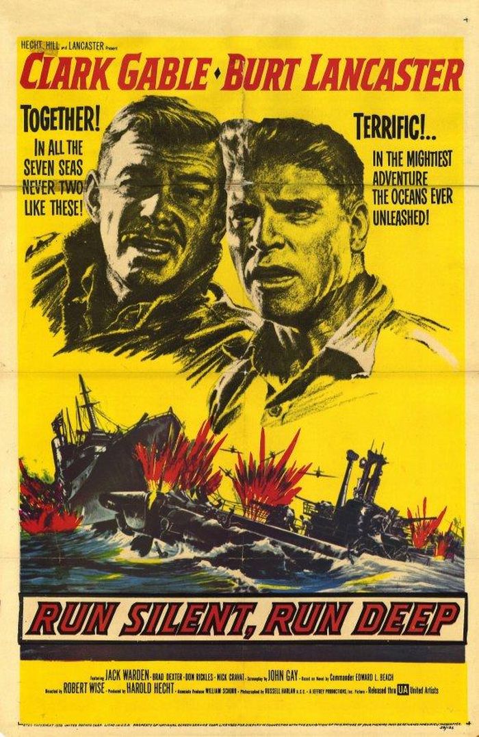
Bungo Channel became widely known across the globe due to its depiction in the 1958 war movie Run Silent, Run Deep. It was adapted from the best-selling novel of the time, written by a United States Navy officer and famous author Edward Latimer Beach Junior. He had fought in the Second World War and the Battle of Midway. The storyline portrays submarine warfare in the Pacific between 1940 and 1945.
You might also like to read-
- 11 Not-So-Known Facts about the Indian Ocean
- Top 10 Amazing Facts About the Lost City of Atlantis
- 10 Amazing Facts About The Aral Sea
- 10 Important Panama Canal Facts Everyone Should Know
Disclaimer: The author’s views expressed in this article do not necessarily reflect the views of Marine Insight. Data and charts, if used, in the article have been sourced from available information and have not been authenticated by any statutory authority. The author and Marine Insight do not claim it to be accurate nor accept any responsibility for the same. The views constitute only the opinions and do not constitute any guidelines or recommendations on any course of action to be followed by the reader.
The article or images cannot be reproduced, copied, shared, or used in any form without the permission of the author and Marine Insight.
Do you have info to share with us ? Suggest a correction

About Author
Zahra is an alumna of Miranda House, University of Delhi. She is an avid writer, possessing immaculate research and editing skills. Author of several academic papers, she has also worked as a freelance writer, producing many technical, creative and marketing pieces. A true aesthete at heart, she loves books a little more than anything else.
Latest Maritime Knowledge Articles You Would Like:
Subscribe To Our Newsletters
By subscribing, you agree to our Privacy Policy and may receive occasional deal communications; you can unsubscribe anytime.


