

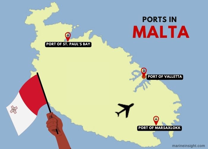
5 Major Ports in Malta
The Republic of Malta consists of an archipelago in the Mediterranean region, just 80 kilometres from southern Italy across the Malta Channel. It incorporates the three biggest islands of Malta, Comino and Gozo, out of which Malta with its capital at Valletta is the largest. The islands span 316 square kilometres and house 500,000 inhabitants.
Maltese coastline is dotted with natural harbours, marinas, cruise ports and two commercial ports. Historically, these ports have established Malta as an important hub of Mediterranean Commerce, travel and tourism. Favourably positioned at the intersection of vital sea lanes connecting Europe, North Africa and the Middle East, Malta is a major trading hub and a transhipment centre of the region.
With the opening of the Suez Canal, Malta became a fueling point and acted as a service station for vessels passing through the Mediterranean sea. However, with the development of new commercial ships requiring few stopovers, its economy declined.
Since then, the Maltese islands developed a reputation of being the perfect holiday destination, but in the past few years, the nation sought to diversify its economy by investing in other key sectors.
With a 2.5 per cent GDP growth in 2020 and a declining unemployment rate, it has emerged as an advanced economy. Apart from tourism; financial services, maritime services, manufacturing and Igaming are the sectors that form the backbone of the economy. Significant investments in infrastructural development, capacity building and transportation and energy sectors can transform Malta into a truly competitive global economy.
Almost 50 % of foreign trade is conducted with European Union countries and significant exports include electrical machinery, household appliances, seafood, pharmaceutical products and printed material.
Mineral fuels and oils, waxes, Refined Petroleum, Passenger and Cargo Ships, aircraft, plastics, helicopters, spacecraft, yachts, automobiles, paper, wood and Integrated Circuits are imported from South Korea, Italy, China, Russia, Germany and the United States.
Let us review the 5 major seaports of Malta, their layout, capacity and other important characteristics.
1. Port of Valletta
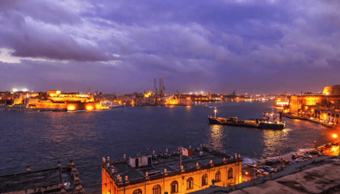
The Grand harbour or Valletta is the principal seaport of Malta handling 85 % of its maritime trade. Situated on its southeastern coastline, it is a natural deepwater harbour protected by two main breakwaters. It has facilities offering ship repair and maintenance, drydocking, transhipment and storage. Traditionally, it was a fortification town and served as a naval base during the second world war. It was used by Phoenicians, Greeks, Carthaginians, Romans, and Arabs and was the site of important historic settlements. Hence, UNESCO declared 55 hectares of land area near the port as a world heritage site in 1980.
Approximately 1,800,000 tonnes of general cargo, 502,000 tonnes of dry bulk, 1,000,000 tonnes of liquid bulk cargo, 820,000 tonnes of containerised cargo and over 5000 cargo ships are handled at the port annually.
The capital of Malta, Valletta is also a renowned cruise destination lined with expansive beaches and traditional churches. A passenger terminal was built in 2005, containing 4 wharves for accommodating cruise ships, yachts, ferries and small boats.
Quays and Port terminals
Port of Valletta has numerous multipurpose terminals equipped for handling automobiles, trailers, Roro, conventional cargo, breakbulk and liquid cargoes. It has 6 Roro berths with inbuilt stern ramps for accommodating pure car carriers. It also houses a modern container terminal having 5 berths covering 1000 m. In 2021, the facility handled 2,400,000 TEUs.
The General cargo terminal comprises 8 wharves, five located at Deep Water Quay and three at Laboratory Pier. It also has two sheds covering 18,000 m2 for storing general cargo. The Deep Water Quay spans 600 m and has berthing facilities for roll-on/roll-off vessels apart from cargo ships. It has three transit sheds covering 8500m2.
The Laboratory Pier is 540 metres long and specialises in handling containers and Roro cargo. It has a 10,400 m2 parking space that can accommodate at least 785 vehicles.
The Magazine Wharf is mainly utilised for handling cereal transshipments. Managed by Kordin grain terminal Company, it is 320 m long with an alongside depth of 15 m for accommodating Panamax size vessels weighing up to 80,000 DWT.
Three quays at the Fuel wharf are decked with the latest equipment for loading and discharging edible oil. Covering 205 m with a depth of 10 m, these wharves also hold three silos for storing cement, owned by private operators. The Flagstone Pier is a petroleum terminal used for storing petroleum in 5 oil tanks. It can accommodate the largest oil carriers and also offers bunkering services.
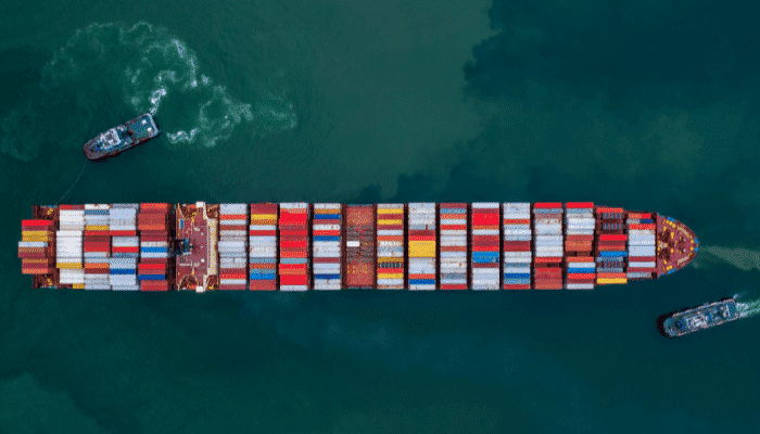
2. Marsaxlokk Port or Malta Freeport
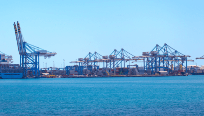
Malta Free Port is located on the coast of Marsaxlokk Bay in the southeastern part of the island nation. It is an industrial port and a fishing harbour lying near the busiest shipping routes forming Europe, West Africa and the Middle East trade triangle. It is an important transhipment centre of the region, mainly dealing with containerised cargoes. Around 2,700 vessels, 5,810,000 tonnes of cargo and 1,480,000 TEUs are handled at the port annually.
It occupies 68 hectares of land area and has a total berthing line covering 2140 m, 15,000 container ground slots and 894 reefer connections. The port is divided into four main areas namely the container terminal, an oil terminal operated by Oiltanking Malta, a logistics department serving the offshore oil and gas industry, and a storage area.
The port authorities have made improvements to accommodate the largest container vessels and offer efficient services. The Northern berths were dredged to a depth of 17 m and the approach channel was also deepened to 25 m.
Container terminal
The container handling facility at the Malta freeport is equipped with specialised real-time container tracking systems that enable the port authorities to plan and manage the containerised cargo while offering numerous benefits to its customers.
There are two container terminals at the port known as Terminal One and Terminal Two.
The former occupies 45.8 hectares and consists of 10,140 ground slots and 606 reefer points. It has two wharves; the North Quay and the West Quay and fully functional port equipment including 10 ship-to-shore cranes, 6 mobile cranes, 13 port trucks, 15 reach stackers etc. Terminal two spans 23 hectares and contains 4950 ground slots and 288 reefer plugs. It comprises three quays and a RORO berth.
Both the facilities have a combined 62-hectare container storage area. It also houses a Border inspection post and a Vehicle and Cargo inspection system operated by Malta Freeport Terminals.
Liquid Bulk terminal
Four oil jetties at the Malta Freeport are operated by Oil tanking Malta Limited, capable of accommodating 120,000 DWT vessels with a maximum draft of 16 m. Petroleum products and derivatives, crude oil, fuel oil, feedstock, diesel, gasoline and jet fuel are handled at this terminal. The company also owns five tank farms with a total capacity for storing 550,000 m3 of liquid fuels.
Roro terminal
The port has two Roro berths covering 400 m with an depth of 12.5 m. The authorities plan to expand it further and transform it into a major car transhipment facility.
3. Ċirkewwa Harbour
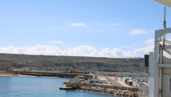
The Cirkewwa harbour is located at the northwestern end of Malta facing the Gozo channel. It connects the island nation to the nearby islands of Gozo and Comino and plays a central role in the economic development of Gozo, the second biggest landmass in the Maltese archipelago.
A ferry terminal operates from this harbour, carrying locals and tourists to the Mgarr port in Gozo. Since it lies at the end of the island and not amidst a major town, the terminal is small and does not offer much, except the natural picturesque waterfront.
It has three docks for accommodating small cruises, car ferries and barges, a terminal building and a waiting area. A resort and a beach are just a few kilometres away from the Cirkewwa harbour.
A pleasure port, it attracts thousands of visitors, especially during summers since the town is famous for its sandy beaches and solitude. A haven for water sports enthusiasts, it also organises several diving excursions and boating competitions. Its crystal clear waters, underwater cliffs, deep caves and tunnels make it one of the most visited scuba diving places in Malta.
Interestingly, a local community of divers are striving hard to designate the harbour as a Marine Reserve. They have been trying to get the support of the fishing and boating communities to implement rules and regulations to preserve its natural biodiversity and prevent marine pollution.
4. Mġarr Harbour
The Mgarr port is being developed by Maltese authorities to handle greater cargo traffic and passengers, thereby boosting the economic growth of the Gozo island. In this regard, new berths are being constructed to allow the insular island to engage in limited yet vital international maritime trade.
The area around the harbour developed in the late 19th and 20th centuries, however, modernization began only in 1969. Many companies operated ferries from Gozo island and in 1979 the government established the Gozo channel company which led to further port development and settlement with the coming up of the modern harbour, construction of new berths, restaurants and pubs.
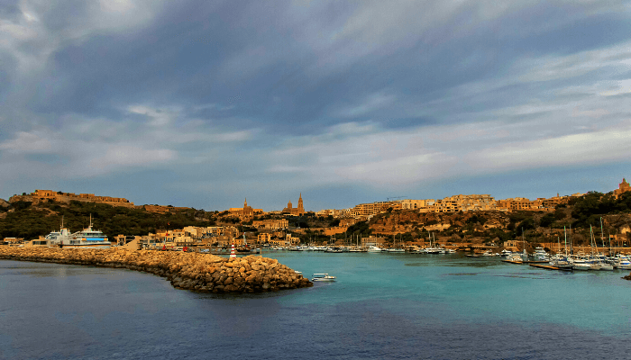
Mgarr port is protected by two breakwaters extending northeast and southwest from the coastline to form the E-shaped harbour entrance. It consists of a commercial berth for handling small general cargo and an inter-island ferry terminal having two roro berths covering 220 m with an average water depth of 6 m. Pontoons dot the remaining part of the natural harbour, with mooring facilities for fishing vessels on the western side and leisure crafts, locally owned boats, small cargo ships and ferries on the northern part of the harbour.
Fort Chambray overlooks the harbour. Commissioned by Jacques François de Chambray on the orders of St John in the late 17th century, the fort was intended to be a powerful fortified city and the capital of Gozo. The harbour also contains the famous
Mġarr yacht marina, Żewwieqa waterfront and the restored mediaeval facility of Dgħajsa tal-Latini, are utilised for ferrying people and goods between the Maltese islands.
5. Port of St Paul’s Bay
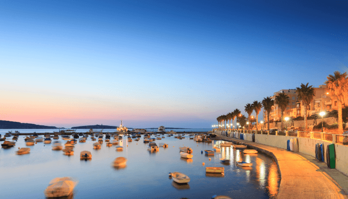
The village of St Paul’s Bay lies on the northern Maltese coastline and also includes the neighbouring regions of Bugibba, Qawra and other localities like Xemxija and Mistra. Historically a fisherman’s village, St Paul’s Bay was named after the famous shipwreck of St Paul who is said to have introduced Catholicism to Malta.
Today, it is a popular tourist destination lined with rocky beaches, an old church, traditional Maltese houses and resorts, offering the peace of village life. It is usually quieter compared to other villages but is crowded during summers.
Tourists can enjoy water polo and also participate in the annual Festa or village feast organised every year near the harbour. Offering a taste of the vibrant Maltese culture and cuisine, the event attracts thousands of people and also supports the local economy.
A seaside town, it has a rocky coastline and no expansive smooth sandy beaches. It does have small bays perfect for swimming and sunbathing, such as the Bajja tax-Xama and the Bajja ta’ l-Għażżenin. Another famous spot is the Ferkuna beach however it is lined with pointed rocks and deep waters.
You might also like to read:
- 7 Major Ports in Saudi Arabia
- 6 Major Ports in South America
- 8 Major Ports in Australia
- 7 Major Ports in Kazakhstan
- 5 Major Ports in Mozambique
Disclaimer :
The information contained in this website is for general information purposes only. While we endeavour to keep the information up to date and correct, we make no representations or warranties of any kind, express or implied, about the completeness, accuracy, reliability, suitability or availability with respect to the website or the information, products, services, or related graphics contained on the website for any purpose. Any reliance you place on such information is therefore strictly at your own risk.
In no event will we be liable for any loss or damage including without limitation, indirect or consequential loss or damage, or any loss or damage whatsoever arising from loss of data or profits arising out of, or in connection with, the use of this website.
Do you have info to share with us ? Suggest a correction
Disclaimer :
The information contained in this website is for general information purposes only. While we endeavour to keep the information up to date and correct, we make no representations or warranties of any kind, express or implied, about the completeness, accuracy, reliability, suitability or availability with respect to the website or the information, products, services, or related graphics contained on the website for any purpose. Any reliance you place on such information is therefore strictly at your own risk.
In no event will we be liable for any loss or damage including without limitation, indirect or consequential loss or damage, or any loss or damage whatsoever arising from loss of data or profits arising out of, or in connection with, the use of this website.

About Author
Shilavadra Bhattacharjee is a shipbroker with a background in commercial operations after having sailed onboard as a Third Officer. His interests primarily lie in the energy sector, books and travelling.
Latest Maritime Knowledge Articles You Would Like:


Subscribe To Our Newsletters
By subscribing, you agree to our Privacy Policy and may receive occasional deal communications; you can unsubscribe anytime.