

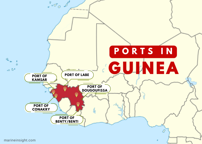
5 Major Ports in Guinea
The West African nation of Guinea is a developing economy primarily driven by agriculture and other rural activities. The coastal nation has tremendous scope for development since it is centrally positioned amongst the 15 ECOWAS member countries such as Guinea Bissau on the northwestern side, Mali on the northeastern and Ivory Coast on the eastern border while Sierra Leone and Liberia on its southern side. ECOWAS is a regional union of West African nations to promote cooperation and collective decision making in spheres of industry, economy, trade, etc.
The country has a coastline stretching 200 miles facing the Atlantic Ocean on its western border. Guinea’s strategic geographical location allows it to engage in international maritime trade directly through its major seaports. It also has numerous inland river ports and waterways as the Niger, Gambia and Senegal rivers originate from the highlands of Guinea, flowing into neighbouring countries and facilitating the transport of trade goods in the region, promoting interregional maritime trade.
The Agricultural sector employs 75% of the population and the major crop is rice, however, the production is unable to meet the national consumption level, hence it is exported from Asian countries. Bananas are grown and plantations of grapes and strawberries have come up due to an expanding horticultural sector. Devoid of proper storage facilities Guinea is unable to maximise its earnings from agro-based exports. Guinea also holds the world’s largest reserves of Bauxite and also significant diamonds, gold and unexplored uranium reserves. It also possesses high-quality iron ore deposits and untapped oil deposits.
Though it is rich in natural resources and mineral wealth, the population of the country suffers from poverty and low standards of living due to rampant unemployment. Slow infrastructural development coupled with high corruption rates has arrested Guinea’s economic progress. Political factors and government policies are also to blame for the lack of modernisation and technological development of most port facilities.
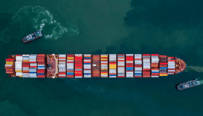
About 14.5 million tonnes of Bauxite is exported every year from the seaports of Guinea. Other export commodities such as gold, diamonds, coffee, and oil are sent to Spain, India, US, Chile and India. Imports of fuel such as refined petroleum, medicines, trucks, cars, machinery, construction equipment, and packaged food are brought from China, Belgium, the Netherlands, and the UAE. The import-export trade is carried through the country’s major ports mentioned below.
Port of Conakry
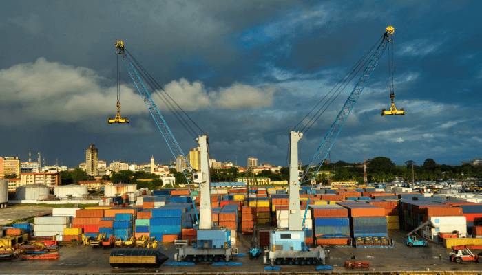
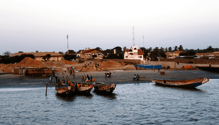
The Port of Conakry is Guinea’s largest and major port, situated on the southern coast of Guinea, in the country’s capital and biggest city serving as the nation’s financial, trade, cultural and administrative centre. Conakry’s economy revolves around this port which has facilities for handling conventional cargo, containerised cargo, bulk and breakbulk, ro-ro and fishing vessels.
The major commodities exported from Conakry port include shipments of bauxite and alumina and seafood. Major imports handled at the port include manufactured products, cement, flour, sugar, and rice. More than 850 cargo ships visit the port annually carrying 7,000,000 tonnes of cargo and 81,000 TEUs. The port can accommodate ships weighing more than 50,000 DWT and tankers with a maximum LOA of 210 m. The port is divided into 3 facilities for handling containerised goods, general cargo and oil.
The Container handling facility
The container terminal at the Port was constructed in the 1980s covering 80,000 m2 with a dock measuring 275 m. However, due to increased container traffic at the port, the Bollore Company, operator of the terminal and the Autonomous Port of Conakry, the government-owned enterprise, worked together on the container expansion project. An additional berth spanning 340 m was built to handle ro-ro and containerised cargo, along with three new shore cranes and a power plant. The container facility now covers roughly 22 hectares with a total berth length of 600 m.
Bollore plans to transform the terminal into a major regional transhipment hub decked with the latest port operation systems and at par with global standards to increase the port’s productivity.
The container terminal has two berths with a length of 260 m and 330 m and depths of 11 m and 13 m. Around 12 hectares are used for the storage of containerised cargo and a 6-hectare paved space is utilised for stacking empty containers. It has sufficient port equipment such as 2 container gantries, 2 mobile cranes with a capacity of 100 million tonnes, 13 reach stackers, and 6 forklifts. The terminal can store roughly 7150 TEU and handle 340,000 TEU annually.
General Cargo handling facility
The port’s conventional cargo is handled at this terminal comprising a total wharf length of 830 m. This facility can be reached through the southern navigation channel close to the Boulbinet lighthouse lying in the port’s basin, which spans 5000 m with a depth of 10 m, protected by dykes to prevent silt deposition at the port entrance.
The lighthouse of Tamara located just 15 km from this port with a range of 55 km guides the ships easily into the port harbour. The port also offers many services such as wastewater treatment, bunkering, a shop for buying repair equipment, and a small workshop offering ship repair and maintenance.
This facility comprises designated berths for handling specific cargoes. Two berths covering 345 m and 10 m deep are dedicated to alumina and clinker apart from the raw material used for manufacturing. Two berths with varying depths of 8 and 9 m and lengths of 300 and 190 m are used for handling general cargo and bulk such as sugar, flour and rice. Three berths, 395 m long and 10 m deep, handle the largest bulk carriers for exporting Bauxite.
Oil jetty
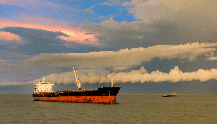
The oil handling facility was built in the second phase of expansion undertaken in 1992. The wharf covers 200 m and has an average depth of 12 m. Comprising four mooring dolphins and 4 docking facilities, this jetty can accommodate oil tankers weighing around 50,000 million tonnes. Apart from big ships, the jetty also handles ferries and small tankers for transporting oil to major Guinean cities and neighbouring regions. It is operated by SGP, a prominent petroleum company of Guinea.
Port of Kamsar/ Kakande
Kamsar port lies on the eastern banks of the Rio Nunez river and handles around 14% of the global production and transportation of Bauxite. It is one of the major ports of Guinea, visited by more than 300 bulk carriers and cargo ships every year. Ships with an LOA of 230 m and a maximum draught of 10.5 m can enter the port Kamsar through its wide navigation channel with a depth of 9 m, leading to the Bauxite handling pier.
Container terminal
The Kamsar container handling facility is an autonomous terminal managed by the Abu Dhabi Ports, which aims to expand the port’s capacity and productivity by constructing new facilities for accommodating Capesize and Newcastlemax ships for exporting bauxite to the major port facilities across the world and especially China. Also, the terminal has offered long-term employment to the locals by creating 5000 jobs while boosting the economy of Guinea.
The facility comprises 2 berths and can accommodate ships with an LOA of 135 m. The port is close to a bauxite mine hence the government plans to link them by constructing a direct railway line.
In 2017, the port underwent expansion undertaken by the VINCI construction company. The mineral berth was expanded for handling more vessels simultaneously and the entrance channel was dredged. The former was extended by 350 m to allow berthing of the biggest ore carriers.
Bauxite pier
Apart from handling bauxite, this pier comprises facilities for handling petroleum products such as diesel oil, gasoline and Bunker C using hoses. The pier has storage tanks, including three for storing 10,000 m3 of Bunker C, 2 tanks for keeping 3000m3 of diesel oil and 3 tanks for keeping 1500 m3 of petrol.
Port of Dougoufissa Creek
It is a sub-port of port Kamsar that is dedicated to handling general cargo and ro-ro. This small facility has two berths, the first-named Quai Francais capable of accommodating ships with a total length of 100 m and a maximum draft of 6 m. The second berth cannot accommodate cargo vessels but is visited by small boats and ferries carrying miscellaneous goods.
Port of Benti/ Benty
The port of Benti is a deepwater seaport in western Guinea, situated at the mouth of the Melacoree river, just a few kilometres from the Atlantic coastline. It is an important facility famous for its banana exports. The city is also an important trading hub of fruits such as pineapples, rice, fish, salt, coconut and palm oil. The port can accommodate vessels with a maximum draft of 6 m.
The port has a long history dating back to the 18th century. It was a slave port, a crucial point in the transatlantic slave trade. During French colonial rule, it emerged as an important west African port for shipping gold to the Empire. Later it developed as a naval base for all the colonial powers that acquired it such as the British.
From the 1930s to the 1950s, the region was known for its booming Banana production; however, it went into decline in the late 90s. After attaining independence the government of Guinea undertook its expansion including dredging work. Hence, today it is a naturally well-sheltered and deep draft facility capable of accommodating supertankers and the biggest cargo ships.
The port is strategically positioned amidst the west African coastal zone and is the region’s only facility that is well-linked with roadways such as the Trans-West African Coastal Highway that connects all the West African nations including the landlocked nations such as Burkina Faso. Hence, the Guinean government in 2020, decided to construct an oil terminal at the Benti port.
The terminal would accommodate the biggest vessels that are unable to berth at the Conakry port. Given its position, it could become a major oil facility in the region. In 2021, a 700 km long railway connecting the port with Simandou is being built for transporting iron ore to the port of Benty.
Port of Labe
The Labe is a small port lying on the Gambia River in the Fouta Djallon district. The town of Labe was established in the early 17th century and named after the chief of the Dialonke tribe. As it grew into an important political and trade centre, the importance of the Labe port grew. Presently it handles the trade of cattle, livestock, millet and fruits. The port is known for transporting oranges to Senegal. It also exports these to the fruit juice factory in Mamou. The port has a separate berth for handling seafood and receives small fishing boats too.
Disclaimer: The authors’ views expressed in this article do not necessarily reflect the views of Marine Insight. Data and charts, if used, in the article have been sourced from available information and have not been authenticated by any statutory authority. The author and Marine Insight do not claim it to be accurate nor accept any responsibility for the same. The views constitute only the opinions and do not constitute any guidelines or recommendations on any course of action to be followed by the reader.
The article or images cannot be reproduced, copied, shared or used in any form without the permission of the author and Marine Insight.
Do you have info to share with us ? Suggest a correction
Latest Maritime Knowledge Articles You Would Like:


Subscribe To Our Newsletters
By subscribing, you agree to our Privacy Policy and may receive occasional deal communications; you can unsubscribe anytime.