

10 Interesting Facts About The Tasman Sea
Sandwiched between the Australian and New Zealand landmasses, the Tasman Sea is a marginal sea in the South Pacific Region of the Eastern Hemisphere.
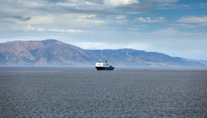
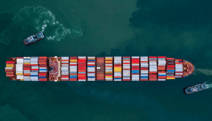
As a major trading route between parts of Oceania viz. Australia and New Zealand, the Tasman Sea are responsible for a considerable volume of trade between both countries.
Similarly, shipping consignments destined for other parts of the globe pass through the Tasman Sea to reach nations in South-East Asia or across the Pacific to the Americas.
The Tasman Sea was first explored by European navigators and cartographers in the mid-17th century, as part of global conquest plans by the British and Dutch empires.
The famous Captain James Cook was one of the earliest explorers to extensively travel and map the Tasman Sea.
The basin countries for the Sea are Australia and New Zealand, with several major cities lying on the Tasman Sea’s coast. The region is primarily shaped by the Tasman’s underwater mid-ocean ridge that formed 85 – 55 million years ago.
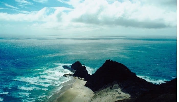
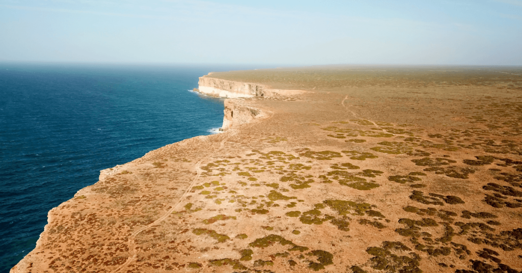
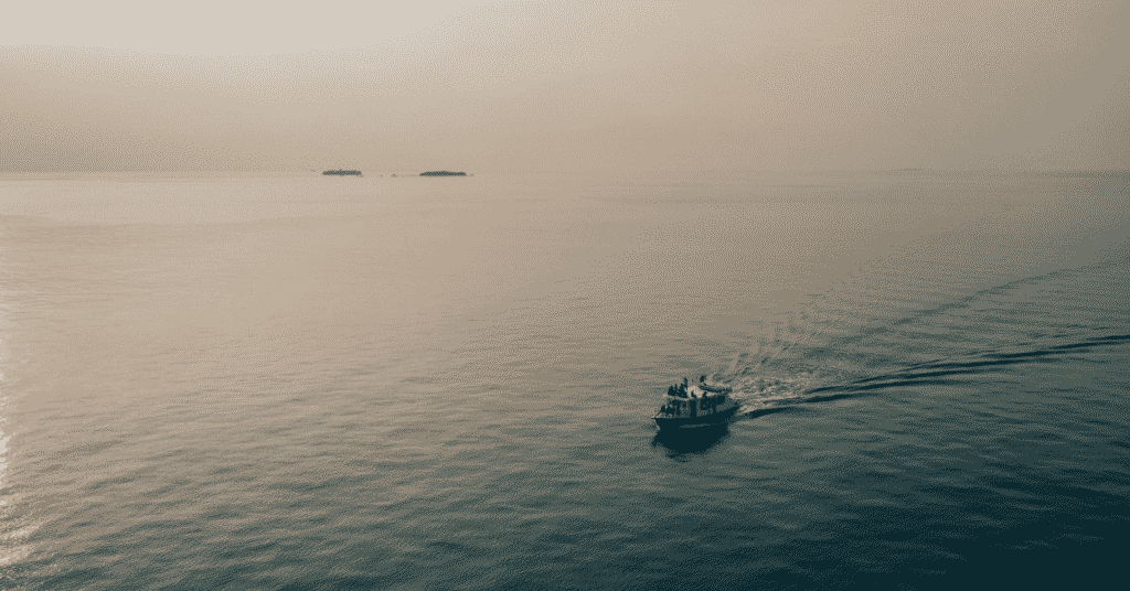
The Sea is considered to be one of the most picturesque locations on Earth, with beautiful corals and bloom formations.
Cruise ships regularly pass through this route and boating activities are common during months with calm waves and wind conditions. In this article, we explore 10 interesting facts about the Tasman Sea. With a plethora of interesting historical and geographical facts, this is bound to make for some interesting reading!
1. The Tasman Sea gets its name from Dutch explorer Abel Tasman
The rather unique name stems from Dutch 17th-century explorer Abel Janszoon Tasman (1603 – 1659), who travelled extensively as part of the Dutch East India Company (VOC). He is noted for being the first explorer from Europe to visit New Zealand and Tasmania.
An avid seafarer and explorer, Abel Tasman was also a merchant with interests in the East Indies Council. The overseers of the council regularly sent explorers to distant lands, and Tasman was one such explorer who travelled to the Eastern hemisphere.
His first major voyage in 1642 was to explore the so-called “Province of Beach” which are today known as Australia and Zealandia. Many of the landmarks around Oceania were named by Tasman after reigning the governors-general or naval commanders.
The first voyage was to Australia and New Zealand, and his excursion team was the first group of Europeans to land in the area. Over the next voyage from 1643-44, he further explored North Australia and christened the land “New Holland”.
The region of Tasmania (Australia) and the Tasman Sea are named in honour of Abel Tasman. Many of his observations during the exploration led to the development of cartography in the 17th century.
However, the Dutch East India Company viewed his exploration as wasted opportunities as they failed to yield any new trading routes, new commodities for export from Oceania, and any form of contact with the locals. His failure to fully explore the land led to Oceania being viewed as a distant and unapproachable land until the famed voyages of James Cook.
Abel Tasman and his craft’s pilot, Frans Visscher, had written detailed notes in their journal, outlining the routes, landmarks, and events they encountered during the voyages.
Maps prepared by Tasman’s crew and the memoirs of Visscher served as major sources of information for the cartography and East India industries.
As a prominent explorer, several other places in and around Oceania are named after Tasman. These include the Tasman peninsula, the Tasman Glacier, Abel Tasman National Park, and Tasman Lake.
2. The Sea stretches nearly 3,000 kilometres from North to South
The Tasman Sea is by no means a small waterbody, spanning a surface area of over 2.3 million square kilometres. It spans nearly 3,000 kilometres in length and a further 2,200 kilometres from East to West.
The maximum depth of the Sea is 5,500 meters, located near a series of ridges and peaks on the Zealandia midocean ridge. Located between the Australian and New Zealand landmasses, the Sea is a large expanse of water that is treacherous to cross during certain periods of the year.
This is predominantly because of the poor wave conditions for thousands of kilometres at a stretch.
The International Hydrographic Organization (IHO) is an intergovernmental organization comprised of 94 member nations that study hydrography and standardizes information about the world’s oceans.
The IHO maintains the extent of the Tasman Sea based on surrounding landmarks. To the north, the Sea is bounded by the Elizabeth Reef, the South East Rock, and the Lord Howe Island.
In the East, the Cook Strait and Foveaux Strait define the limits. The other references for the Eastward limits are Cape Palliser, Cape Campbell lighthouse, and the Waipapapa Point.
In the South, Stewart Island, Auckland Island, and the Southernmost point of Tasmania serve as a reference. In the West, a line joining Gabo and East Sister Islands mark the boundary.
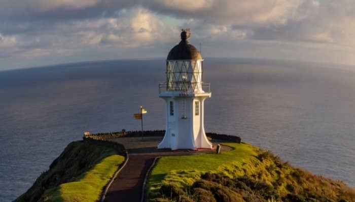
Flinders and Barren Islands are other prominent landmarks that demarcate the Western extent. The nature of the Tasman Sea’s weather condition necessitates several lighthouses on the coastline.
These extend along the Australian and New Zealand coastlines located at strategic Capes and natural ridges.
3. The geological base of the Sea consists of a unique siliceous biogenic ooze
Most Seas and large water bodies present on Earth have rocky bases. This occurs due to a cycle of sub-surface molten eruptions, cooling into rocky surfaces, and the eventual erosion into sedimented or powdered bottoms.
Flora and fauna found at the base are generally restricted to a few plant species that have adapted to the reduced sunlight and presence of dissolved oxygen. Corals are commonly found near the base and are often covered by smaller plant species that cover sparse tracts of the sea bed.
Underwater currents in some parts of the World Ocean prevent small organisms or plankton from settling near the base.
However, in reality, vast areas of the ocean bottom are covered in plankton and other microorganisms, known simply as planktonic ooze.
This “ooze” is defined as sediments that contain at least 30% skeletal remains of pelagic organisms, as determined by Bohrmann, Abelmann, Gersonde, Hubberten & Kuhn (1994).
Oozes can be of different types, with Globigerina ooze being the most common. It is found across the ocean floor in almost all major water bodies.
Researchers have determined the age of most globigerina ooze planktons be over 200 million years ago, during the Jurassic era. Globigerina ooze consists of foraminiferous shells and was first identified when laying transatlantic telegraph cables.
The Tasman Sea has a rather unique type of sea bed ooze – siliceous ooze. It is found in only 15% of the world’s ocean floor and consists mainly of silica (SiO2) from the shells of prehistoric organisms.
The siliceous ooze features a series of spiny silica protrusions on the surface of planktonic organisms such as radiolarians and diatoms.
These organisms were able to secrete shells and sequester carbon dioxide. They played an important role in the deep-sea carbon pump and gradually accumulate with time over the ocean floors.
Researchers can use sections of planktonic ooze to study how the oceans have changed over time. They can learn about sediment patterns, sea circulation, tectonic activity, and climatic conditions by taking core samples of the sea bed and studying the paleo-oozes.
A rather interesting feature of paleo-ooze is that during the K-T mass extinction period when most life on earth was facing extinction, paleo-ooze was thriving due to an altered nutrition cycle and ocean upwelling.
4. The Tasman Sea is located close to other prominent waterbodies
The Tasman Sea’s prominence in the global supply chain and logistics sector is primarily due to its proximity to other major water bodies.
To the east lies the Pacific Ocean, the largest water body on Earth and a major shipping route between the Americas and Eastern Asia. Prominent canals and straits between the Pacific and the Atlantic Ocean also make it a busy ocean for shipping from Europe and Africa.
Cape Horn is the southernmost point of the South American mainland, while the Magellan Straits is a natural crossing between both Oceans located slightly North of the Cape. Further North, the Panama Canal connects the American Eastern coastline with ports in Asia and on the Tasman Sea.
To the West of the Sea lies the Indian Ocean, one of the roughest water bodies on Earth with extreme wind and wave conditions for most parts of the year.
The Tasman Sea is not commonly accessed from the Western Hemisphere through this Ocean. However, Asian nations such as Indonesia, Malaysia, India, and China all trade regularly with Oceania through the Indian Ocean.
The Tasman Sea is a preferred location for ships to berth due to the easy access to both Australia and New Zealand. However, due preparation is undertaken to weather the rough weather conditions of the Tasman Sea.
The Tasman Sea is a favoured route for ships heading to and from Oceania towards Europe, the Americas, and the Western coast of Africa.
From Europe, a major market is the automobiles and electronics industry, with most ships making stops at ports in both Australia and New Zealand.
The Americas primarily export agricultural and chemical products to Oceania, using intermodal transport. Barring consignments from the Western coastline that are directly shipped across the Pacific Ocean, goods from the East Coast are trucked or transported using railroads to ports either on the West Coast or close to the Panama Canal. Countries in South America tend to prefer shipping goods across Cape Horn or the Magellan Straits.
Ships from Africa’s Eastern coastline prefer staying close to the shore due to the rough weather conditions in the Indian Ocean. They take the route across the Southern tip of India and then sail close to Indonesia or through the Straits of Malacca, before reaching Oceania.
Ships from the Western shore of Africa, on the other hand, use the less treacherous South Atlantic crossing to South America, from where they cross over to the Pacific either via Cape Horn or the Magellan Straits.
This saves them from the arduous and often dangerous trip across the rough Indian Ocean. Interestingly, most ships to and from Europe also access ports on the Tasman Sea via South America and not through the Suez Canal.
A few other important features close to the Tasman Sea are the Cook Straight and the Bass Straight. To the East, the Cook Strait separates the North and South islands of New Zealand’s landmass and directly connects the Southern Pacific Ocean and the Tasman Sea.
In the West, the Bass Strait separates Tasmania from the Australian mainland and links the Tasman Sa with the Great Australian Bight. It was formed roughly 8,000 years ago as the sea level rose and is a relatively young geographic formation.
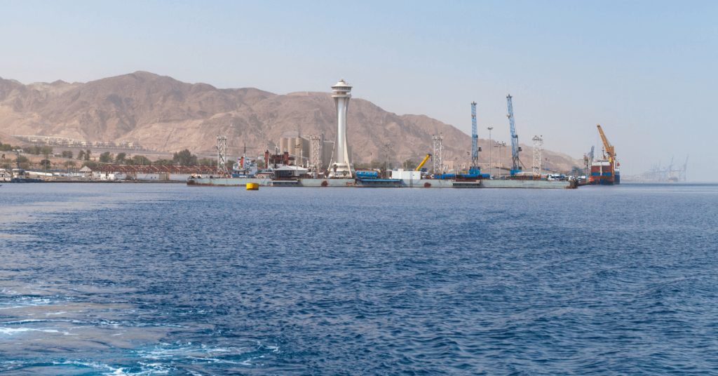
5. Several major cities are located on the Tasman Sea’s coast
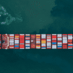
The Tasman Sea is a major trade route between New Zealand and Australia. Despite the rough weather and wave conditions, there are several ports on both coastlines that service the shipping industry.
New Zealand, with its smaller goods market, is dependent on trade with Australia to meet the growing demands of its populace. These ports ship a variety of products, ranging from chemicals and metal ores to agricultural produce and livestock.
The ports of Australia and New Zealand are famed for their livestock exports across the globe, spanning from the Americas to the Middle East. The major ports on the Tasman Sea include South West Rocks, Darling Harbour, Kaipara Harbour, Port of Newcastle, Batemans Bay Marine, Port of Mallacoota, Hythe Southport, Port of Auckland, Port Nelson, Port of Sydney, Greenwell Point, and Port of Flinders Island.
Besides trade routes on the Tasman Sea, it is also a picturesque, albeit stormy, location with the opportunity to live close to a hub of activity and a major trade route on the Southern Hemisphere.
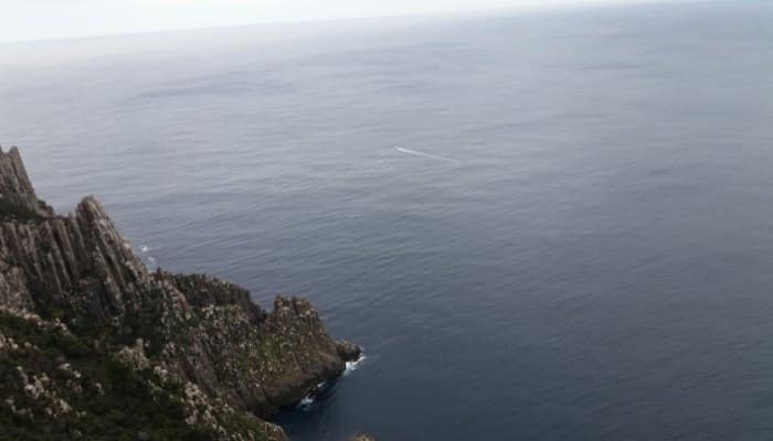
The tourism sector in Oceania operates mainly across the Tasman Sea, and cruise ships operate during several months of the year. These cruises operate from the above ports while the major coastal cities cater to tourists from around the world.
The prominent coastal cities include Newcastle, Sydney, Wollongong, Auckland, Wellington, Hobart, New Plymouth, and Whanganui.
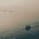
6. The Tasman Sea is one of the roughest waterbodies on Earth
Wind and wave conditions on the Tasman Sea are rough for most parts of the year. Regular atmospheric depressions pass over the Sea from West to East below the 40°S latitude.
The significance of this latitudinal limit is the naming of these adverse wind conditions as the “Roaring Forties”. However, the wind directions reverse from East to West during the April – October months creating extreme wind activity.
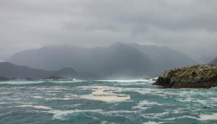
The Sea is buffeted by headwinds acting against the trade winds (Easterlies) for most of the year and making passage of the Tasman Sea by boat or kayak difficult.
The winds generate surface currents that further increase the wave activity. Numerous travellers across the Tasman Sea have fallen to the deceptive nature of the wind and wave activity in the region.
Today, boaters and even large ships plan their crossing or passage through the Tasman based on accurate weather reports to bypass the rough conditions.
7. Capt. James Cook was an early explorer to the Tasman Sea during his voyages
Captain James Cook (1728 – 1779) was a famed British navigator and cartographer who travelled extensively across the Pacific Ocean over three voyages spanning 1768 to 1779.
His main explorations were concentrated around Oceania and he is credited with the first recorded circumnavigation of the New Zealand mainland. During his first voyage with the Royal British Navy in 1768, Cook sailed to New Zealand where we accurately mapped much of the coastline.
This voyage also brought him into contact with the Māori tribe, giving him the distinction of being the first recorded European to have met the native tribe. After his initial explorations of New Zealand, Cook travelled back to England through the Indian Ocean via Jakarta.
Capt. Cook’s second voyage is particularly remembered for its aim. The Royal Society had commissioned him to identify the hypothetical Terra Australia, a continent that they believed would be found in the Southern Hemisphere.
According to the now-disproven logic, the several continents in the North Hemisphere had to be balanced by a very large continent to the South.
Despite Cook’s evidence that his initial voyage proved there was no such land beyond Australia and New Zealand, he was sent on a new journey.
This expedition circumnavigated the globe close to Antarctica. At one point, Cook was very close to reaching Antarctica after crossing the Tasman Sea.
However, a resupply trip to Tahiti prevented this from happening. Had he discovered Antarctica, it would have resulted in the Royal Society incorrectly proclaiming that landmasses had to be balanced across the Hemispheres.
James Cook’s final voyage was to Hawaii and North America, where he died at the hands of the Māori tribe after an argument. Capt. Cook is known for his advances in the field of navigation and cartography. He was particularly important in mapping the coastline of the Tasman Sea and making detailed notes on the water body.
8. The Tasman Sea is locally referred to as The Ditch
An oft-used phrase is “crossing the pond”, referring to the North Atlantic Ocean. During the era of maritime travel in steamers and luxury cruise ships between Europe and North America, the Atlantic was jokingly called the pond, in reference to its size.
Early explorers had mistaken the size of the waterbody and assumed it could be easily crossed. With the discovery of America by Columbus and Amerigo Vespucci, the actual vastness of the ocean had been estimated as definitely much larger than a “pond”.
The Tasman Sea between Australia and New Zealand is known as “the ditch”. The exact origin of this phrase is not known, but the usage became prominent in the late 18th century.
Various theories have been suggested over the years as to its origin. One such theory is that New Zealand was sparsely inhabited and a heavily forested area when early explorers from Australia crossed the Tasman Sea.
Combined with the rough weather conditions en route, plans for a potential trade route to New Zealand had to be abandoned. With time, the Australian explorers began calling New Zealand “across the ditch”.
9. A tooth from the ancient Megalodon was discovered in the Sea
The Megalodon, popularized by the 2018 film (The Meg), is an extinct shark that lived between 23 – 3.6 million years ago. The Meg is close to the Mackerel shark and is known as Otodus megalodon.
There are no whole skeletons of the Megalodon and its size has been estimated from partial and fragmented remains. The Meg’s teeth are the major skeletal remains found from prehistoric sites, and this is used to extrapolate the size of the creature.
Estimates point towards a shark measuring between 10 and 20 meters in length, one of the largest predators known to have lived on our planet.
Megalodon remains have been found in Europe, Africa, the Americas, and Oceania. Most fossils are concentrated around the equatorial region of the Americas and the Western coastline of Europe. Some remains have been found as far East as Japan. Another major site for the Meg fossil recovery is Oceania.
Megalodon teeth have been found at prehistoric sites along the Tasman Sea, along with rare remains of the vertebrae and other fragmented bones.
The Megalodon primarily lived in warmer waters. With the onset of cooler temperatures (near the ice age period), the viable sites for the Meg to survive began shrinking.
The baleen and sperm whales, a common prey for the Meg, began shifting towards cooler climates, reducing food sources for this shark. With time, the Meg eventually became extinct due to a lack of viable nursery sites and prey large enough to meet their nutritional requirements.
It is interesting to note that as the Meg went extinct, the size of baleen whales began increasing, perhaps because their primary predator no longer posed a threat to members of this species.
10. Crossing the Tasman Sea is an adventure sport and competitive event
The Tasman Sea is one of the roughest water bodies on Earth, and this has led to several competitions and annual events aimed at attempting to cross the Sea. Most challenges are attempted from the Australian side towards New Zealand in the hope of catching on to favourable winds that propel them faster.
Competitive events do not usually involve crossing the entire Sea, and instead, focus on participants travelling a few hundred kilometres in a kayak or sailboat before returning to the shore. These events are locally organized and are common during the mid-calendar months when wave and wind conditions are marginally calmer.
Besides these events, there are planned crossings of the Tasman Sea with people vying to successfully make the crossing and achieve it in the shortest time possible. The first unassisted crossing was made in 1977 by Colin Quincy, a solo rower who set off from New Zealand.
His journey was filled with challenges since there were no digital means of navigation or communication. He remained the only person to have made an unassisted crossing across the Tasman until 2010 when his son, Shaun Quincy repeated the feat.
The fastest Tasman crossing was achieved in 2007 by a 4-member Australian rowing team that achieved the feat in 31 days.
The first crossing in a kayak was achieved in 2008 by the Australian pair known as Cass and Jonesy who made the trip in 60 days using their custom kayak. Their journey stood out for not using any form of external support or assistance during the journey.
However, there have been numerous failed attempts at the crossing, some of them fatal. Andrew McAuley was an Australian adventurer who attempted crossings during 2006 and 2007. He survived 30 days at sea before disappearing less than 60 kilometres from his final destination.
You might also like to read:
- 10 Facts About The Laccadive Sea
- 8 Amazing Facts About the Black Sea
- 10 Amazing Facts About The Aral Sea
- 10 Caspian Sea Facts You Must Know
- 8 Facts about the Java Sea
Disclaimer :
The information contained in this website is for general information purposes only. While we endeavour to keep the information up to date and correct, we make no representations or warranties of any kind, express or implied, about the completeness, accuracy, reliability, suitability or availability with respect to the website or the information, products, services, or related graphics contained on the website for any purpose. Any reliance you place on such information is therefore strictly at your own risk.
In no event will we be liable for any loss or damage including without limitation, indirect or consequential loss or damage, or any loss or damage whatsoever arising from loss of data or profits arising out of, or in connection with, the use of this website.
Do you have info to share with us ? Suggest a correction
Disclaimer :
The information contained in this website is for general information purposes only. While we endeavour to keep the information up to date and correct, we make no representations or warranties of any kind, express or implied, about the completeness, accuracy, reliability, suitability or availability with respect to the website or the information, products, services, or related graphics contained on the website for any purpose. Any reliance you place on such information is therefore strictly at your own risk.
In no event will we be liable for any loss or damage including without limitation, indirect or consequential loss or damage, or any loss or damage whatsoever arising from loss of data or profits arising out of, or in connection with, the use of this website.

About Author
Ajay Menon is a graduate of the Indian Institute of Technology, Kharagpur, with an integrated major in Ocean Engineering and Naval Architecture. Besides writing, he balances chess and works out tunes on his keyboard during his free time.
Latest Maritime Knowledge Articles You Would Like:


Subscribe To Our Newsletters
By subscribing, you agree to our Privacy Policy and may receive occasional deal communications; you can unsubscribe anytime.