

10 Facts About The Laccadive Sea
Off the Western coastline of India, nestled between Kerala, Sri Lanka, and the Maldives, the Laccadive Sea is a thriving marine ecosystem and prominent Gulf in the Indian Ocean region.
The sea stretches across the Southern portion of the Indian subcontinent, across Sri Lanka, to the South-East of the Indian state of Tamil Nadu.
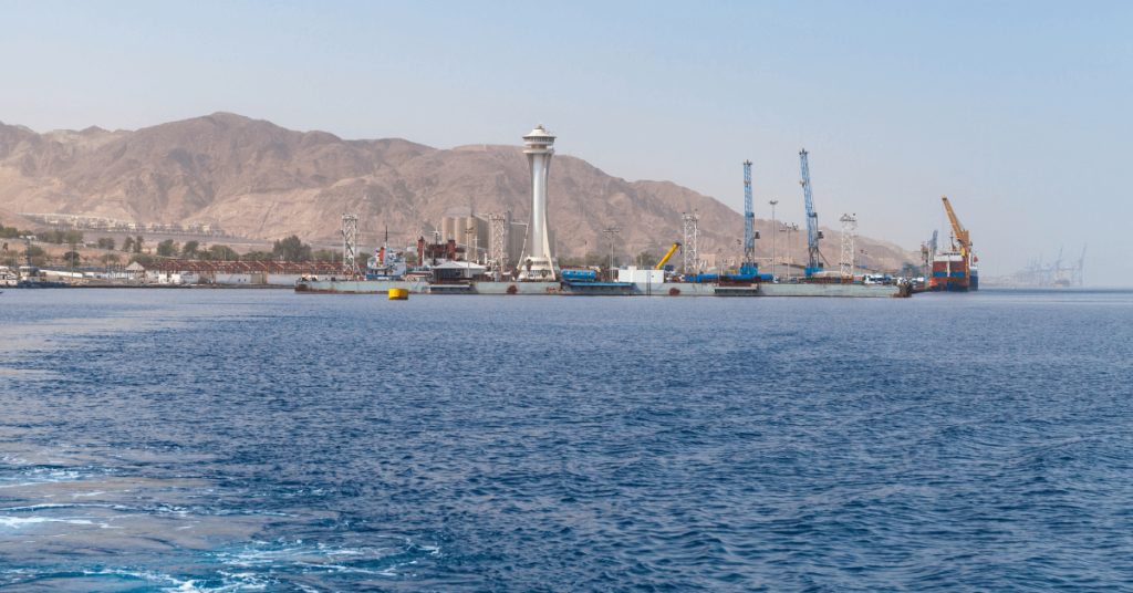
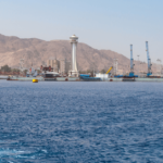
A host of major cities are located along the Laccadive Sea, making it a hub for local trade and tourism. On the Western side, Kochi, Kozhikode, Thiruvananthapuram (the capital of Kerala, India), and Malé (capital of Maldives) are the prominent cities, while Jaffna, Tuticorin, and Colombo are located on the Eastern side.
The Lakshadweep islands rise out of the Laccadive Sea and form a 36-island archipelago, classified as a Union Territory of India.
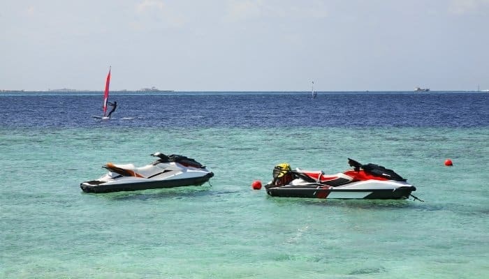
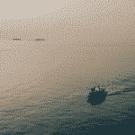
It is situated 200 kilometres of the Kerala coastline and is considered to be an extremely picturesque location. The region witnesses considerable annual tourism and is a world-famous hub for diving, snorkelling, and boating.
The Laccadive Sea plays a major role in the livelihood of the local communities and has much to offer to tourists and visitors.
In this article, we’ll look at 10 interesting facts about the Laccadive sea, ranging from its rich history to the flourishing biodiversity!
1. Laccadive is an anglicization of Lakshadweep
Lakshadweep refers to a Union Territory (UT) of India, located in the Arabian Sea off the Malabar coastline of India. The UT consists of 36 islands situated in the Laccadive Sea and lies close to the Maldives.
Laccadive is an anglicized version of Lakshadweep, coined by British colonialists who took over control of the island in 1799.
The term Lakshadweep refers to “one-lakh islands” (or 0.1 million islands) in the native tongue and encompasses the Laccadives, the Maldives, and the Chagos ranges. The majority of these islands are now underwater due to erosion and tectonic activity.
Lakshadweep has recorded evidence of settlement as early as 1500 BC and is mentioned in Buddhist texts from 500 BC. With the arrival of Muslim and Christian traders in the 7th and 15th century respectively, foreign trade was established with the region.
The Lakshadweep archipelago was governed by a host of kings from the neighbouring Indian state of Kerala, with control eventually passing on to Tipu Sultan, an Indian king from Karnataka. With his death, the British East India Company (EIC) began a trade-based governorship of the islands.
The native name for the archipelago was gradually anglicized to Laccadive and continues to be used in informal and unofficial records to this date. The Laccadive Sea is often referred to as the Sea of Lakshadweep in India.
2. The Sea’s temperature remains stable year long
A rather unique feature of the Laccadive Sea is the relatively stable temperature that is experienced throughout the year.
Water temperature peaks from April to July at 26° – 28°, while the winter months experience a small decrease to 25°. This near-constant temperature of the Sea is credited to the ocean circulation currents common in this part of the world.
The Arabian Sea is bounded by the Arabian Gulf to the West and the Indian Ocean to the South. Ocean currents tend to move from the West towards the Laccadive Sea, while cold currents from the Antarctic region propagate North through the Indian Ocean.
The movements of the currents from both parts of the world create a rough sea condition but regulate the temperature throughout the year. The constant inter-mixing of water from the Indian Ocean and the Arabian Gulf creates an average temperature of 27° throughout the year.
Another effect of this inter-mixing is the average salinity found in the Laccadive Sea. Compared to the more saline Arabian Gulf currents, the salinity of this Sea ranges from 34 ppt (parts per thousand) to 35 ppt during the year. The hydrology of the Laccadive Sea is strongly influenced by the inter-mixing of ocean currents from different parts of the world.
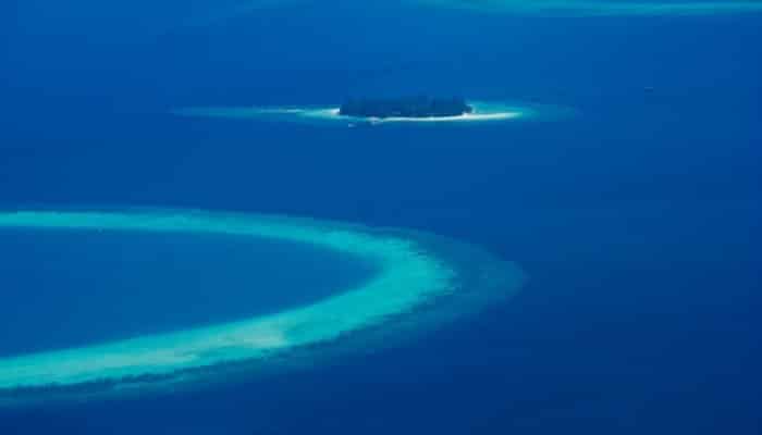
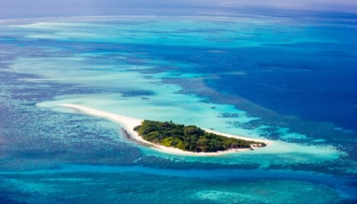
3. The Laccadive Sea boasts of an impressive coral reef ecosystem
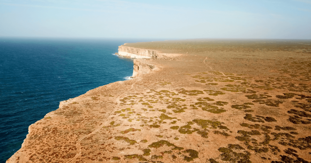
The coral reefs of Lakshadweep are a relatively undisturbed tract of corals and atolls situated to the North of the Laccadive-Chagos underwater ridge.
Based roughly 250 kilometres of the Indian coastline, these corals are gradually gaining interest in the scientific community for their hardiness against adverse ocean currents.
The lagoons of the Laccadives are famous for their pristine nature and beauty. Historians such as Pliny the Elder and Ibn Khordadbeh included detailed accounts of the biodiversity and picturesque underwater reefs of the region.
The Laccadives are composed of a series of atolls and corals, with most of the inhabited islands being large-scale coral systems covered with sand.
A few islands such as Minicoy and Kavaratti form part of the larger atoll system. The corals protect lagoons in Lakshadweep from the circulation of the Arabian Sea and are a popular tourist and recreation destination.
Lagoons vary in depth from 1-5 metres closer to the shore to as high as 16 metres in the larger systems. The various species of corals that are present in the Laccadive Sea belong to Acroporidae, Portitidae, Pocilloporidae, Favidae, Fungiidae, and Mussidae.
Aquatic species that live in the coral system include gastropods, bivalves, echinoids, foraminifers, ostracods, and bryozoans.
The Laccadive islands that are atoll systems include Kavaratti (the capital of Lakshadweep, India), Kalpeni, Agatti, Bitra, Kiltan, Chetlat, Minicoy, Amini, Bangaram, Suheli, and Kadmat. The submerged reef islands include Cheriapani, Beliapani, Perumalpar, and Androth.
The coral reefs are a major source of tourism to the Laccadives and the Indian government has exercised control in preserving the biodiversity and pristine nature of the reefs.
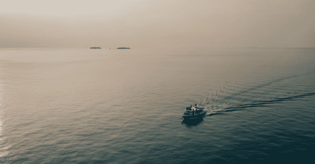
Of the 35 islands still above water (Parali 1 is submerged but is still counted as an island for official purposes), only six are open to Indian tourists, and of these, only 3 are open to foreign nationals. Scuba diving and snorkelling to explore the lagoons and reefs are common activities in this region, and the Laccadives is considered to be a top tourism destination.
4. The Sea has been referenced in ancient Greek, Roman, and Persian texts
The Gulf of Mannar, part of the Laccadive Sea, was a prominent trade route to the Maldives and the South-Western coastline of India. During expansions of the Roman and Greek empires in the early 1st centuries AD and BC (circa. 100 BC to 100 AD), trade commonly passed through this Sea.
Gaius Plinius Secundus, better known as Pliny the Elder, was a Roman naturalist, commander, and philosopher who wrote extensive treatises on foreign lands visited during his era.
One such destination was India, where the Laccadive Sea received much praise for its beauty. He also explicitly wrote about the pearl fisheries of the Gulf of Mannar at great length, going on to mention them as one of the most productive fisheries in the world.
There are accounts from Greek and Persian travellers who visited India to establish trade routes. Many of them were cartographers who wrote detailed accounts of their visits and the biodiversity in the region.
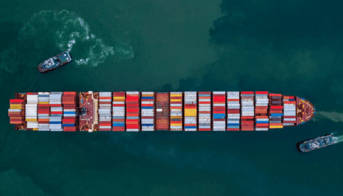
Many of them went on to establish regular trade with settlements on the Laccadive Sea coastline. These routes gradually began to flourish as they were found to be faster than the traditional sea route through the Hindu Kush mountains from the North. They also ran a lesser risk of being attacked by land-based pirates that regularly looted convoys.
5. The Gulf of Mannar Marine National Park is a Biosphere Reserve
The Gulf of Mannar is home to 3,600 unique species of flora and fauna including 44 protected species. The region is considered protected and consists of 21 islets spread across the Gulf. Located close to the Tamil Nadu coastline, the Reserve has a high density of species that are indigenous and vulnerable to drastic environmental change. The biosphere consists of a core zone and a 10-km buffer zone to the nearest inhabited islet.
Spanning 560 square kilometres, the Marine National Park also includes barrier reefs within the core zone. It consists of estuaries, mudflats, beaches, and densely forested areas. There are different varieties of mangroves that grow near the shores of the Reserve, most of which provide nutrition and shelter to endangered species.
The Reserve is home to the dugong, a marine mammal that is on the national endangered list. Other endangered creatures in the Reserve include green turtles and Olive Ridley turtles.
Other marine faunas inhabiting the region include Pacific bottlenose dolphins, finless porpoises, melon-headed whales, sperm whales, minke whales, Bryde’s whales, and humpback whales. The Reserve is considered to be one of the most biodiverse regions in the world.
An interesting note about the marine fauna at the National Park is the Ptychodera fluva, a species of the Balanoglossus family that is a hemichordate.
This is of particular significance given that this species is a living evolutionary link between invertebrates and vertebrates. It has been located only at the Kurusadai island near the Mandapam in the Gulf of Mannar. Interestingly, Kurusadai is also home to three unique seagrass species that are not located anywhere else in the country.
6. The Laccadive Sea is famous for natural pearls and ornamental shells
Pliny the Elder recorded that the pearl fisheries industry in the Laccadive Sea was one of the most productive sites in the world, at that time.
The Sea is known for two main varieties of highly-sought pearls- the Pinctada radiata and the Pinctada facata. Recorded by Pliny in the early 1st century, these pearls are located in “pearl banks” spread across the region.
The Gulf of Mannar boasts of one of the few remaining natural pearl extraction sites in the world. This is partly because the process is time-consuming and also very expensive. The pearls of the region are regularly harvested by expert divers from Tamil Nadu and Kerala, who dive tens of metres deep to collect the molluscs housing the pearl.
The Xancus pyrum species of molluscs are considered important by the Hindu community, as discussed in Fact #8. The coral reefs are home to rich biodiversity including butterflyfish, parrotfish, clownfish, squirrelfish, and snappers.
The Gulf of Mannar is home to 106 different species of corals, including stony corals from the Portitidae and Faviidae families. The predominant reef features include fringing and patch reefs. Further East, barrier reefs become more common.
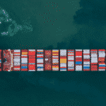
7. The region is a major fishing hub for sharks and tuna
Fishing is a major occupation of the local inhabitants alongside agriculture. Tuna and sharks are the major exports from this sector and contribute to a significant part of the economy. The annual catch is in the range of 3,000 to 5,000 tons with shark and tuna accounting for nearly 80% of the total catch. Other fish species that are commonly exported include perches, halfbeaks, Carangidae, needlefish, shrimp, cardinal fishes, oily sprats, and ray-finned fish.
The tuna export industry includes species such as Skipjack pelamis, the albacore tuna, and the Yellowfin variety. Other marine creatures are caught for the seafood industry with most products shipped to Kerala for processing. The processed goods and repackaged and exported across the country and around the world. Shrimp, squid, crab, lobster, and sprats are common species in the Laccadives.
The Gulf of Mannar consists of 130 fishing villages with the Indian Census of 2011 estimating 35,000 individuals engaged in fishing for their livelihood. Of these, the majority are daily fishermen while others specialize as sea cucumber divers and sea wood collectors.
Sea wood is exported around the world from the Gulf of Mannar. Certain species of sea wood can only be collected from October to March, to protect these endangered varieties.
8. The “shankhas” used by the Hindu community are found in the Laccadive Sea
A particular species of molluscs, Xancus pyrum, is known by the Hindu community as “shankhas” and forms an important part of their religious beliefs. The shells of sea snails of the species Turbinella pyrum are unique in appearance and acoustic characteristics. These shankhas are available in select locations across the globe primarily owing to the temperature and sensitivity of the pyrum sea snails.
The Laccadive Sea is the only major location from where these shells are retrieved. In English, the shell is known as a “conch” and has an appearance similar to porcelain.
The hollow interior creates a distinct acoustic effect that mimics the sound of the ocean. Most conches are right-turning or dextral, while the sinistral or left-turning variants are very rare.
Given the importance of the conch by the Hindu community, the Laccadive Sea is a hub of conch diving and expert divers are sought after in the region. References to the conch appear in ancient Tantric, Greek, and Buddhist texts, where it was identified as a celestial trumpet. The conch obtained from the Laccadive Sea has significance in other parts of the Asian continent, including Nepal, Bhutan, and Cambodia.
9. The Laccadive Sea covers a broad expanse of the Indian Ocean Region
Covering an area of 786,000 square kilometres, the Laccadive Sea is by no means a small water body. With an average depth of 1,929 metres and a maximum depth of 4,131 metres, it covers a significant area South of the Indian subcontinent. It borders three Indian states, and the nations of Sri Lanka and the Maldives.
The boundaries of most water bodies are defined by the International Hydrographic Organization (IHO), an inter-governmental organization that surveys and charts waterbodies across the world. It also maintains global standards on hydrographic surveying and is an observer organization at the United Nations. For the Laccadive Sea, the IHO defines its geographical boundaries through four main limits.
To the West, it is bounded from Sadashivgad (in Karnataka, India) to Addu Atoll (in the Maldives). In the South, the Sea is bounded by Addu Atoll and Dondra Head (one of the southernmost points in Sri Lanka). In the East, the Sri Lankan coastline defines the boundary, while Adam’s bridge demarcates the North-West region. The Gulf of Mannar is located between the Laccadive Sea and the Palk Strait.
10. The Sea is bounded by the famed “Rama Setu” from Hindu mythology
Connecting the Indian and Sri Lankan landmasses to the South-East is the Rama Setu, known as Adam’s Bridge. The Bridge is a series of limestone shoals in the Gulf of Mannar that historically connected the two landmasses. The formation is now used as a geographical division between the Palk Strait in the East and the Gulf of Mannar in the South.
Geological findings have established that the shoals were above sea level until the 15th century. Today, the depth of the channel is often less than 1 metre, preventing its use as a channel for navigation. Hindu mythological texts mention that the shoals were placed by the God Rama to cross the straits and reach Sri Lanka.
In Christianity and Islam, a mountain peak in Sri Lanka is known as Adam’s Peak after the supposed location where Adam fell to Earth after being expelled from Eden. The straits are called Adam’s Bridge after he crossed over to India, and the term was used for the first time by British cartographers in the early 1800s.
In Islam, ancient cartographers and travellers such as Ibn Khordadbeh and al-Biruni have mentioned the straits in detail during their travel. They were also among the first to link Adam’s Peak to near the Laccadive Sea.
You might also like to read:
- 10 Facts About Northwest Passage
- 8 Facts about the Java Sea
- 10 Gulf Of Aden Facts You Must Know
- 5 Strait of Magellan Facts You Must Know
- 8 Amazing Facts About the Black Sea
Disclaimer :
The information contained in this website is for general information purposes only. While we endeavour to keep the information up to date and correct, we make no representations or warranties of any kind, express or implied, about the completeness, accuracy, reliability, suitability or availability with respect to the website or the information, products, services, or related graphics contained on the website for any purpose. Any reliance you place on such information is therefore strictly at your own risk.
In no event will we be liable for any loss or damage including without limitation, indirect or consequential loss or damage, or any loss or damage whatsoever arising from loss of data or profits arising out of, or in connection with, the use of this website.
Do you have info to share with us ? Suggest a correction
Disclaimer :
The information contained in this website is for general information purposes only. While we endeavour to keep the information up to date and correct, we make no representations or warranties of any kind, express or implied, about the completeness, accuracy, reliability, suitability or availability with respect to the website or the information, products, services, or related graphics contained on the website for any purpose. Any reliance you place on such information is therefore strictly at your own risk.
In no event will we be liable for any loss or damage including without limitation, indirect or consequential loss or damage, or any loss or damage whatsoever arising from loss of data or profits arising out of, or in connection with, the use of this website.

About Author
Ajay Menon is a graduate of the Indian Institute of Technology, Kharagpur, with an integrated major in Ocean Engineering and Naval Architecture. Besides writing, he balances chess and works out tunes on his keyboard during his free time.
Latest Maritime Knowledge Articles You Would Like:


Subscribe To Our Newsletters
By subscribing, you agree to our Privacy Policy and may receive occasional deal communications; you can unsubscribe anytime.