

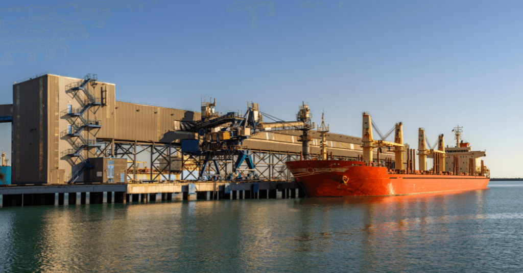
Real Life Incident: Grounding In Narrow Channel
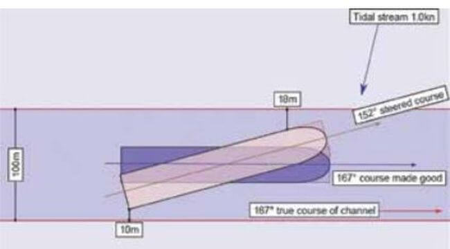
A bulk carrier weighed anchor and, with two pilots on the bridge, proceeded towards the port approach channel at a speed of about 3kt. Due to the westerly set across the channel entrance, the vessel’s heading was adjusted to keep to east of centre of the dredged channel. This was well intentioned given that the vessel had experienced a minor bottom touching at the western side of the entrance on the first, unsuccessful, attempt to enter the port the day before. While the Master oversaw the operation the OOW operated the engine telegraph and monitored the vessel’s position using radar parallel indices. The helmsman remained at the steering stand.
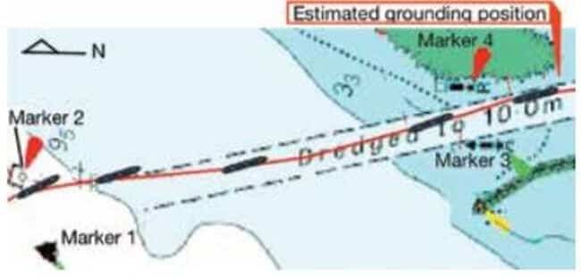
As the vessel passed between No. 3 and No. 4 lateral markers on a heading of 163˚ at nearly 5kt there was an exchange between the two pilots about an alteration of heading to starboard. During the exchange, the pilots gave different starboard helm orders, which prompted the helmsman to seek clarification from the Master. The Master told the helmsman to follow only his orders. Seconds later shuddering and heavy vibration was felt on board and the vessel’s speed reduced for a few seconds to less than 3kt.
Although the bulk carrier was thereafter safely berthed, a dive inspection identified a series of splits, deep indentations and buckling of the shell plating on the port side that required drydock repairs.
Some of the report’s findings include:
- In view of the tidal set experienced the previous day, it was logical to keep the vessel towards the eastern side of the dredged channel.
- The embarked pilots, although experienced elsewhere, were not fully familiar with this particular port and its approaches and had completed only two previous pilotage acts in the port.
- The narrowness of the dredged channel and the potential for squat limited the action that could be taken on board larger vessels to counter the effects of a tidal set and to remain within the dredged channel.
- The lateral markers indicating the dredged channel were potentially misleading as they were sited up to 50m outside the channel. This fact was not clear from the chart due to its scale.
Reference: nautinst.org
Do you have info to share with us ? Suggest a correction
About Author
Marine Insight News Network is a premier source for up-to-date, comprehensive, and insightful coverage of the maritime industry. Dedicated to offering the latest news, trends, and analyses in shipping, marine technology, regulations, and global maritime affairs, Marine Insight News Network prides itself on delivering accurate, engaging, and relevant information.

- Real Life Incidents: Near Miss In Open Water And Good Visibility

- Real Life Incident: Poor Situational Awareness Leads to Collision
- Real Life Incident: Monkey’s Fist Knocks on Office Window
- Real Life Incident: Paint Storage Slip-Up On Ship
- Real Life Incident: Checklist Mentality Is A Burning Problem
- Real Life Incident: Vessel Speed Exacerbates Bank Suction


Latest Case studies Articles You Would Like:


Subscribe To Our Newsletters
By subscribing, you agree to our Privacy Policy and may receive occasional deal communications; you can unsubscribe anytime.