

What Methods Are Used For Marine Seismic Operations At Sea?
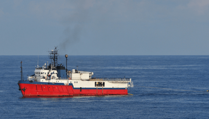
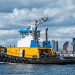
Marine seismic operation or seismographic acquisition is the method used for collecting information about the subsea surface. In marine seismic operation, the geophysicists use the same principle used by earthquake seismologists, but relatively low acoustic energy (sound waves) is generated mechanically for collecting the data. The data thus collected provides accurate information about the rock formation and other vital data of the ocean surface. Marine seismic survey is mainly used for oil and gas exploration, but on land they help in locating mines or even to find ground water.
There are three main types of seismic operations
- Marine seismic exploration or offshore (depth more than 10 meters or above)
- Land seismic exploration or onshore
- Transition zone exploration (on shallow waters)
For marine seismic operation, various methods of acquisition are used. But the popular ones are:
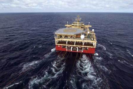
a) 2D (single streamer cable)
b) 3D ( Two streamer cables or more)
These are the two most popular methods used to acquire seismic data, which helps to locate the exact position of wells on seabed. Although the operation is expensive, the bet pays off by minimising the financial peril of drilling an empty well.
Here’s a quick video of how marine seismic operations are carried out:
Let’s take a quick look at 2D and 3D survey methods:
2D Seismic Operation:
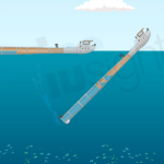
This is the simplest and less expensive method of seismographic acquisition as compared to 3D and other methods of acquisition. In this method, a single streamer cable is paid out from the aft of the vessel and towed on the previously designated track lines. Then, with the help of equipment such as hydro phones, air gun etc. the required data is acquired. This is the primary form of acquiring data, which provides a general idea of the subsea surface and its structure. Processing of data and operation is this method is less complex as compared to 3 dimensional acquisitions.
3D Seismic Operation:
In this method, a specific area or block is chosen with the help of preliminary 2D survey data. Such area for 3D operation is finalised after carefully analysing the previous data. The objective of this operation is to locate precisely the position of wells with hydrocarbons (oil or gas). No company wants to invest millions of dollars on drilling an empty well. Time is a major factor for such operations, because during rough weather, seismic acquisition is highly impossible. Taking into account, the complex nature of the operation and limited time, detailed planning of boundaries, total area to be covered, the direction of track lines are scheduled before setting the course.
3D acquisition can be explained in as the acquisition from several 2D lines running in parallel. The distance between these acquisition lines depends on the number of cables used (It can be close up to 50 meters).
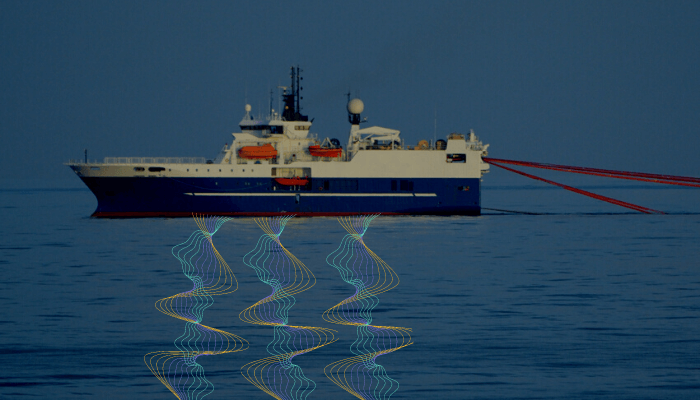
When all the equipment and systems of the seismic vessel are in place, the course is set to follow the track or survey line. The vessel then arrives at the starting point, which is pre-determined by the navigators in consultation with the captain and party chief. The air guns that are being towed along with cables are filled with high pressure air and have a mechanism to release them as air bullets (with high pressure).
These air bullets that hit the sea surface causing seismic reaction, which is picked by pressure sensitive hydro phones inside the streamer cables. The hydro phones then convert pressures signals in to electrical energy and transmits them to the recording system on board, thus providing with the necessary data.
Seismic vessels have special compressors for feeding the air guns with pressure capacity of up to 2000 psi. These compressors are capable of supplying high pressure air to the air guns continuously over a very long period of time. Once the line is completed, the vessel will maneuver to a new starting point as advised by the navigators and the whole process repeats. The ideal speed of the vessel while acquiring data is kept between 2 and 5 knots.
For quality data, the vessel is maintained on a track line. Too much deviation from the track line results in change of feather angle between the cable and vessel, which results in noisy or faulty data. Other factors that affect the quality of acquisitions are rough weather, heavy rain and other vessels passing by close to the survey vessels.
For efficient survey operation, all seismic equipment and tools are checked thoroughly before deployment as even a minor problem on seismic cable or any other connected device requires pulling the whole length of tow inside the ship and deploying it back after fixing the issue. This is a time consuming process which will stop the production for quite a long time. Moreover, traffic density and fishing activity can also cancel the whole track line.
The length and depth of streamers are as per the operator’s requirement. The length of streamer can vary from 1 nautical mile to 7 nautical miles. The depth of streamers can be between 4 to 6 meters for shallow waters and between 8 to 10 meters on deep sea acquisition.
Watch this video to understand two main types of Seismic operation methods:
Do you have more information to add to this article? Let’s know in the comments below.
Do you have info to share with us ? Suggest a correction
Latest Type Of Ships Articles You Would Like:

Subscribe To Our Newsletters
By subscribing, you agree to our Privacy Policy and may receive occasional deal communications; you can unsubscribe anytime.
thank u for giving good information about marine seismic survey
@Sharafudeen: Glad you find the information useful ????????