

10 Timor Sea Facts You Might Not Know
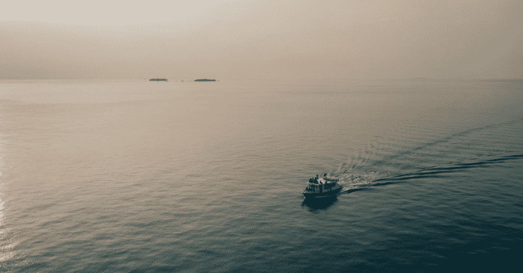
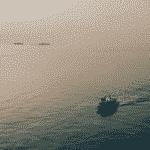
The Timor Sea is a shallow water body bordered by Australia from the west and Timor island from the north. From the eastern side, it is bounded by the Arafura Sea and from the western side by the Indian Ocean.
The Timor Sea is a site of contestation since it is rich in natural resources. It has great diversity in the form of islands, reefs, beautiful coastal beaches and varied marine life.
The International Hydrographic Organization, founded in 1921 to protect marine environments, declared the Timor Sea as a part of the East Indian Waters.
1. Timor Sea is called by different names
The Sea was named after the most prominent island near its northern shoreline. The name of the island is a variant of the word ‘timur’, a Malay word meaning east.
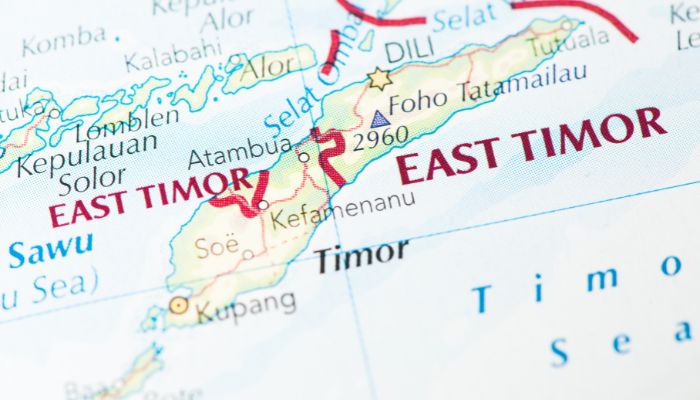
In native languages, the sea is known by different names; for example, it is called Laut Timor in Indonesian. It is called Mar de Timor in Portuguese since they were one of the first to colonise the region. The sea is referred to as Tasi Mane or Tasi Timor in the Tetum language.
Tasi mane literally means ‘male sea’ in Tetum, denoting the sea’s powers, strong waves and might. Another water body, the Ombai-Wetar strait, which is gentle, calm and less ferocious, is called Tasi feto or the female sea.
2. It has three important gulfs or inlets
Three important gulfs lie near the Timor Sea. They are located on the northern coast of Australia. The first is the Joseph Bonaparte Gulf, named after the King of Naples, who was also the brother of Napolean. It is a part of the Timor Sea.
The Beagle Gulf faces the Timor Sea from the west. It is surrounded by the Australian mainland from the south and faces the islands of Bathurst and Melville from the north. It was named after the famous ship HMS Beagle which Charles Darwin and Robert Fitzroy used to explore the areas around Australia.
The Van Diemen Gulf is connected to the Timor Sea through the Dudas Strait. It is named after the Dutch governor Anthony Van Diemen.
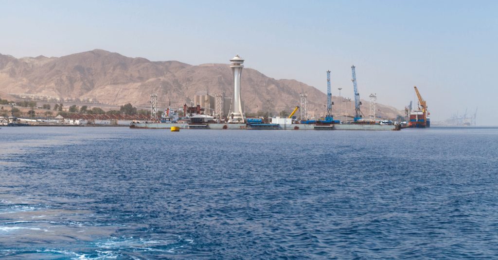
3. Australian city of Darwin is the closest large city to the Timor Sea
Darwi city lies on the shores of the Beagle Gulf and is closest to the Timor Sea. It is a regional centre and one of the most visited Australian cities due to its pleasant climate and the eco-tourism opportunities it offers.
It has many national parks like the Kakadu, Litchfield and Catherine Gorge National Parks.
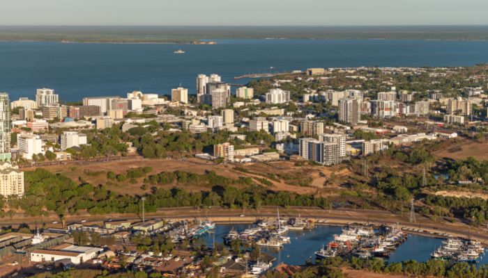
Its closeness to Southeast Asia makes it an essential link between the Australian continent and nations like Indonesia and East Timor.
The economy of Darwin rests on mining and tourism. Minerals like gold, zinc, bauxite, manganese etc., are abundant. Uranium deposits are also found in some places.
Secondly, most people visit the city in the cooler months of April to September, making tourism largely seasonal. Darwin’s importance is growing as a port due to the exploration and exploitation of petroleum in the Timor Sea and increasing trade links with Asia.
4. Timor Trough is the deepest point in the Timor Sea
The Timor Sea is 480 km broad and covers about 235,000 square miles. The deepest point of the sea is the Timor Trough which lies in its northern part; it reaches a 3300 m depth, while the rest of the sea is relatively shallow, with average depths of around 200 m or 650 ft.
The Timor Trough is said to be an extension of the Java or the Sunda Trench. It is also the boundary between the Indo-Australian and the Timor Plate. Hydrocarbon reserves are found to the south of this trench.
The region around this trench is also geologically active, with several earthquakes every year. A 50 kilometres wide crater was found on the floor of the Timor Sea in 2010.
5. Home to rare marine animals and plants
Due to its remote geographical location, the Timor Sea is still free from large-scale pollution. It also contains exotic and rare marine animals not found anywhere in the world.
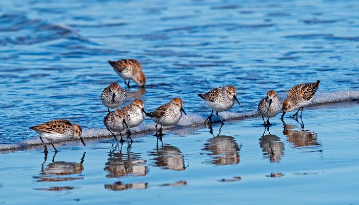
Several species of shorebirds, the sea cow or dugong, 5 out of 7 turtle species and a variety of colourful sea snakes are found in its waters.
Mammals like the Blue and the beaked whales, the melon-headed whales, bottlenose dolphins, short-fin pilot whales and five more dolphin species live in the Timor Sea.
6. Has coral reefs, shoals and important islands
The Timor Sea and the Arafura Sea share around 10% of the planet’s coral reef formations and 0.75% of sea mounts found in the world.
Interestingly, there are many underwater banks lying amidst the Timor Trough and the continental edge. These are known as the Big Bank Shoals.
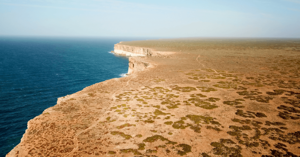
Islands such as the Melville and a part of the Tiwi islands are found in the sea. It also has the Australian islands of Ashmore and Cartier.
Per some researchers, the aboriginals of Australia reached the continent by island-hopping or after crossing these islands of the Timor Sea.
The Timor Sea is home to coral reefs like the Scott and Seingaptanam reefs. They are atoll-like reefs over 300 km from Western Australia, lying at the end of the continental shelf. Towards the west on the same submerged area is the Rowley shoals.
The nutrient-rich waters of the Timor sea receive freshwater from 8 rivers, some of which are the Victoria River, Forrest River and Durak River.
7. The biggest oil spill in Australia occurred in the Timor Sea
One of the worst oil disasters in Australia happened in the Timor Sea on August 21, 2009, when the Montara oil rug blew and began to spill oil into the ocean waters. The oil well was 250 ft in water and lay between Australia and East Timor.
Oil oozed out from the well for 75 days until November 3, 2009, leaking about 400 barrels daily. Though the rig was in shallow water, it was only after several attempts that the oil could be contained.
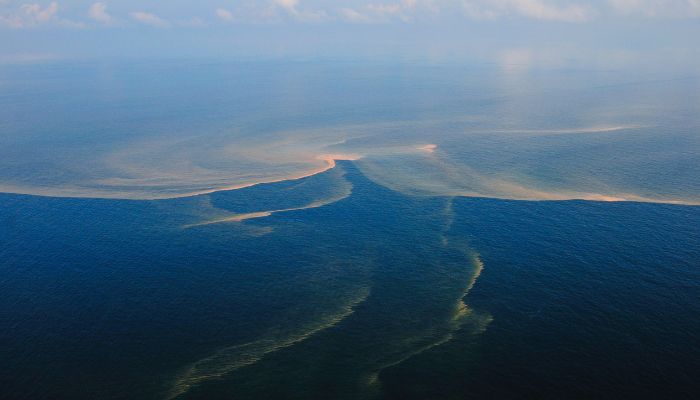
Per estimates, the oil engulfed about 19,000 square miles of ocean waters. It harmed the whales, turtles and sea dolphins living in that region. Many seabirds died while breeding in the reserves and migrating through the area. The Australian authorities tried to save them, and many birds, including noddies and brown boobies, were treated.
The spill’s impact was felt in Indonesia as fishermen from the nation reported that the oil slick was making them sick and harming the seaweed crop, which was ready for harvest. It resulted in great loss for seaweed farmers in Indonesia as the crop is used as food and an ingredient in cosmetics, biofuels and fertilisers.
The Montara oil spill had rippling effects and portrayed that offshore drilling in shallow waters is equally dangerous, especially for the local economy.
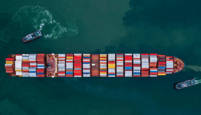
8. A disputed water body between Australia and Indonesia
The Timor Sea has rich reserves of oil and natural gas. The presence of these hydrocarbon resources has led to a series of disputes between Australia and Indonesia over the ownership and sharing of its resources.
The resource-rich area called the Timor Gap lies beyond each country’s territorial waters, which has led to these contestations over the years. The Timor Gap Treaty was signed but soon abandoned after East Timor became an independent nation in 1999.
After this, negotiations started again between Australia and East Timor, leading to the signing of the Timor Sea Treaty on May 20 2002. It led to the formation of the Timor Sea Designated Authority, which oversees all exploitation activities in the Joint Petroleum Development Area.
9. Site of wars between Japan and Australia during the Second World War
The World Wars had devastating impacts on nations and wiped out much of the world’s population. In these wars, strategic water bodies played a crucial role in launching attacks on enemies.
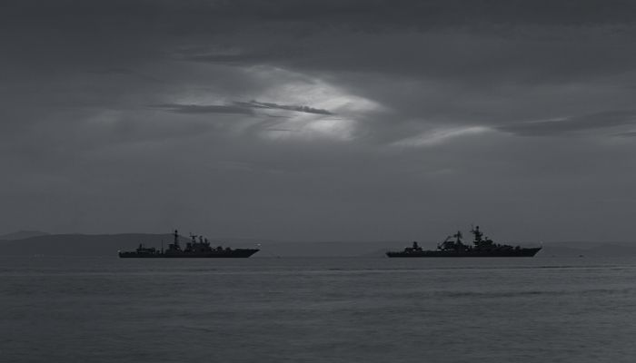
The Japanese Navy conducted raids and strikes on Australia using ships in the Timor Sea. One such attack was by the Navy of Japan on the Australian city of Darwin. The aircraft carrier, Kaga and other navy ships launched air strikes on the city.
It led to the sinking of 9 Australian ships, including the famous USS Peary. The attack was on February 19 1942, and led to the commencement of the Battle of Timor.
10. Tropical storms and cyclones are formed in the Timor Sea
The Timor Sea has a tropical and monsoonal type of climate. Hence many storms, strong winds and waves, and cyclones are formed in the sea. When strong cyclones pass through the area, the production of petroleum and hydrocarbons is halted, although the facilities are designed to withstand their effects to a certain degree.
During such conditions, even the working personnel are sent by helicopters to the nearby cities of Darwin and Dilli.
The two recent cyclones that disrupted production were the Vivienne cyclone in 2005 and Cyclone Willy, which formed just one month later.
The Timor Sea current flows southwest from the Indonesian or Malay archipelago and Australia. It contributes to the Indonesian throughflow that circulates water from the Pacific to the Indian Ocean, thereby regulating wind, weather and climate conditions.
You might also like to read-
- 15 Not-So-Known Facts about the Indian Ocean
- 15 Amazing Facts About Coral Reefs
- 10 Major Facts About Sulu Sea You Must Know
- 10 Marine Biome Facts You Must Know
- 10 Facts About The Laccadive Sea
Disclaimer :
The information contained in this website is for general information purposes only. While we endeavour to keep the information up to date and correct, we make no representations or warranties of any kind, express or implied, about the completeness, accuracy, reliability, suitability or availability with respect to the website or the information, products, services, or related graphics contained on the website for any purpose. Any reliance you place on such information is therefore strictly at your own risk.
In no event will we be liable for any loss or damage including without limitation, indirect or consequential loss or damage, or any loss or damage whatsoever arising from loss of data or profits arising out of, or in connection with, the use of this website.
Do you have info to share with us ? Suggest a correction
Disclaimer :
The information contained in this website is for general information purposes only. While we endeavour to keep the information up to date and correct, we make no representations or warranties of any kind, express or implied, about the completeness, accuracy, reliability, suitability or availability with respect to the website or the information, products, services, or related graphics contained on the website for any purpose. Any reliance you place on such information is therefore strictly at your own risk.
In no event will we be liable for any loss or damage including without limitation, indirect or consequential loss or damage, or any loss or damage whatsoever arising from loss of data or profits arising out of, or in connection with, the use of this website.

About Author
Zahra is an alumna of Miranda House, University of Delhi. She is an avid writer, possessing immaculate research and editing skills. Author of several academic papers, she has also worked as a freelance writer, producing many technical, creative and marketing pieces. A true aesthete at heart, she loves books a little more than anything else.
Latest Maritime Knowledge Articles You Would Like:


Subscribe To Our Newsletters
By subscribing, you agree to our Privacy Policy and may receive occasional deal communications; you can unsubscribe anytime.