

10 Largest Estuaries In The World
The National Geographic Society defines an Estuary as a region where a freshwater river or stream meets the salty ocean, forming brackish water habitats. Brackish water is salty but not as salty as ocean water.
An estuary may also be called a lagoon, sound, slough or Bay.
Tides play a crucial role in the rise and fall of water levels and salinity levels in an estuary. During monsoon, rivers flood the estuary with freshwater, declining salinity levels, while in summer, the estuary shrinks and its water becomes much more saline.
Estuaries are diverse environments that exist around the world. They are home to wetlands, mangroves, various bird, mammal and invertebrate species.
Estuaries are of four types, classified according to the way they were formed, namely: coastal plain estuaries, tectonic estuaries, bar-built estuaries and fjord estuaries.
Let us look at the ten largest estuaries in the world.
1. St. Lawrence, North America
The St. Lawrence River, which links the Great Lakes to the Atlantic Ocean, is the largest estuary in the world. The St.Lawrence River is around 1,197 km or 744 miles long.
This estuary is situated downstream of the St. Lawrence River and upstream of the Gulf of St. Lawrence. It is a unique habitat formed when the fresh and salty water mix between the river and the Gulf.
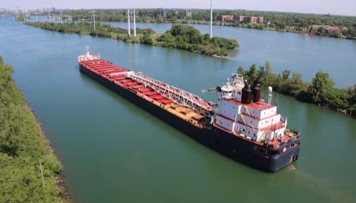
The St. Lawrence Estuary starts at Saint Pierre Lake and terminates at the Pointe-des-Monts, Quebec in Canada.
Hence, this estuary covering over 3000 square miles begins at Ontario Lake and passes through New York into Canada until it drains into the Atlantic near Quebec.
St. Lawrence River has been a vital shipping route since prehistoric times. Native Americans lived along its banks, and later, Europeans established their settlements along it after colonising North America for its timber, fur and other resources.
Much of North America’s freshwater comes from here, and it is also one of the richest fishing areas, making it a productive and viable ecosystem in need of preservation.
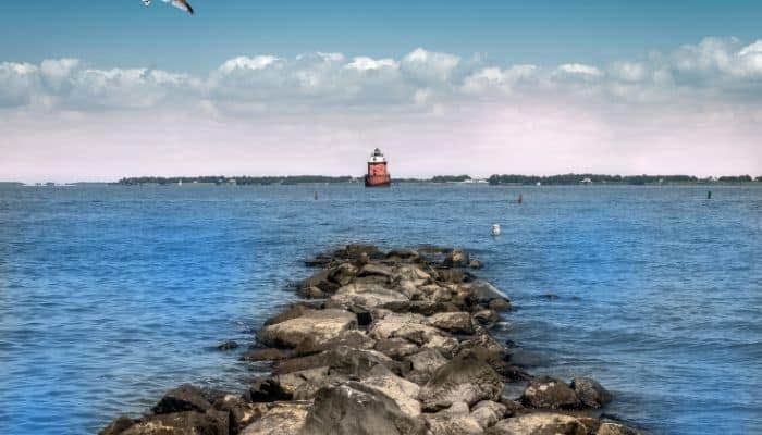
2. Chesapeake Bay, U.S.
The largest estuary in the U.S., the Chesapeake Bay, is in the Mid-Atlantic region, mainly separated from the Atlantic Ocean by the Delmarva Peninsula.
It is around 200 miles or 320 km long and 2.8 miles wide at its narrowest point and 30 miles at its widest point. Its total shoreline is 18,804 km long and covers 11,601 sq km.
A dozen rivers flow into the Bay to create one of the biggest brackish water bays on the planet, creating a diverse habitat consisting of tidal pools, marshes and rivers.
Crustaceans, fish species like striped bass, and predators like bull sharks live in the Bay, threatened by urban runoffs and nutrient pollution. Even the shellfish population in the Bay has declined considerably due to overharvesting.
3. Orange River Mouth, South Africa
The Orange River is the longest in South Africa, with a length of 2200 km. The Orange River Mouth is a Ramsar Site and a typical wetland.
The region called the Ramsar Site consists of the Orange River estuary before it reaches the Atlantic Ocean, between its river mouth and Ernest Oppenheimer Bridge, which connects the two towns of Oranjemund, Namibia and South Africa’s Alexander Bay.
The Orange River Mouth is said to be the second most important estuary in South Africa from the point of conservation. It is home to many fish and bird species mentioned in South African and International Red Data Books.
Also, it is home to over one per cent of the total world population of 3 waterbird species endemic to Southern Africa, which includes Damara Tern, Cape Cormorant and Hartlaub’s Gull.
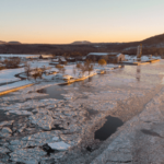
4. Gulf of Ob, Russia
The Gulf of Ob is actually a bay of the Arctic Ocean, situated in the Northern part of Russia at the mouth of River Ob. It is the longest estuary in the world and is also the migration ground for Beluga whales.
The Gulf of Ob’s mouth lies in the Kara Sea. It is roughly 1000 km long and has a width between 50 -80 km. The Gulf of Ob is shallow and has an average depth of 10-12 m.
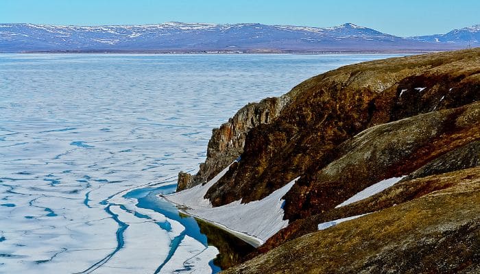
Many islands lie close to the mouth of Ob, like Khaley Island, which is flat and low-lying.
The region is rich in natural gas and petroleum reserves. The world’s 3rd largest natural gas field, the Yamburg gas field, is situated amidst the gulf’s southern part and the Taz estuary.
5. Rio de la Plata, South America
Rio de la Plata, also called La Plata River, is an estuary formed when the Uruguay and Parana rivers meet at Punta Gorda.
It then flows into the Atlantic Ocean and creates a funnel-like indentation on South America’s southeastern shoreline.
The river is 290 km long and 2 km wide at the source, about 220 km near its mouth. It forms a portion of the boundary between Argentina and Uruguay.
Though it is generally regarded as a river, many say it is a bay or even a marginal sea of the Atlantic Ocean.
The coast of the Rio de la Plata has been enriched with many cultures and traditions passed down by the nomadic aboriginal people who lived on its shores for centuries before the arrival of European settlers.
6. San Francisco Bay, North America
A tidal estuary in California, it is also the largest estuary on the western coast of North America.
It spans five different regions: the river delta, North Bay, South Bay, Central Bay and Suisun Bay.
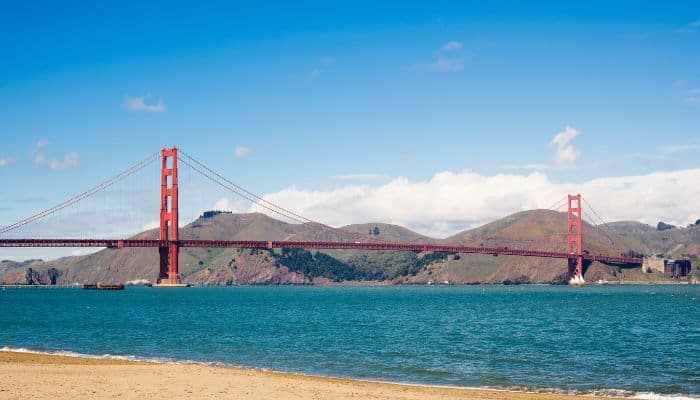
It covers about 4000 km2, extending from the rivers in the Sierra Nevada Mountains to the Golden Gate Strait. The edges of this Bay are dotted with wetlands and also marshes.
It is also home to several endangered bird species like California’s least tern and the Ridgway’s Rail.
This estuary is the primary source of water for millions in California. It is also used for irrigating farms and by industries.
San Fransisco Bay is a diverse ecological habitat on the west coast, sheltering the Dungeness crab, California halibut and Pacific salmon.
San Fransisco Bay was a vital transportation route before the arrival of the Europeans. Indigenous people traversed it with canoes to fish and catch clams. Later, steam-powered vessels came into vogue in the 19th century.
Also, numerous ship construction yards, such as the Kaiser shipyards or the Richmond Shipyards, were established along the Bay after the advent of the First World War.
7. Yenisey Gulf, Russia
Yenisey River, also called the Enisei or Ioanesi, meaning the Great River, flows through Central Russia. It is one of the longest rivers in Asia and the 6th largest in the world in terms of water discharge.
The Yenisey Gulf is formed when the river widens to about 50 km near the Munguy settlement. This gulf is a huge estuary through which the lower Yenisey drains into the Kara Sea.
The entire area of the lower Yenisey is sparsely populated, and settlements thrive on permafrost ground with little to no vegetation except moss, lichens and grass in some places. However, the waters of the Bay are home to Beluga Whales.
The Yenisey Gulf is a part of Russia’s largest nature reserve called the Great Arctic State Nature Reserve.
Near the Bay’s mouth lies a Polar Station called the Willem Barents Biological Station.
8. Tampa Bay, North America
Tampa Bay is a natural harbour and estuary flowing into the Gulf of Mexico. It was formed 6000 years ago, before which it was a freshwater lake.
Tampa Bay is the biggest open-water estuary in Florida, stretching more than 1,000 square kilometres, leading to the formation of coastlines of several counties, including Manatee and Hillsborough.
The Hillsborough River is the biggest freshwater source of the Bay, while many other small rivers and streams also drain into Tampa Bay, creating a huge watershed area.
Tampa Bay’s bottom, with an average water depth of 3.7 m, is sandy and covered with silt. The shallow waters of the Bay, along with tidal mudflats, support seagrass beds, marshes and wetlands, home to over 200 fish species like the bottlenose dolphins, oysters, clams, shrimp, crab etc.
Over two dozen species of birds, like herons, spoonbills, laughing gulls, etc., dot the landscape around the Bay.
9. Thames Estuary, Europe
The Thames Estuary is one of the UK’s major east-coast estuaries. It is the place where the Thames River meets the North Sea.
It stretches from the Thames tidal limit at Teddington Lock all the way through the heart of London to the North Sea.
The Thames is about 330 km long and runs 226 km from its origin to the tidal waters limit, i.e. from the Thames Head to Teddington Lock, and it flows as an estuary an extra 104 km from that point to the Nore sandbank where it drains into the North Sea.
The estuary is one of the biggest of the 170 similar inlets lying on the coast of Britain.
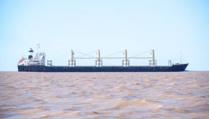
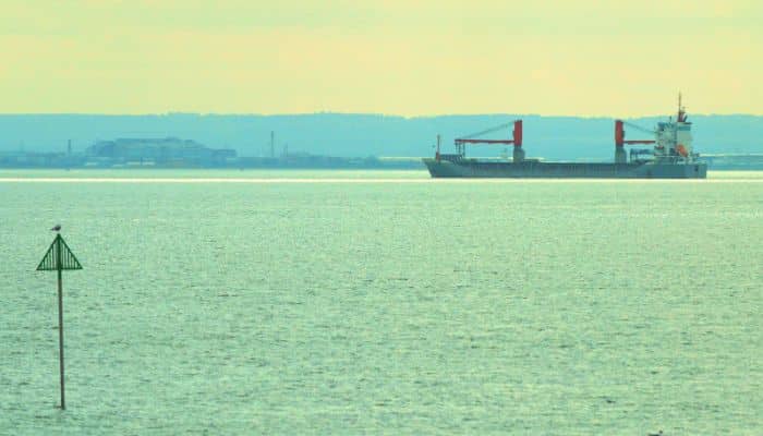
Thames Estuary is a key shipping route utilised by thousands of oil tankers, containers, bulkers and RORO ships.
Many key ports like the Port of London, Sheerness, Thamesport and Chatham are located here.
This estuary supports millions of people and also wildlife. It is home to 115 species of fish and 92 bird species.
10. Long Island Sound, North America
As the name suggests, Long Island Sound is a Marine Sound and a tidal estuary of the Atlantic Ocean. It is nestled between the US State of Connecticut and Long Island, in New York.
It spans 180 km from west to east, going from the East River in New York all the way to Block Island Sound.
It measures 34 km at its widest point and has a 20-70 m depth.
Approximately 15,000 native people lived along the Long Island Sound before it was colonised. Adriaen Block, a Dutch Navigator, was the first European to officially record the existence of the Sound in 1614.
Several factories dealing in textiles, manufacturing, and oyster harvesting came up near Long Island Sound during the period of the Industrial Revolution, which led to pollution along its coasts.
Conclusion
Estuaries are partially enclosed water bodies formed when freshwater from land, such as water from rivers, meets and mixes with salty ocean waters.
Barriers like reefs, deltas and headlands protect the estuaries from the ocean forces. Estuaries also trap and transport sediment and nutrients through freshwater flows, the action of wind, waves and tides.
Estuaries are diverse habitats that support a myriad of flora and fauna. They are also home to millions of people who depend on them for their livelihood.
You might also like to read-
- 10 Largest Fjords In The World
- 10 Best Great Lakes Ship Tracker Tools
- 10 Gulf of Martaban Facts You Might Not Know
- 12 Gulf Of Mannar Facts You Might Not Know
- 10 Celtic Sea Facts You Should Know
Disclaimer :
The information contained in this website is for general information purposes only. While we endeavour to keep the information up to date and correct, we make no representations or warranties of any kind, express or implied, about the completeness, accuracy, reliability, suitability or availability with respect to the website or the information, products, services, or related graphics contained on the website for any purpose. Any reliance you place on such information is therefore strictly at your own risk.
In no event will we be liable for any loss or damage including without limitation, indirect or consequential loss or damage, or any loss or damage whatsoever arising from loss of data or profits arising out of, or in connection with, the use of this website.
Do you have info to share with us ? Suggest a correction
Disclaimer :
The information contained in this website is for general information purposes only. While we endeavour to keep the information up to date and correct, we make no representations or warranties of any kind, express or implied, about the completeness, accuracy, reliability, suitability or availability with respect to the website or the information, products, services, or related graphics contained on the website for any purpose. Any reliance you place on such information is therefore strictly at your own risk.
In no event will we be liable for any loss or damage including without limitation, indirect or consequential loss or damage, or any loss or damage whatsoever arising from loss of data or profits arising out of, or in connection with, the use of this website.

About Author
Zahra is an alumna of Miranda House, University of Delhi. She is an avid writer, possessing immaculate research and editing skills. Author of several academic papers, she has also worked as a freelance writer, producing many technical, creative and marketing pieces. A true aesthete at heart, she loves books a little more than anything else.
Latest Maritime Knowledge Articles You Would Like:


Daily Maritime News, Straight To Your Inbox
Sign Up To Get Daily Newsletters
Join over 60k+ people who read our daily newsletters
By subscribing, you agree to our Privacy Policy and may receive occasional deal communications; you can unsubscribe anytime.