10 Gulf of Martaban Facts You Might Not Know
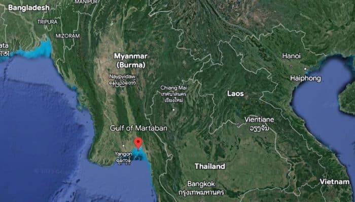
The Gulf of Martaban, also called the Gulf of Mottama, is an arm of the Andaman Sea lying in the southern part of Burma or Myanmar. It is named after the city of Mottama, which was earlier called Martaban.
1. How was the Gulf of Martaban formed?
The formation of the Gulf of Martaban was a complex and dynamic process that involved many geological factors, some of which are discussed below.
The most important was the tectonic plate movement in the region. The Indian and Eurasian Plates have been moving close to each other for millions of years. Their convergence led to the subduction of the Indian Plate under the Eurasian Plate along the Sunda Trench that lies to the west of the Gulf of Martaban.
The subduction created an uplift of land and gave birth to the mountain ranges in Myanmar. It also formed the Sunda or Andaman Trench along the western side of the Gulf of Martaban.
These processes occurring in the region gave birth to the Gulf of Martaban and shaped its topography. Also, rivers flowing from Myanmar’s eastern highlands into the Gulf of Martaban take huge amounts of sediments, depositing them in the Gulf, forming coastal plains and delta regions.
Also, changes in the sea level have played a major role in shaping the coastline of the Martaban Gulf. Erosion by winds and tides and coastal features like beaches, sandbars and estuaries along the Gulf of Martaban are constantly evolving due to these processes.
2. Where does the Gulf of Martaban lie?
The Gulf of Martaban is located along the southern coast of Myanmar, between the western shores of the Malay Peninsula and the southern part of Myanmar’s coastline.
The Gulf of Martaban covers approximately 23,000 square kilometres or 8880 square miles. It is around 150-200 km wide at its mouth and extends inland for around 100 km or 62 miles.
3. Many important cities situated along its coast
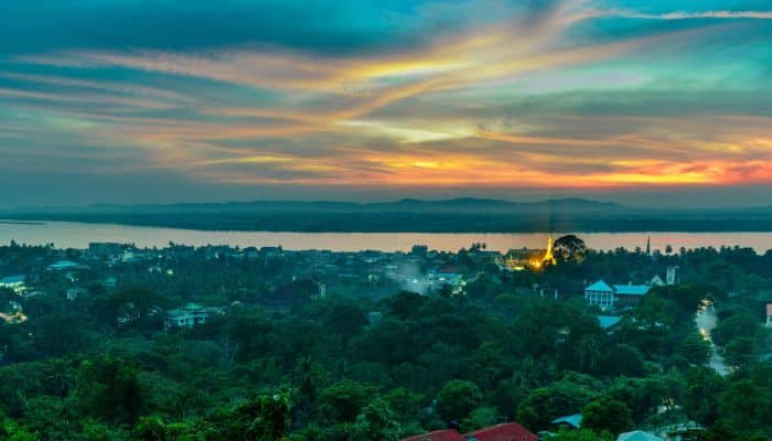
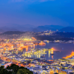
Several famous cities lie close to the Martaban Gulf. Mawlamyine, earlier called Moulmein, is the 4th biggest city in the country, lying 300 km southeast of Yangon and 70 km south of Thaton, at the mouth of the Salween River. It is an ancient city that was the first capital of British-occupied Burma. Presently, it is the capital and biggest city of Mon State and also the main trading centre in the southeastern part of the country.
Pathein, or Bassein, is the biggest city and capital of the Ayeyarwady region, lying 190 km west of Yangon. It was once a significant part of the Mon Kingdom but now has very few ethnic Mon residents. The majority of its inhabitants are Karen, Burmese Indian, Rakhine and Burmese-Chinese.
Yangon is the largest city in Myanmar and also its most populous city and commercial hub. It boasts numerous colonial-era buildings and the popular colonial-era urban core centred around Sule Pagoda, which is more than 2000 years old. It is also a widely visited tourist destination in Myanmar, famous for its Shwedagon Pagoda, the most sacred Buddhist Pagoda in Myanmar.
4. Gulf of Martaban is fed by Sittaung, Salveen and Yangon Rivers
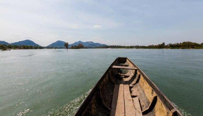
The Sittaung River flows in south-central Myanmar, and its basin is separated from Irrawaddy by the Pegu Range. It originates from Shan Hills and flows southward to the Martaban Gulf. It is 420 km long and discharges 50 cubic km of water per year. It is used to carry timber south for export.
Salween River is 3289 km long and flows from Tibetan Plateau into the Andaman Sea. It flows within southwestern China and eastern Myanmar. In its course, it goes through the rugged canyons, and despite being so long, only its last 90 km is navigable when it forms an estuary and delta at Mawlamyine.
It is known by various names, such as Thanlwin in Myanmar and Nu Jiang in China. It is called Salween as well, an anglicisation of its Burmese name going back to the 19th century.
Yangon River, also known as the Rangoon River or Hlaing River, is created by the confluence of the Pegu and Myitmaka Rivers in Myanmar. It is an estuary going from Yangon to Martaban Gulf of the Andaman Sea. It is navigable for big ships and plays an important role in Myanmar’s maritime trade and economy.
Twante Canal links the Yangon River with the Irrawaddy Delta, once called ‘the rice bowl of Asia’. It had 1000 sq miles of teak plantations and mangroves, most of which have been cleared for producing rice.
5. Martaban Gulf has coastal plains and fertile deltas
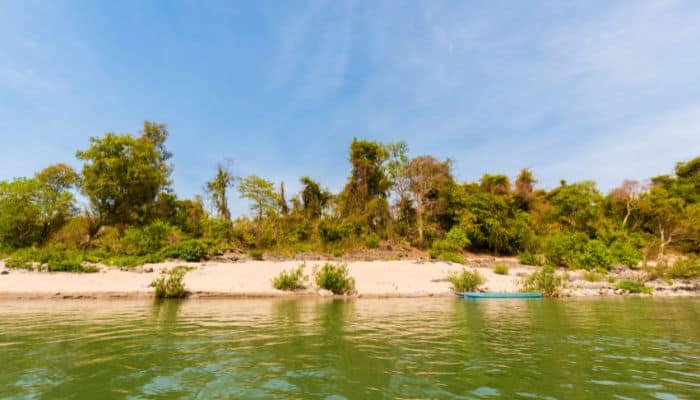
The Gulf of Martaban has extensive plains and deltas formed by the deposition of sediments by rivers. The Irawaddy or Ayeyarwaddy is the most prominent delta and the most important agricultural area in Myanmar. It is densely populated and plays a major role in rice cultivation.
Its rich alluvial soil is 3 m above sea level, and it also supports fishing communities who live around the region abundant with rivers and streams.
Since the region is economically significant, its road infrastructure was developed during the 1990s-2000s. Fishing is another activity carried out here through fishing frames and small boats.
Other activities include prawn fishery and harvesting sea turtle eggs, both of which are threatened due to the loss of mangroves and the clearing of land for farming. Transportation through the delta is easiest by waterways. Hence almost all households have a boat, and the main towns along it, like Bogale, Mawlamyinegyun and Myaungmya, are connected by steamer services.
6. Has a unique estuarine mudflat environment supporting diverse marine life
The coastal and marine waters of the Martaban Gulf are home to diverse flora and fauna. The Eden’s or Sittang whale, smaller than other whales, is restricted to Indo-Pacific and was found in the Gulf’s waters.
The unique mudflat environment created by the deposition of sediment by rivers hosts over 150,000 migratory birds which arrive here in winter, including half of the world’s population of Spoon-billed Sandpiper, a critically endangered species.
The mudflats are also rich in mussels, worms, shrimp, crabs, crustaceans and other species that are ideal food for these birds. Due to its diverse ecosystem, a part of the Gulf was declared a Wetland of International Importance in 2017. The Gulf’s waters also have seagrasses, algae, reef fish and pelagic fish.
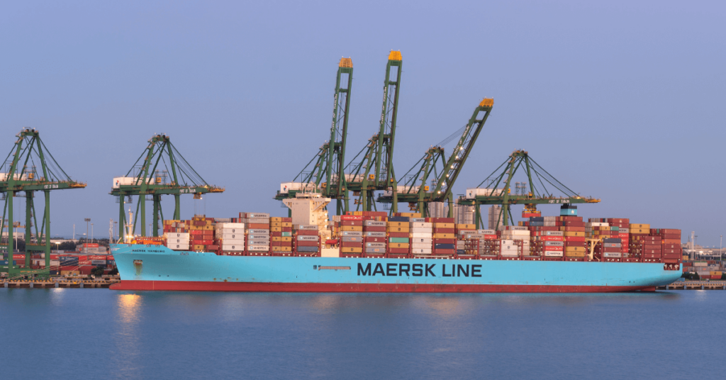
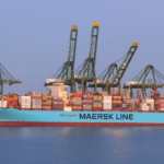
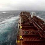
7. Serves as a natural gateway for ships coming to Southeast Asia
The Gulf of Martaban functions as a natural maritime gateway for vessels plying between the Indian Ocean and the countries in Southeast Asia like Thailand and Malaysia. It is home to many important ports and harbours and facilitates the movement of goods, raw materials and energy resources.
The Gulf of Martaban also supports the regional economy, particularly of Myanmar, by enabling the convenient export of rice, minerals, timber, natural gas etc. It has also enhanced regional connectivity and trade within ASEAN and other neighbouring countries.
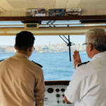
8. Home to important ports and harbour facilities
The Gulf of Martaban has many ports, like Yangon, which is also the largest city and former capital of Myanmar. It is a crucial maritime hub and the main port of the country, lying at the confluence of the Yangon River, Pazaundaung Creek and Pegu River.
It has more than 30 berths for oceangoing ships and facilities for oil, coal and general cargo. Rice is handled in huge quantities through a bag-loading conveyor system.
The port has specialised areas for different cargo like the Hteedan Wharf, Ahlone Wharf, Myanmar Industrial Port Wharf, Sule Pagoda Wharf, Bo Aung Gyaw Wharf, Botataung Container Port Thaketa Wharf, Myanmar Integrate Ports Limited and Myanmar International Terminals Thilawa.
Approximately 188,900 tonnes of cargo and 500 vessels are handled annually.
Another important port is Moulmein, formerly known as Mawlamyine. It is situated on the east coast of the Gulf of Martaban.
Moulmein has berths for coastal cargoes and lighterage facilities for deep-sea ships. Major exports are rice, rubber and timber, while imports comprise hardware.
Approx 100 passenger ships and 60 tankers visit the port annually.
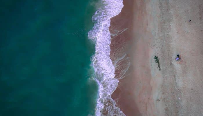
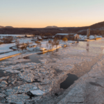
9. Gulf of Martaban experiences high tides and tidal bore phenomenon
A characteristic feature of the Gulf of Martaban is its coastline, dominated by high tides ranging between 4 metres and 7 metres. The highest tidal range is recorded at Elephant Point in the western Gulf of Martaban.
The phenomenon occurs due to the gulf’s mouth, which is 100 km broad and narrows down into a funnel-like bay, giving rise to the strong tides reaching more than a metre in the upper estuary. Hence, the tidal mudflats of Martaban Gulf are among the biggest in the world.
During the spring tide, the tidal range is about 6.6 m; the turbid zone covers over 45,000 km2, making it one of the biggest perennially turbid zones of the world’s oceans.
The four big rivers, namely Sittaung, Thanlwin, Yangon, and Ayeyarwady, take about 350 million tons of sediment into the Gulf annually. As the rivers flow into the Gulf, strong tides can push water backwards into the rivers at 3 m per second, forming a tidal bore that is so strong it temporarily reverses the flow of the river.
The resultant waves as high as 7 m are tools of erosion. The phenomenon alters the rivers’ course, tears down banks, forms another and so on. However, much land has been lost along the Gulf of Martaban, and the process has sped up since 2016, leading to the loss of 12 villages by 2018, displacing small-scale farmers and fishermen who depend on the Gulf for their livelihood.
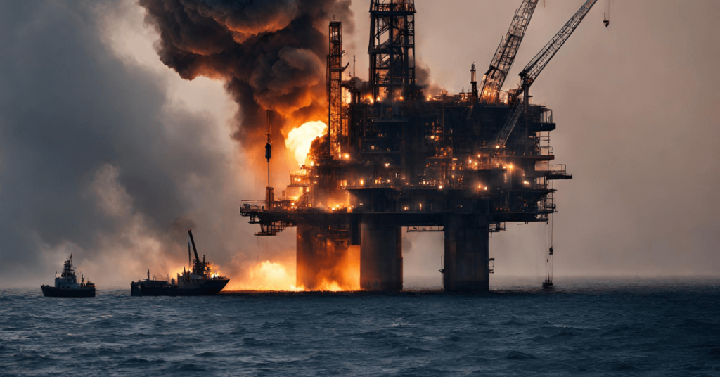
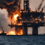
10. Significant Oil Reserves were found in the Gulf of Martaban in 2008
The discovery of oil in the Gulf of Martaban was a turning point in the country’s oil industry and garnered the attention of major oil corporations. Since 2014, it has been a site of oil exploration under the Zawtika Development project that focuses on the M7, M9 and M11 blocks in the Gulf of Martaban.
It involves the exploration and extraction of oil and natural gas in the aforementioned offshore blocks. Operated by PTTEP International Limited, it includes a consortium of American, British, French, Chinese, Indonesian and Indian oil and construction companies.
The oil exploration activities here are mainly offshore. These activities have led to infrastructural developments in Myanmar and also generated a new revenue source and employment opportunities.
- 12 Gulf Of Mannar Facts You Might Not Know
- 10 Celtic Sea Facts You Should Know
- 9 Interesting West Philippine Sea Facts You Must Know
- 13 Gulf Of Riga Facts You Must Know
- 12 Major Gulf Of Bothnia Facts
Disclaimer :
The information contained in this website is for general information purposes only. While we endeavour to keep the information up to date and correct, we make no representations or warranties of any kind, express or implied, about the completeness, accuracy, reliability, suitability or availability with respect to the website or the information, products, services, or related graphics contained on the website for any purpose. Any reliance you place on such information is therefore strictly at your own risk.
In no event will we be liable for any loss or damage including without limitation, indirect or consequential loss or damage, or any loss or damage whatsoever arising from loss of data or profits arising out of, or in connection with, the use of this website.
Do you have info to share with us ? Suggest a correction
Disclaimer :
The information contained in this website is for general information purposes only. While we endeavour to keep the information up to date and correct, we make no representations or warranties of any kind, express or implied, about the completeness, accuracy, reliability, suitability or availability with respect to the website or the information, products, services, or related graphics contained on the website for any purpose. Any reliance you place on such information is therefore strictly at your own risk.
In no event will we be liable for any loss or damage including without limitation, indirect or consequential loss or damage, or any loss or damage whatsoever arising from loss of data or profits arising out of, or in connection with, the use of this website.

About Author
Zahra is an alumna of Miranda House, University of Delhi. She is an avid writer, possessing immaculate research and editing skills. Author of several academic papers, she has also worked as a freelance writer, producing many technical, creative and marketing pieces. A true aesthete at heart, she loves books a little more than anything else.
Latest Maritime Knowledge Articles You Would Like:


Daily Maritime News, Straight To Your Inbox
Sign Up To Get Daily Newsletters
Join over 60k+ people who read our daily newsletters
By subscribing, you agree to our Privacy Policy and may receive occasional deal communications; you can unsubscribe anytime.