

10 Interesting Gulf of Tomini Facts You Must Know
The Gulf of Tomini, also called the Bay of Tomini, lies close to the Island of Sulawesi in Indonesia. It is surrounded by Gorontalo province, Minhassa Peninsula Buyat and East Peninsula, Sulawesi. Towards the east, the Gulf of Tomini opens to the Molucca Sea.
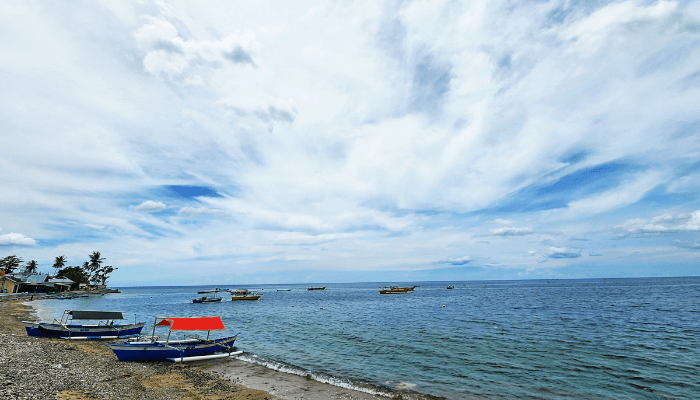
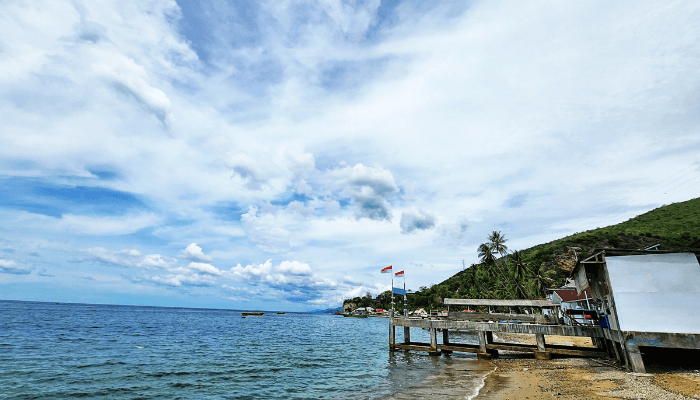
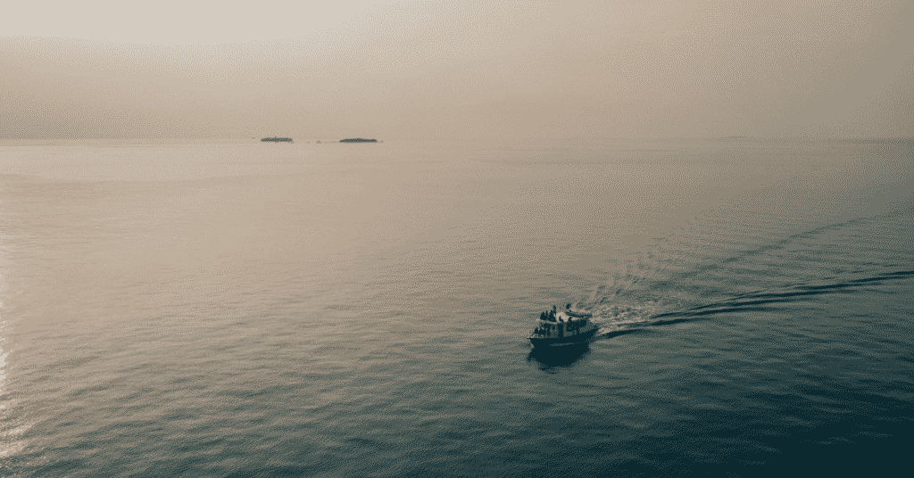
The Gulf is a popular tourist destination, given its beautiful landscapes, crystal clear waters, fine sand beaches, lush green islands, lagoons, and estuaries that support hundreds of plant and animal species.
Read along to learn 10 interesting facts about the Gulf of Tomini.
1. Formation of the Gulf of Tomini
The Gulf of Tomini took its present-day shape due to changes in the sea level and tectonic plate movements over millions of years. The region is seismically quite active as it comes within the Pacific Ring of Fire.
During the ice ages, when sea levels were low, the region, which is now the Gulf of Tomini, was land, but as sea levels rose, it became filled with water. The faulting and folding of the crust created basins that were filled with water, creating the gulf. The process was gradual and occurred in the last 65 million years.
The major phase of basin formation was in the Miocene, 23 to 5 million years ago. Rifting and expansion opened the gulf basin. In the Pliocene, around 5 to 2.5 million years ago, the basic structure and morphology of the Gulf of Tomini took shape. However, geological processes still continue to affect the Gulf of Tomini today.
2. Teeming with hundreds of fish species, marine mammals and aquatic plants
The Gulf of Tomini is home to many vibrant fish, crustaceans, molluscs and other exotic flora and fauna. Some species are endemic to this region, like the Banggai cardinalfish and Tomini fantail.
There are over 500 species of fish in the Gulf, including snappers, goatfish, barracuda, trevallies, fusiliers, groupers and whale sharks, which are occasional visitors.
Clams, conchs, giant clams, oysters and nautilus shells are also found. The bay is also inhabited by Irrawaddy dolphins, sperm whales and dugongs. More than 100 species of sponges have been recorded on the coral reefs of the Gulf of Tomini.
Near the gulf are many islands which are breeding and nesting grounds for green turtles and hawksbill turtles. Saltwater crocodiles live in estuaries and mangroves that line the islands’ coasts. There are large seagrass meadows that support invertebrates, juvenile fish, and birds like terns, kingfishers, herons, and egrets.
3. Has over 250 species of hard corals
The Gulf of Tomini has different types of beautiful coral reefs, forming extensive reef systems. More than 250 species of hard corals were recorded in the Gulf, with some of the common ones being Acropora hyacinths, Acropora Masuta, Acropora Muricata, Montipora Digitata, Acropora secale, all branching corals which help in the development of reefs.
Larger corals like Porties Cylindrica and Porites lutea and foliose corals like Echinopora lamellose and Favites pentagona add to the texture and complexity of the coral reefs.
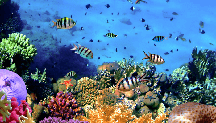
The corals, many of which grow in dense thickets and mounds, have formed rich reef systems in the Gulf of Tomini. Conservation efforts are ongoing to preserve these ecologically significant ecosystems from natural and man-made threats.
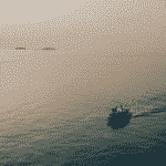
4. There are around 200 diving spots in the Gulf of Tomini
Tomini Bay is known for its clear waters and diverse underwater habitats, making it the perfect diving destination. The Gulf has 200 diving spots; the largest 30 are in Gorontalo, and 20 are in Togian. In fact, some of the diving spots have not been properly explored.
Called the hidden paradise on the equator, this gulf has incomparable beauty. Most divers fly to Gorontalo since it has Salvadoran coral and blue sea fans, which are not found anywhere else in the Gulf.
5. Tomini Bay has three famous marine parks
The three Marine Parks in the Gulf of Tomini include the Olele Marine Park, the Bitila Island Marine Park and the Buyat Marine Park.
Olele Marine Park is in Olele village, Bone Bolanga Regency, Gorontalo province. It is around 20 km from Gorontalo city. It has 30 dive spots, two of them being ruins of Second World War Japanese cargo ships that sank here. A famous attraction in the park is the coral of Salvador Dali, a massive coral flower.
Bitila Island Marine Park is on Bitila Island, Pohuwatu Regency, Gorontalo province. The island has no significant population; however, it has freshwater springs, coral reefs, and white sand beaches, making it the ideal holiday destination.
Buyat Marine Park lies in southeast Minahasa Regency, North Sulawesi Province. The marine park has 25 dive points. One can reach Buyat in 7 to 8 hours from Gorontalo City. Another famous tourist destination within the Tomini Bay region is the Togean archipelago and Pulau Cinta.
6. Experiences a tropical climate
Tomini Gulf has a tropical climate with no distinct wet or dry seasons. It usually remains warm and humid throughout the year. The average temperature ranges from 24°C to 31°C, with little variation between seasons.
Rainfall is high, with an annual average of about 98 to 118 inches. It rains all year round but is heavier between December and March. Southwest monsoon winds prevail from December to March, bringing heavy rain, and Southeast Winds are prevalent from June to September.
Humidity generally remains over 70 to 80%, which makes the heat feel more intense even when the temperature is moderate.
7. Site of many shipwrecks
Many ships sank in the Gulf of Tomiini. One such was KM Tidore, which sank after hitting a mine which killed 200 people. KM Ciremai was another frigate which exploded and sank close to Manado, killing 100 sailors.
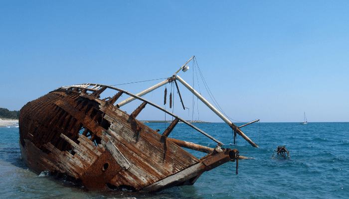
The cargo ship MV Dumai caught fire and claimed 11 lives. In 1978, the MV Sinar Bangka ferry capsized during a storm near Bitung, taking over 150 passengers and crew members with it. In the 1980s and 1990s, MV Trisula collided with a cargo vessel, leaving more than 200 dead, and MV KM Lembar sank in heavy seas near Manado, claiming 60 lives.
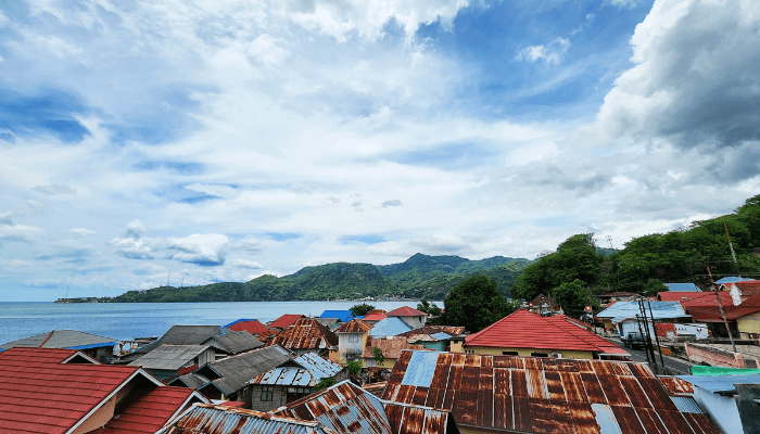
8. Togean Islands lie in the centre of Tomini Gulf
The Togean or Togian Islands are an archipelago of 56 islands and several offshore islets in the Gulf of Tomini, off the Central Sulawesi coast, Indonesia. There are 59 villages on the islands, one populated by Bajau people, popularly known as sea gypsies. The biggest islands of the group are Batudaka, Togean, Talatako and Una-Una.
The islands were formed as a result of volcanic activities and are covered with rainforests. Surrounded by coral reefs, they also offer diverse habitats and breeding areas for dugongs, hawksbill turtles and green turtles.
Some animals native to these islands are Togian babirusa and Togian hawk-owl, which was discovered in 1999. Non-venomous jellyfish are found in the Togian Islands; the unique one is jellyfish with tiny red spots.
The government has categorised a part of the Togean Islands as National Park. It comprises 292,000 hectares of water, including 132,000 hectares covered with coral reefs, 70,000 hectares of land and another 11,000 hectares of forests and mangroves.
The islands are known for their amazing diving spots, which are easily accessible. There are about 20 famous resorts on the islands that can be reached from Ampana or Gorontalo by a public or private boat. Some of the most visited resorts are Reconnect, which lies on Buka Buka Island, Kadidiri Paradise, Sanctum Dive Resort, and Fadhila Cottages.
9. A famous volcano lies in the Gulf of Tomini
The Coco Volcano forms Una-Una Island, a small and isolated island amidst the Gulf of Tomini in northern Sulawesi near Togean National Park.
The volcano’s summit rises to 500 m above sea level with a two km wide caldera. Una-Una is a scenic island formed due to the Coco Volcano’s eruption. An interesting by-product of the island’s volcanic nature is that while other islands in the gulf have white sand beaches, Una-Una has black sand beaches.
Mount Coco erupted just three times in recorded history. In 1983, after remaining dormant for 80 years, a powerful eruption released thick, yellow clouds rising five kilometres and volcanic ash reaching East Kalimantan.
The island was swept by pyroclastic flows that destroyed everything in its path, including several settlements. Only a narrow stretch along the island’s eastern shores remained untouched.
The island residents had already evacuated, so there were no deaths. After this, Mount Colo has not erupted since. The island remained uninhabited for some time, but people returned to rebuild their homes and start agriculture as the volcanic ash and lava increased soil fertility over many years. The island’s deer population rose manifold, and the residents raised elks for food and clothing.
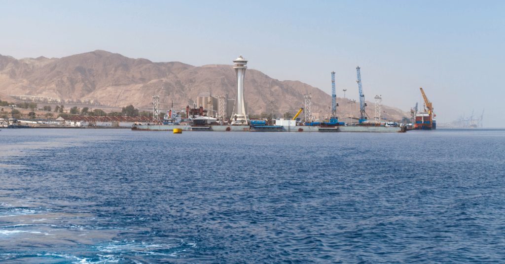
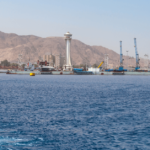
10. Bitung, Manado and Gorontalo are 3 major ports
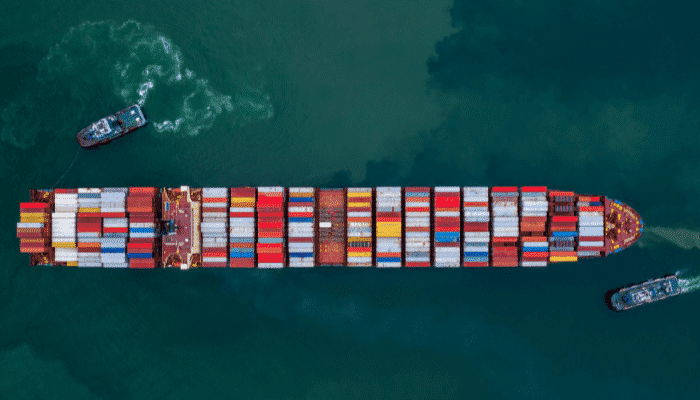
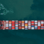
The Gulf of Tomini has many ports and harbours. A major Port is Bitung, which lies at the northeastern tip of Sulawesi province, 15 nm from Manado. It mainly exports copra, as 216,000 tonnes are produced annually. It also handles containers, petroleum products and tuna fish. Around 4,760,000 tonnes of cargo and 166,000 are TEU handled annually here.
Manado is situated on the northwestern coast of Sulawesi. It is a trade centre and a chief port in the northern part of Sulawesi. It caters to local vessels carrying general cargo and local ferry services. Major exports comprise nutmeg, copra, ebony and sugar.
Gorontali is on the northern coast of Sulawesi. It is a lighterage port that exports copra. It also has an oil terminal and two breakwaters. Around 487,500 tonnes of cargo and 23,600 TEU are handled annually.
You might also like to read-
- 10 Major Gulf of Oman Facts
- 10 Top Eco-Friendly Cruise Ships
- Are Polar Waters Navigable – 10 Things You Should Know
- 2 Major Ports in East Timor
- 5 Major Ports In Antigua And Barbuda
Disclaimer :
The information contained in this website is for general information purposes only. While we endeavour to keep the information up to date and correct, we make no representations or warranties of any kind, express or implied, about the completeness, accuracy, reliability, suitability or availability with respect to the website or the information, products, services, or related graphics contained on the website for any purpose. Any reliance you place on such information is therefore strictly at your own risk.
In no event will we be liable for any loss or damage including without limitation, indirect or consequential loss or damage, or any loss or damage whatsoever arising from loss of data or profits arising out of, or in connection with, the use of this website.
Do you have info to share with us ? Suggest a correction
Disclaimer :
The information contained in this website is for general information purposes only. While we endeavour to keep the information up to date and correct, we make no representations or warranties of any kind, express or implied, about the completeness, accuracy, reliability, suitability or availability with respect to the website or the information, products, services, or related graphics contained on the website for any purpose. Any reliance you place on such information is therefore strictly at your own risk.
In no event will we be liable for any loss or damage including without limitation, indirect or consequential loss or damage, or any loss or damage whatsoever arising from loss of data or profits arising out of, or in connection with, the use of this website.

About Author
Zahra is an alumna of Miranda House, University of Delhi. She is an avid writer, possessing immaculate research and editing skills. Author of several academic papers, she has also worked as a freelance writer, producing many technical, creative and marketing pieces. A true aesthete at heart, she loves books a little more than anything else.
Latest Maritime Knowledge Articles You Would Like:


Subscribe To Our Newsletters
By subscribing, you agree to our Privacy Policy and may receive occasional deal communications; you can unsubscribe anytime.