

10 Interesting Bali Sea Facts
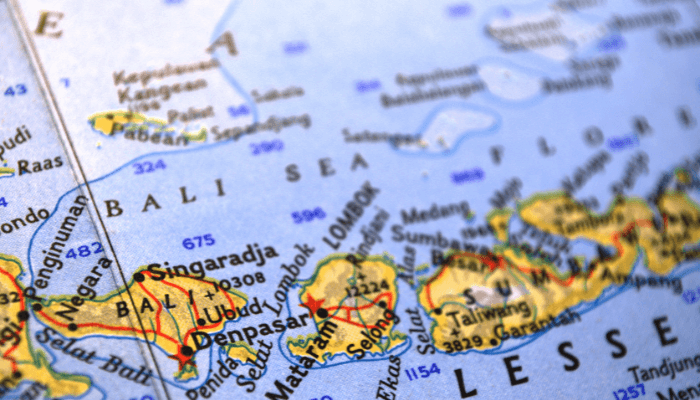
The Bali Sea lies north of Bali Island and south of Kangean Island in Indonesia. It forms the southwest part of the Flores Sea, and the Madura Strait opens into the Bali Sea from the west. At some places, the depth of the Bali Sea reached 5217 feet.
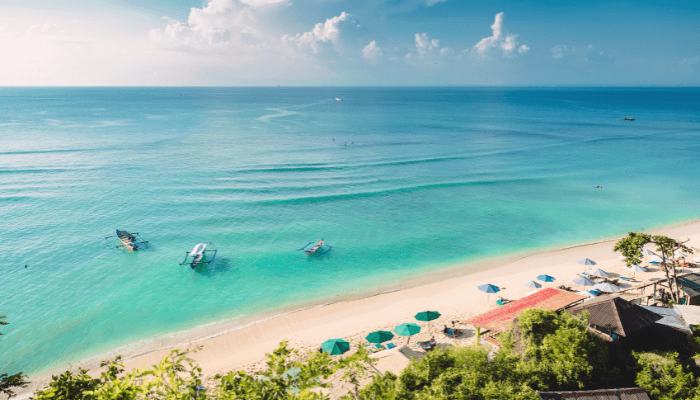
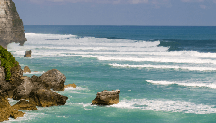
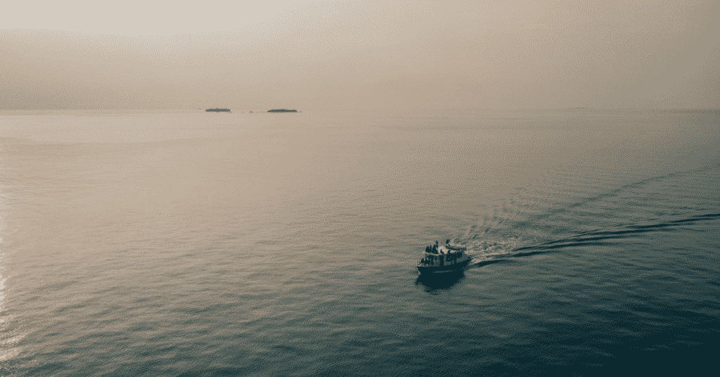
Though it is one of the world’s most shallow seas, it can easily accommodate 4 Empire State Buildings stacked on each other. People visit the Bali Sea for its turquoise blue waters, rich marine life, pleasant climate and beautiful beaches.
Read this article to find out more interesting facts about the Bali Sea.
1. One of the seas in the East Indian Archipelago
According to the International Hydrographic Organisation, the Bali Sea is one of the seas of the East Indian Archipelago. Regarding its oceanography, the Bali Sea corresponds with the Indonesian Throughflow that flows from the Pacific Ocean to the Indian Ocean through the Bali and Lombok Straits.
2. Some view it as a part of the Flores Sea
Since the Bali Sea shares its eastern boundary with the Flores Sea, some oceanographers define it as part of it. A few nautical charts identify it as a separate sea for navigation. Bali sea covers 45,000 km2 and has a maximum depth of 1,590 m.
3. Home to many volcanic islands
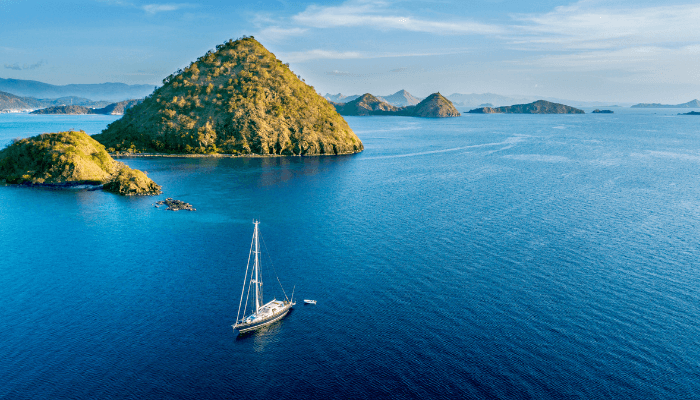
A popular tourist attraction with more than 4 million people is Bali Island, which gives the sea its name. It comprises 4 islands: Bali and the smaller Nusa Penida, Nusa Lembongan and Nusa Ceningan.
Bali has something for everyone, from beaches to historical temples, rice terraces, mountains, forests and fields. It has several historical temples, such as Besakih, Uluwau, and Tanah Lot. Famous beaches include Seminyak, Nusa Dua and Kuta. Hiking enthusiasts must explore the two active volcanoes, Mount Batur and Mount Agung, that rise above the island.
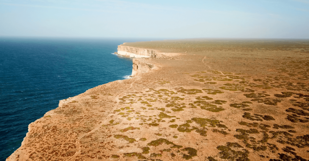
Off the tourist trail is Nusa Penida, with its rugged beauty, sweeping bays and cliffs covered with foliage. One can hop on a boat from Sanur Beach in Bali, and in 30 minutes, you arrive at Nusa Lembongan. It is a haven of yoga retreats and independent restaurants. Nature enthusiasts will appreciate its beaches and mangroves. It is linked to the smaller Nusa Ceningan via a suspension bridge. Nusa Ceningan is quieter and offers a more private experience with its blue lagoons and calm ambience.
Lombok Island lies east of Bali, and its Mount Rinjani volcano is Indonesia’s second-highest volcano and a well-known hiking and adventure place. It is perfect for people who want to experience a slow and peaceful atmosphere. Bali draws many tourists, but you can find many offbeat places in Lombok.
4. Bali Sea lies in the Pacific Ring of Fire
The Ring of Fire, also called the Pacific Ring of Fire, the Girdle of Fire, Rim of Fire and Circum-Pacific Belt, has many volcanoes. It is seismically active, and most earthquakes occur here.
It covers around 40,000 kilometres of area and is 500 km wide, surrounding much of the Pacific Ocean. The Ring of Fire has roughly 750 to 915 volcanoes, about two-thirds of the world’s total. Also, 90% of the earthquakes in the world, including some of the deadliest, occur in this belt.
Ring of Fire has existed for over 35 million years, and some of its volcanos are active while others are dormant. Over 350 of its volcanoes have been active since historical times.
Most of Earth’s active volcanoes with summits above sea level lie in the Pacific Ring of Fire. Most of these are subaerial volcanoes like Mount St Helens. Other volcanoes in the Ring of Fire include the subaerial shield volcanoes and submarine seamounts such as Plosky Tolbachik and Monowai.
5. Bali Sea has a tropical climate
The weather in the Bali Sea is warm throughout the year. There are only two seasons, rainy and dry, lasting from November to March and April to October. Tourists can visit in any season, but most prefer the dry season since the sea is calm and the average temperature is about 86 degrees Fahrenheit.
The rainy season has more humidity, sporadic storms and rougher seas, making it less conducive for water sports like scuba diving, snorkelling, etc. Most people go on mountain hikes and bicycle rides on the islands’ peaks, which is also impossible during monsoon season.
6. Home to many shipwrecks turned popular diving spots
The USS Liberty Wreck is one of the world’s best sunken shipwrecks and the most popular dive site in Bali. The vessel was struck by a Japanese torpedo and then beached near Tulamben. 1963, Mount Agung erupted and caused the ship to slip off the beach, reaching a sand slope in 9 to 30 m of water.
The wreck is around 130 m long, and its shallowest part is just 5m deep, while the deepest is 30 m, making it ideal for beginners and professional diveers. The vessel has become home to marine organisms such as Bumphead Parrotfish.
Kubu Boga wreck lies near the USS Liberty Shipwreck. The vessel is intact, but one needs an advanced diver license as it lies deep in 30 m of water. Originally, it lay in 18 m deep waters; however, due to an earthquake, it slipped to its current depths.
Jepun Wreck in Padang Bai lies in 17 meters-deep waters. It is home to shrimps, crabs, seahorses, frogfish, and sharks.
Japanese Wreck Amed lies near the beach of Amed, at a depth of 7-10 meters. While it is not as fascinating as the USS Liberty Shipwreck, its inhabited by several damselfish and seahorses.
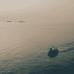
7. Guided fishing tours in the Bali Sea
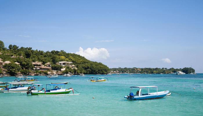
Anglers from around the world visit the coast of the Bali Sea to experience fishing in these crystal-clear waters. One can learn many advanced and local fishing techniques. Jukungs, locally made wooden boats, are used for fishing and tours are specially organised for big-game fishing.
Karangasem and Kota Denpasar are popular fishing hotspots. The rocky coasts in the South are known for the Giant Trevally, one of the fighter fishes. Big game fishing is a thrilling experience preferred by anglers about 15 miles from Denpasar. One can expect to catch Wahoo, Snappers, Tunas, Mahi Mahi, Amberjack, etc. Chances of catching Marlin and Sailfish increase as we go deep in the waters.
Sport fishing is popular, done using a rod, reel and hooks. The method that uses hooks is called angling, and when one uses a lightweight lure, it is called fly-fishing. These are some fishing techniques common in Bali.
However, experienced fishers who want more thrills should go for big-game fishing. One can book a fishing tour organised and led by trained operators.
8. Formed 25 to 30 million years ago
The Bali Sea was created due to complex plate tectonics that formed the Indonesian Island arc. The Australian continental plate pushed under the Eurasian plate, leading to seismic uplifting around 25 million years ago.
This caused increased volcanic activity and folding of the overriding plate, leading to the creation of the islands of Bali and Java about 15 to 5 million years ago. The gaps between these islands were filled with water, forming the Bali Sea.
By around 5 million years ago, Bali and eastern Java had emerged fully above sea level as separate landmasses. The gaps between them had filled with seawater, beginning to form the initial basin of the Bali Sea.
Continued subduction over the last 5 million years has shaped and deepened the sea, separating it from surrounding water bodies like the Java Sea. The basic shape and boundaries of the Bali Sea were formed around 2 to 3 million years ago.
9. Site of most destructive earthquakes
The subduction process is ongoing, and in 2018, an earthquake and tsunami in the Bali Sea killed more than 400 people in Indonesia. In August 2023, a 7.0 magnitude earthquake struck the Bali Sea.
Its epicentre was 201 km north of Mataram, Indonesia and around 518 km below the earth’s surface. It hit 525 km beneath the epicentre close to Bangsal, West Nusa, Tenggara, Indonesia.
There were no tsunami threats; however, people, especially tourists, came out of their rooms and hotels. Luckily, there were no casualties; however, a few people were injured.
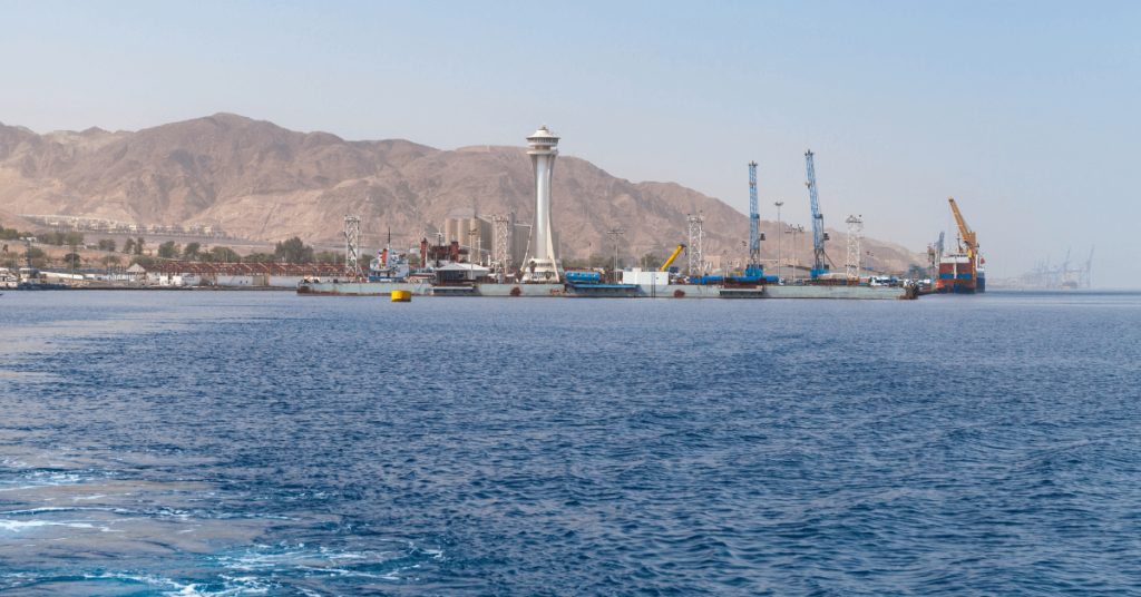
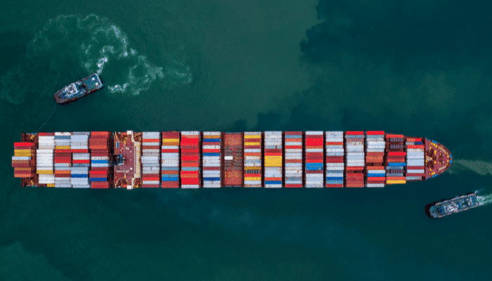
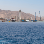
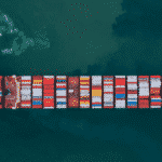
10. Has many major ports and harbours
Benoa Port is a key facility on the southern shores of Bali, on the northern side of the Benoa Channel. It mainly handles exports of tuna fish, handicrafts, garments and other equipment. Cruise Lines also call at this port regularly. Around 7,000 ships visit Benoa Port annually, with 129,000 tonnes unloaded and 50,000 tonnes loaded.
Padanbai Port is another port on Bali Island’s eastern tip. It also offers ferry connections to Lombok. Gilimanuk is 1.5 nautical miles from Cekek on Gilimanuk Bay. It has a ferry boat terminal used by state railways connecting overland communication from Bali to Jaba. It has 5 berths for passenger and vehicle ferries. Other ports include Sape, Tanjung Bira, Lembar Port, Ketapang Port, etc.
You might also like to read-
- Who are Houthis & Why are They Attacking Ships in Red Sea?
- 10 Interesting SS American Star Facts
- 10 Interesting Facts About the Gulf of Finland
- 11 Busiest Shipping Lanes In The World
Disclaimer :
The information contained in this website is for general information purposes only. While we endeavour to keep the information up to date and correct, we make no representations or warranties of any kind, express or implied, about the completeness, accuracy, reliability, suitability or availability with respect to the website or the information, products, services, or related graphics contained on the website for any purpose. Any reliance you place on such information is therefore strictly at your own risk.
In no event will we be liable for any loss or damage including without limitation, indirect or consequential loss or damage, or any loss or damage whatsoever arising from loss of data or profits arising out of, or in connection with, the use of this website.
Do you have info to share with us ? Suggest a correction
Disclaimer :
The information contained in this website is for general information purposes only. While we endeavour to keep the information up to date and correct, we make no representations or warranties of any kind, express or implied, about the completeness, accuracy, reliability, suitability or availability with respect to the website or the information, products, services, or related graphics contained on the website for any purpose. Any reliance you place on such information is therefore strictly at your own risk.
In no event will we be liable for any loss or damage including without limitation, indirect or consequential loss or damage, or any loss or damage whatsoever arising from loss of data or profits arising out of, or in connection with, the use of this website.

About Author
Zahra is an alumna of Miranda House, University of Delhi. She is an avid writer, possessing immaculate research and editing skills. Author of several academic papers, she has also worked as a freelance writer, producing many technical, creative and marketing pieces. A true aesthete at heart, she loves books a little more than anything else.
Latest Maritime Knowledge Articles You Would Like:


Subscribe To Our Newsletters
By subscribing, you agree to our Privacy Policy and may receive occasional deal communications; you can unsubscribe anytime.