2 Major Ports In Vanuatu
The Republic of Vanuatu is an island nation situated in the South Pacific Ocean, some 1090 miles east of northern Australia. The archipelago consists of 83 small islands of volcanic origin.
The Melanesians first settled the islands, while the Spanish were the earliest Europeans to visit the place, led by the Fernandes De Queiros, who landed on the biggest island, the Espiritu Santo, in 1606. He colonised the people and claimed the island for the Spanish Crown by making it a part of the Spanish East Indies.
In the 1800s, there was a tussle between France and the United Kingdom for managing and controlling parts of the archipelago. In 1906, they decided to manage it together and named it the New Hebrides.
However, the people rose into an independence movement in the late 1990s, and the Republic of Vanuatu was carved in 1980. Since its independence, it has become a part of many international organisations.
The economy of Vanuatu
The country’s developing economy relies heavily on agriculture, tourism, financial services and raising cattle for export. Fishing is also important but is usually done for subsistence purposes and does not bring foreign exchange. The nation is also dependent on foreign aid from New Zealand, Australia and China.
More than 60 per cent population is dependent on agriculture, and the tropical climate allows them to grow many fruits and vegetables for personal consumption and export.
In recent years, tourism has brought much development to the islands and provides additional income to the locals. The islands are a popular vacation spot for recreational divers wishing to explore the coral reefs of the South Pacific. Also, another attraction is the wreck of SS President Coolidge on Espiritu Santo island.
The troop carrier vessel was sunk during the second world war and is one of the biggest shipwrecks worldwide, available for recreational diving.
The islands are rich in natural resources, and essential export commodities include copra, cocoa beans, timber, forest products, coffee and kava. Major imports include construction materials, machines, packaged foodstuff, fuel, oils etc. Mining is relatively low on the islands, and a small industry supports the local economy.
There are no petroleum deposits, and economic growth is slowed due to the absence of vital resources, frequent natural disasters, especially earthquakes and an imbalance between imports and exports and the large distances between the main markets of different islands of the archipelago.
Port Infrastructure
Vanuatu has two ports, the Port of Vila and the Port of Luganville in Santo. Vila is the principal port; however, its infrastructure is quite limited. It has just one multipurpose wharf to handle cargo vessels, cruise ships and oil tankers.
Cargo ships have to wait at the anchorage if cruise ships are about to arrive, which causes a delay in transporting cargo and petroleum. To solve this problem, a new multipurpose berth is being built close to the former Star wharf to accommodate only cargo ships. Another small dock would handle domestic inter-island cargo carriers.
The islands have four ports that offer customs and immigration clearance to yachts. These include the ports of Vila in Efate; Port of Luganville in Santo; Sola in Vanua Lava, Torba Province; and Lenekal in Tafea.
Besides ports, cruise ships can moor at the anchorage near the Mystery islands and close to Champagne beach. During the diving season, vessels can moor at Pangi in the Penama province.
1. Port Vila
Vila is the capital and the biggest city of Vanuatu. Situated on the southern coast of the Efate island in the province of Shefa, it is the economic and commercial centre of the nation.
It is the centre of trade and commerce, while the main industries include agriculture, fishing, and offshore financing. The city receives over 80,000 tourists annually, most hailing from Australia and New Zealand.
Port Vila can accommodate cruise liners, cargo vessels and oil tankers. It is made of three bays: the outer bay, the pontoon bay and the Paray Bay. The Bay of Pontoon is deep and has a government wharf on its southern end.
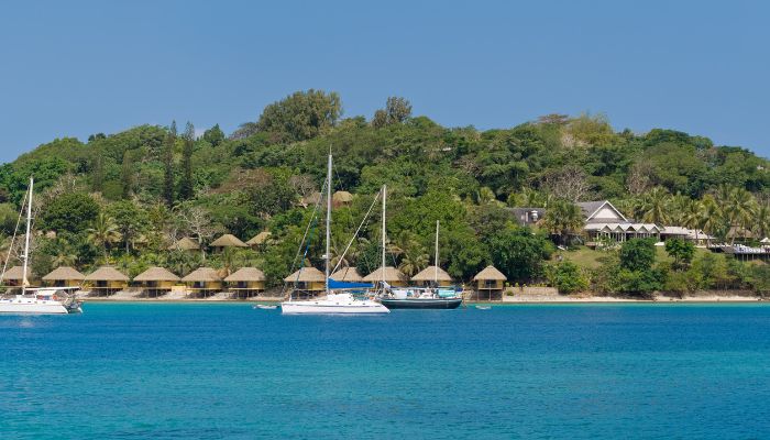
The Ardimanni Wharf, also known as the Star Wharf, is on the southeastern side. A government-owned marine workshop and a fuel depot are located on Paray Bay. The harbour protects vessels except for westerly winds and cyclones. It can handle all kinds of cargo, but the major export commodity is copra.
It is envisaged that a new pier and container facility would improve efficiency, mitigate delays and congestion and better port handling.
The main wharf, or international wharf, is used solely for cruise ships and tankers. The newly constructed Lapetasi wharf would handle only international cargo vessels.
However, there is no facility for discharging fuel from tankers at the Lapetasi wharf. Hence, they berth at the main pier. Once entirely constructed, the Lapetasi wharf would handle 30,000 TEUs annually.
It would also include a warehouse for break bulk, and around 3.5 hectares would be allotted for building storage facilities. A 600-square-metre bonded warehouse is being constructed for LCL cargo, including a small customs office.
The main wharf has four berths, each measuring 200 metres and 11 m water depth. It has four reach stackers and eight forklifts. It has a small space dedicated to container handling, which can accommodate 4500 containers.
The new multipurpose wharf handles domestic cargo ships. It is approximately 132 m across and 21 m wide. The area behind it will be elevated as it is currently used to stockpile the dredged material.
2. Port of Luganville, Santo
Port of Luganville is situated on the Espiritu Santo island and handles dry and wet cargoes. It is known for the import of general goods and oils and exports fish, beef and copra. It has facilities for accommodating cruise ships and also tankers carrying crude oil.
The international pier is government owned and is currently undergoing renovation and expansion. It is 360 m long and has a depth of 22 metres.
A separate cruise terminal is also being constructed for huge passenger and ocean liners. Since copra is a significant commodity of export, two large storehouses for keeping copra are also being built. Another small wharf that handles domestic ships and ferries is the Simonsen wharf, located adjacent to the international wharf. It can handle only one cargo ship at a time.
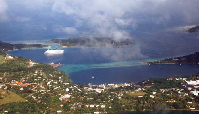
The new NISCOL wharf can accommodate both cruise ships and cargo vessels and would boost the island nation’s economy.
Management and handling are the responsibility of the Northern Islands Stevedoring Company. The port does not have any cranes or gantries. Hence the ships must use their cranes. A Chinese company provides cranes for rental at the Bay of Velit. The port has only two forklifts.
About 1000 TEUs can be handled at the container freight station with 18 reefer connections. The port does not have any grain or bulk-handling equipment.
The main storage area is close to the wharf and spans about 1000 square metres. It includes customs and a small warehouse which can store about 500 bags stacked on top of each other.
You might also like to read-
- 2 Major Ports of Togo
- The Port of Rotterdam – The Biggest Port of Europe
- Important Ports of India: Mundra Port, Gujarat
- 6 Major Ports in the Bahamas
- What Are Different Types of Ports For Ships?
Disclaimer :
The information contained in this website is for general information purposes only. While we endeavour to keep the information up to date and correct, we make no representations or warranties of any kind, express or implied, about the completeness, accuracy, reliability, suitability or availability with respect to the website or the information, products, services, or related graphics contained on the website for any purpose. Any reliance you place on such information is therefore strictly at your own risk.
In no event will we be liable for any loss or damage including without limitation, indirect or consequential loss or damage, or any loss or damage whatsoever arising from loss of data or profits arising out of, or in connection with, the use of this website.
Do you have info to share with us ? Suggest a correction
Disclaimer :
The information contained in this website is for general information purposes only. While we endeavour to keep the information up to date and correct, we make no representations or warranties of any kind, express or implied, about the completeness, accuracy, reliability, suitability or availability with respect to the website or the information, products, services, or related graphics contained on the website for any purpose. Any reliance you place on such information is therefore strictly at your own risk.
In no event will we be liable for any loss or damage including without limitation, indirect or consequential loss or damage, or any loss or damage whatsoever arising from loss of data or profits arising out of, or in connection with, the use of this website.

About Author
Zahra is an alumna of Miranda House, University of Delhi. She is an avid writer, possessing immaculate research and editing skills. Author of several academic papers, she has also worked as a freelance writer, producing many technical, creative and marketing pieces. A true aesthete at heart, she loves books a little more than anything else.
Latest Maritime Knowledge Articles You Would Like:
Subscribe To Our Newsletters
By subscribing, you agree to our Privacy Policy and may receive occasional deal communications; you can unsubscribe anytime.


