

What is ODAS or Ocean Data Acquisition Systems?

Meteorological stations worldwide require access to sea conditions and marine environments to provide weather forecasts and warnings. This data is provided to the meteorological stations through a network of ODAS (Ocean Data Acquisition Systems), ship weather observations, coastal radars, and satellites.
Ship weather observation reports are typically available only along major shipping routes and not worldwide. However, due to increasing workloads and busy schedules, it has become increasingly difficult for ship staff to participate in these reporting activities and maintain the meteorological observation schedules.
The quality of the data transmitted also varies from ship to ship. Ships generally tend to avoid areas with rough weather and rough seas where weather observations are most needed.
Satellite imagery offers a comprehensive view of weather patterns as it can capture a wide area. However, its effectiveness depends on factors such as the satellite type and the positioning of the weather in relation to the satellite. Nevertheless, there are still challenges in obtaining data for all areas and acquiring it promptly. Therefore, while satellite imagery is beneficial, it also has limitations to consider.
Coastal radar serves as a valuable tool for detecting approaching precipitation and severe weather near land. However, its effectiveness is constrained by a limited range and, in certain locations, by topographical factors.
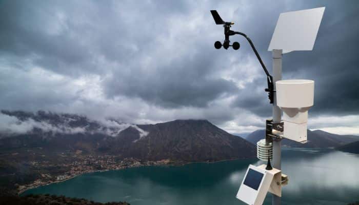
To provide accurate, fast, and real-time data to the meteorological stations, equipment called ODAS (Ocean Data Acquisition Systems) is mounted on buoys, structures, platforms, and unmanned light vessels.
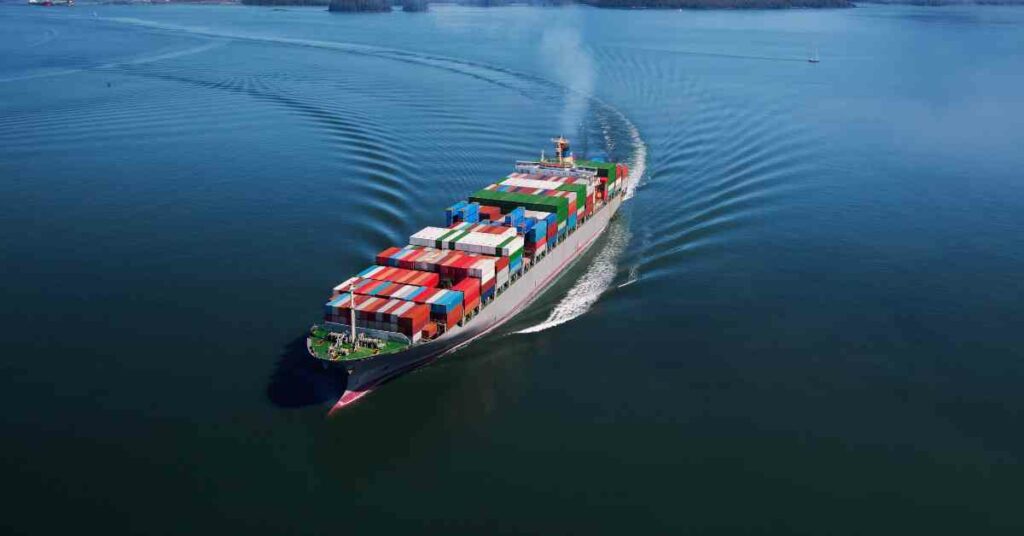
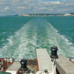
Mariners use this weather information and forecast for passage planning and weather monitoring throughout their routes. This information contributes to the safety of navigation and helps to avoid potential dangers like storms or rough seas. Mariners can choose the safest routes for their vessels based on this information.
What is an ODAS (Ocean Data Acquisition Systems) Buoy?
An ODAS (Ocean Data Acquisition Systems) buoy is an automated buoy used for collecting and transmitting meteorological, scientific, and oceanographic data in real-time. This data is transmitted to shore via geostationary or polar-orbiting satellites. Some ODAS (Ocean Data Acquisition Systems) transmit the data through HF or line-of-sight UHF links to shore.
To provide position coordinates or locate these buoys, they are equipped with GPS (Global Positioning System). ODAS buoys can be deployed either through mooring or as free-floating devices. In the case of mooring, the buoy is anchored to the seafloor using conventional mooring techniques. They are found to be more effective and reliable sources for providing live data to meteorological stations.
The ODAS buoy is not an aid to navigation but is defined as a type of special buoy in the IALA Maritime Buoyage System. The IALA Maritime Buoyage System is a nautical publication 735 published by the UKHO.
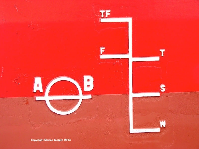
The IALA Maritime Buoyage System is divided into two regions: Region A, and Region B. Region A includes countries such as India, Australia, Gulf countries, and European Union countries. Region B includes countries like North and South America, Japan, Korea, and the Philippines. The marking for special buoys is the same in both regions.
Special buoys are used to indicate a particular area or feature, the nature of which is apparent from reference to a chart, admiralty sailing directions, or notices to mariners.
The colour yellow is assigned for special buoys. The shape of the buoy is optional as long as it does not conflict with the shapes used for lateral or safe water buoys.
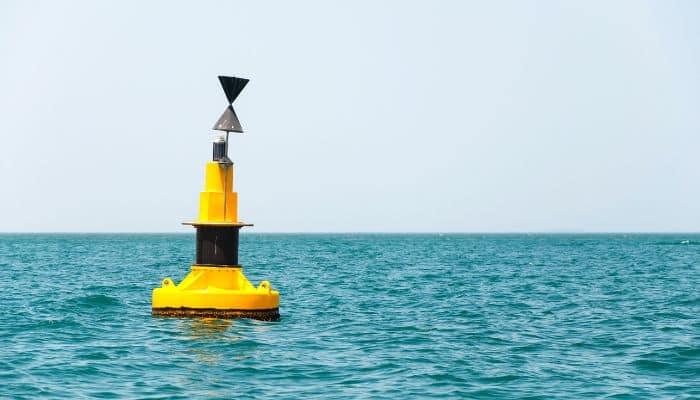
For example, an outfall buoy situated on the port side of a channel can have a can-shaped form, but it should not be conical. The top mark of this buoy is a single yellow cross in the shape of an “X,” but it is also optional. The special buoys are lettered to indicate their purpose.
When fitted, the light used for special buoys must be yellow and may have any rhythmic pattern not used for white lights. In the case of an ODAS buoy, the rhythmic pattern of the light is five flashes in a group every 20 seconds.
To distinguish the unlit buoy at night, retroreflectors are used to reflect the light from the buoy’s back. There are two codes used for the retroreflectors’ marking: the standard code and the comprehensive code.
In a specified area, only one code can be used, and the code in use can be found in the Admiralty Sailing Directions. The marking of the special buoy retroreflector is the same in both codes: one yellow band, an “X,” or a symbol is used.
What is the data transmitted by the ODAS buoy?
The data transmitted by ODAS (Ocean Data Acquisition Systems) is of great importance for meteorological, oceanographic, and scientific research purposes. This data is also crucial for coastal areas, particularly due to the large number of people residing near the coast. It helps in monitoring severe weather situations that pose a threat to life and property along the coast. The ODAS (Ocean Data Acquisition Systems) transmits the following information:
- Wind speed and direction
- Wind gusts
- Wave height, direction, and period
- Air Humidity
- Air temperature
- SST (Sea Surface Temperature)
- Precipitation
- Visibility
- Solar radiation
- Oceanic currents
- Atmospheric pressure
- Sea State
- Position coordinates with transmitted data
Now, as we are near the end, I believe you have grasped the fundamentals of Ocean Data Acquisition Systems. To summarise, ODAS (Ocean Data Acquisition Systems) plays a vital role in transmitting real-time, fast, and accurate meteorological and oceanographic data to maritime stations and for scientific research purposes. Meteorological stations utilise this data to provide weather forecasts and warnings crucial for navigators, the fishing industry, recreational boating, and drilling activities.
You might also like to read-
- 10 Things A Marine Engineer Should Check In A Lab Analysis Report Of Fuel Oil
- Blackwater Treatment Onboard Cruise Ships Explained
- The Strait Of Dover – The Busiest Shipping Route In The World
- What Are Margin Plates In Ships?
Do you have info to share with us ? Suggest a correction

About Author
Bhupinder Marriya is an experienced seafarer currently serving as a Third Mate on chemical tankers. Holding a Second Mate Foreign Going COC (Indian), Bhupinder possesses extensive knowledge of tank cleaning operations, navigation, and cargo work, along with expertise in life-saving appliances and fire-fighting equipment (LSA & FFE). Combining his practical experience at sea with a passion for maritime education, Bhupinder actively contributes as a freelance writer, sharing valuable insights and educating readers about the maritime industry.
Latest Marine Navigation Articles You Would Like:


Subscribe To Our Newsletters
By subscribing, you agree to our Privacy Policy and may receive occasional deal communications; you can unsubscribe anytime.