

10 Baffin Bay Facts You Should Not Miss Out
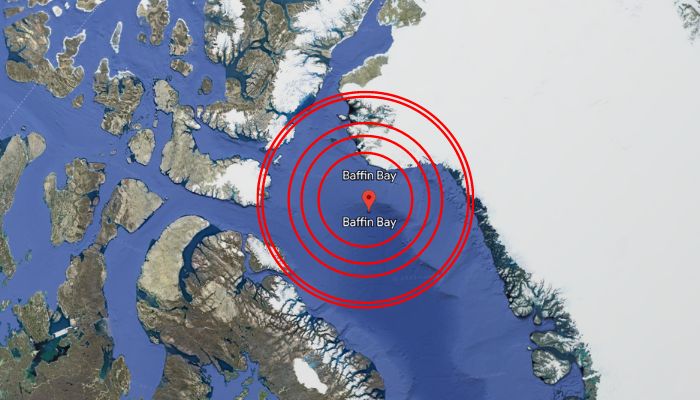
Lying between the western coast of Greenland and Baffin Island, Baffin Bay is seen as a marginal water body of the North Atlantic Ocean. However, The International Hydrographic Organisation defines it as a marginal sea of the Arctic Ocean.
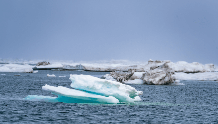
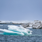
Baffin Bay is connected to the Atlantic Ocean through the Labrador Sea and the Davis Strait. The narrow Nares Strait links the bay with the Arctic Ocean. Ships cannot pass through the bay’s waters in winter due to the thick ice cover and the presence of massive icebergs.
Let us explore 10 fascinating Baffin Bay Facts in this article, starting with its geological age and formation.
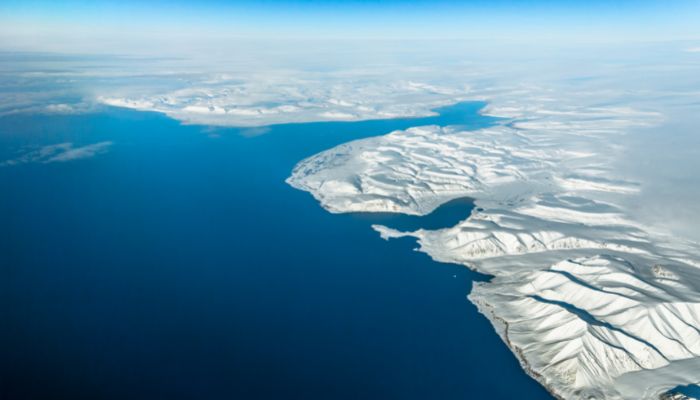
1. Baffin Bay was formed in the Pleistocene Epoch
Per geologists, Baffin Bay was formed in the Pleistocene epoch that continued from 2.6 million years ago to 11,700 years ago. In this time period, the planet underwent many glacial cycles in which the ice cover expanded and contracted in the Northern Hemisphere.
As this process occurred at a massive scale, the heavy ice sheets led to the shrinkage of the earth’s crust. This created depressions in many places, which led to the formation of lakes, seas, bays etc.
Baffin Bay was formed as one of the depressions and is said to have taken shape around one million years ago, primarily due to the glacial activity in the region.
Over the course of thousands of years, it was shaped and influenced by the movement of the ice and other factors like wind and water.
2. Area surrounding the bay has been inhabited since 500 BC.
Archaeological evidence indicates that various Inuit people have lived around Baffin Bay for thousands of years. The Inuit people have similar cultures and are indigenous groups that live in the arctic and subarctic regions of Labrador, Nunavut, Greenland, Alaska and the Northwest Territories.
The Thule, ancestors of the modern-day Inuit, lived in the region in 1000 AD. They were hunters and skilled fishermen and relied on the scarce resources of the land to sustain the communities. Later, Vikings also came, and some settled near the bay, followed by Europeans.
3. North Water opens in summer and has the highest marine biodiversity within the Baffin Bay
Although the Baffin Bay is known for its floating icebergs and thick ice cover, there is an area spanning 80,000 square kilometres or 31,000 square miles that opens up in the summer. It lies north of the Bay, called North Water, close to Smith Sound.
Created by the warm Greenland Current, it has the highest concentration of marine life within the Bay.
Zooplankton and ice algae are found here, along with 20,000 beluga whales. Approximately 15,000 of these live and thrive in the North Water.
Baffin Bay is also home to polar bears, walruses, seals, rorquals, bowhead whales and narwhal. Seals and walruses live in areas with fast ice for giving birth and raising young ones. Bearded seals are found in the shallow waters of the Bay.
About 400 species of plants and trees are found along the Bay’s coast. Trees such as birch, alder and willow are common, including plants that have adapted to salty soil, like lichens, Lyme grasses and moss. These plants are food for the Caribou and rodents like a lemming.
Native fish include the polar cod, four-horned sculpin, Arctic flounder and capelin. Other species like the haddock, herring, rattail, halibut and cod migrate to Baffin Bay from the Atlantic Ocean.
Many birds, like little auk, rock ptarmigan, arctic redpoll, guillemots, snowy owl etc., are found. However, most birds migrate to the south in winter.
4. Has significant oil and gas reserves
The U.S. Geological Survey found that there were undiscovered oil deposits and gas pockets in the Arctic. Baffin Bay could have sufficient reserves of these viable resources as well.
However, oil and gas exploration in Baffin Bay has not been done properly due to the harsh environment and difficulty in navigation posed by icebergs.
The proposition is also controversial as there are concerns over harming the pristine environment, the native communities and the region’s wildlife.
In 2014, the government of Canada put a moratorium on drilling for oil and natural gas in Baffin Bay till research can assess the impact and risk associated with these activities.
In 2016, the government of the United States also issued a similar order for the Baffin Bay waters and the US Arctic.
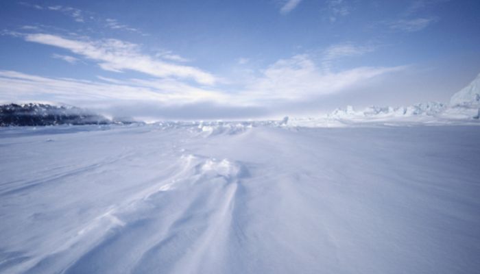
5. Baffin Bay has a frigid climate
The Baffin Bay experiences a cold and harsh climate, with temperatures below the freezing point for most months of the year.
In winter, the climate is quite severe as northwestern winds blow off Baffin Island and on the northern side of the Bay. Storms are also quite common during this time.
The temperature can drop to as low as -40°C, and the bay can be seen covered with ice. In January, the average temperature in the south is -20° C and around -28° C in the north.
Summer is short, with temperatures averaging to about 5°C. During this time, northwesterly and southwesterly winds blow. In July, the average shore temperature is 7 degrees Celsius, and there can be some snow too.
Thus, Baffin Bay’s climate is influenced by the Arctic Ocean, and the area around it experiences prolonged periods of darkness in winter and long periods of daylight in summer.
6. The First European who reached Baffin Bay was John Davis in 1585
The first European to reach the bay was John Davis, who arrived here in 1585. Next, about three decades later, some merchants formed a company, and their governor Thomas Smythe organised five expeditions to explore Canada’s north coasts to find a maritime route to the Far East. They also explored the nearby areas. The Bay was named after William Baffin, who mapped the area during one of the expeditions.
He was on his ship called Discovery and charted the region. In his voyage, he named the discoveries he made after the company’s members. E.g., Lancaster Sound, Jone Sound and Smith Sound.
After his voyage came to an end, he could not find an ice-free passage, and the remaining area remained undiscovered for 200 years. Over time, his account was also not considered authentic and doubted until it could be confirmed by Sir John Ross’s voyage in 1818.
Organised scientific research in the region was conducted in 1928. After Second World War, studies were done by a Danish team and by American and Canadian researchers. Till now, research vessels have visited the area to investigate and record the change in ice distribution over the years.
7. Epicenter of the largest earthquake that occurred north of the Arctic Circle
A devastating earthquake occurred north of the Arctic circle in 1933, with its epicentre at Baffin Bay, on Baffin Island’s eastern coast. The 7.3 magnitude tremor was felt as far as Alaska and Labrador. It had struck Greenland, Nunavut and Canada on 20th November.
Luckily, it did not cause massive damage or loss of lives due to the sparse population and the scattered settlements in the region. However, it produced a small tsunami which went as far as Hawaii.
It became the biggest-ever recorded earthquake to hit the north of the Arctic Circle.
The Bay’s northwestern part is still a seismically active region and one of the earthquake-prone regions in eastern Canada. Around 5 earthquakes have happened there since 1933.
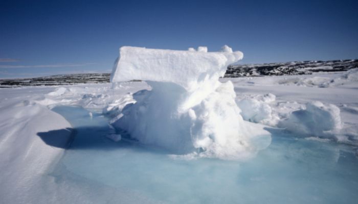
8. Baffin Bay Trough has the deepest point at 2700 m, approximately
The Baffin Bay spans 689,000 square kilometres, is 1450 km long and is 110 to 650 km wide. Its average depth is about 861 m.
It is around 3300 ft deep, close to the coast. As one comes near the shores, the sea floor is layered with crushed stones, gravel and sand. The bay’s central part is home to the Baffin Basin, a deep pit layered with silt.
The Bay’s deepest point lies around 2700 m deep in a trench called the Baffin Bay Trough that stretches along its eastern side. It is quite long and narrow, running for over 1000 km, from the Davis Strait to the Arctic Ocean, i.e. from the south to the north.
The region around the Trough is known for its marine biodiversity, beautiful underwater cliffs and canyons, sponges, cold-water coral species, and deep-sea fish. The Trough is about 2000 m deep in some areas, which makes it one of the deepest parts of the Arctic Ocean.
9. The salinity of its water varies with the seasons
The saltiness of the Baffin Bay waters changes with the season. For instance, salinity levels are higher in winter months, about 34%, than in summer, which is about 30 to 32%.
In winter, 80% of the Bay is covered with ice, be it fast ice or floating icebergs. In warm months from August to September, floating ice is still found in the centre and the west of the bay.
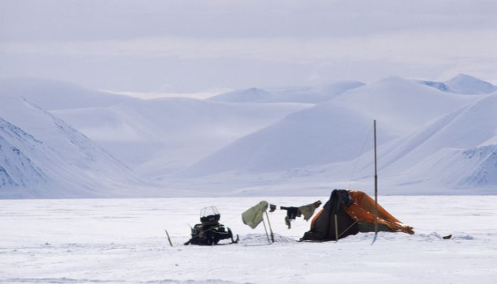
There are some settlements along the Canadian coast of Baffin Bay, such as the Clyde River Settlement, with about 1000 people, lying in a remote area of the Arctic. It is accessible by air and sea, and its residents depend on hunting, fishing and trapping.
Pond Inlet is a small Inuit settlement on Baffin Island’s northern shore. It is one of the bigger communities, having 1500 people.
Another tiny community is Arctic Bay, with a population of merely 800 people, making it one of the smallest communities in the region.
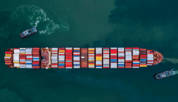
10. Several ports line the Baffin Bay coastline
There are many ports along the Canadian coast of Baffin Bay. These facilities are used for transporting basic goods and services to the Inuit communities that inhabit one of the harshest places on earth yet live their life to the fullest.
Pond Inlet has a deepwater port that handles general cargo. Another one is the Clyde Riverport, a small facility used by the community. Iqaluit port, Cape Dorset and Qikiqtarjuaq are other important ports in the region.
These facilities are crucial as they handle essential commodities like diesel and gasoline. They also deal with fresh produce, canned and dry food, construction materials like lumber and concrete, medical supplies, and consumer products, mainly household items and electronics.
You might also like to read-
- 10 Things About Chukchi Sea You Might Not Know
- 10 White Sea Facts You Might Not Know
- 10 Things About Banda Sea You Must Know
- 10 Southern Ocean Facts You Might Not Know
- 12 Interesting Facts About The Pacific Ocean
Disclaimer: The authors’ views expressed in this article do not necessarily reflect the views of Marine Insight. Data and charts, if used in the article, have been sourced from available information and have not been authenticated by any statutory authority. The author and Marine Insight do not claim it to be accurate nor accept any responsibility for the same. The views constitute only the opinions and do not constitute any guidelines or recommendations on any course of action to be followed by the reader.
Do you have info to share with us ? Suggest a correction
Latest Maritime Knowledge Articles You Would Like:


Subscribe To Our Newsletters
By subscribing, you agree to our Privacy Policy and may receive occasional deal communications; you can unsubscribe anytime.
Web Stories


About Author
Zahra is an alumna of Miranda House, University of Delhi. She is an avid writer, possessing immaculate research and editing skills. Author of several academic papers, she has also worked as a freelance writer, producing many technical, creative and marketing pieces. A true aesthete at heart, she loves books a little more than anything else.