Turkey’s Uzmar Shipyard Launches World’s First LNG Dual Fuel Propulsion Tractor Tug, Sultanhani
Uzmar Shipyard, based in Istanbul, Turkey, has launched a unique tractor tug for BOTAS, a Turkish operator.
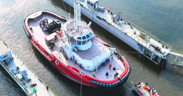
Uzmar Shipyard, based in Istanbul, Turkey, has launched a unique tractor tug for BOTAS, a Turkish operator.

China rebuffed the Biden administration’s proposal to launch an official review of its logistics, maritime, and shipbuilding sector.
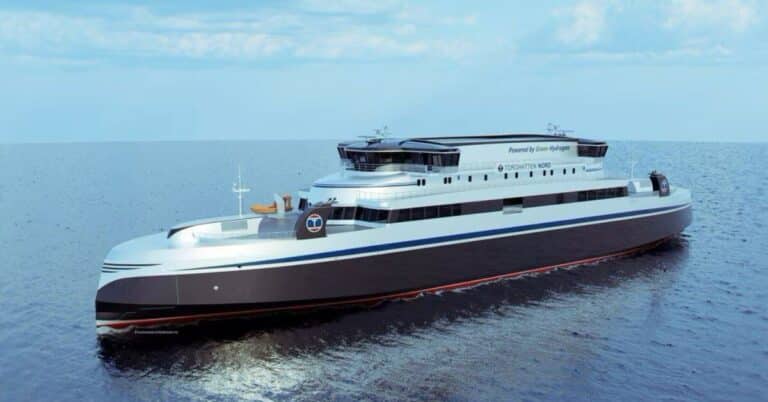
Myklebust Verft, a Norwegian shipyard, has been chosen to begin construction of cutting-edge hydrogen-powered passenger ferries.

Canadian Minister of Transport, has announced a significant increase in monetary penalties for violations following the Canada Shipping Act 2001.
The Cyprus Shipping Chamber (CSC) announced the adoption of 1,000 ships through its renowned ‘Adopt a Ship’ educational initiative.
One of the 17 Indian crew members onboard the MSC Aries that was seized by the Iranian Revolutionary Guard Corps has returned home.

NYK and partners have collaborated and conducted a successful trial of a remote-controlled scraping robot designed for wood chips.
The MV Behshad, a suspected Iranian spy ship, has returned to its home port in Bandar Abbas after three years at sea.
U.S. Department of Transportation has declared the availability of $316 million to support and modernize passenger ferry services nationwide.
"*" indicates required fields