

11 Facts About The Bay Of Fundy
The Bay of Fundy is a funnel-shaped inlet of the Atlantic Ocean. It is sandwiched between the Canadian provinces of Nova Scotia and New Brunswick. A small portion of its vast coastline touches the State of Maine, a US state bordering Quebec.
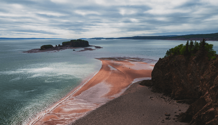
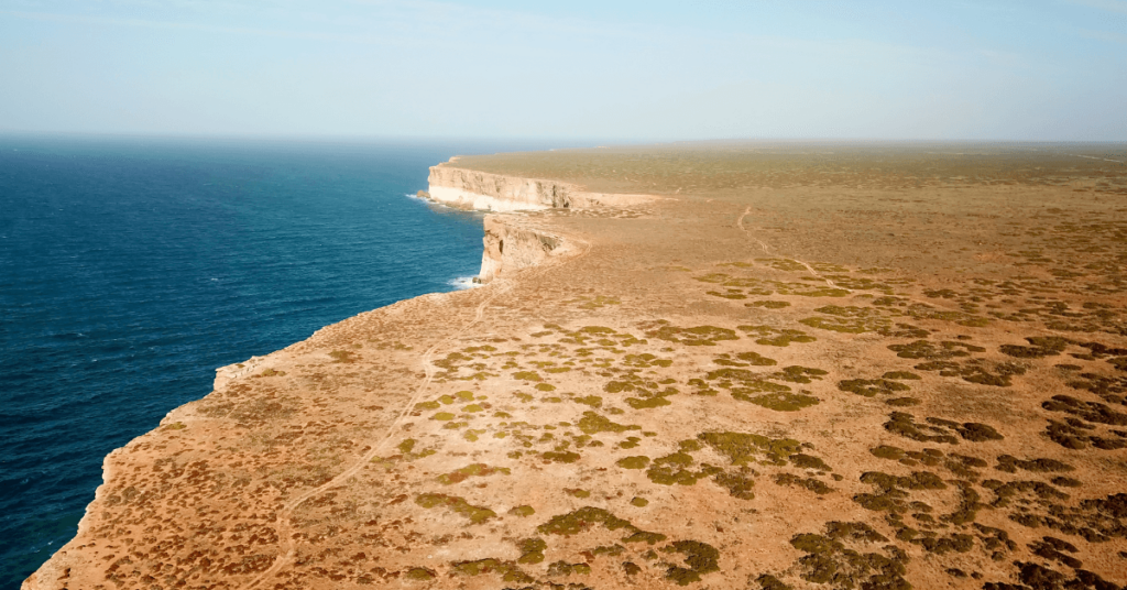
It lies in the Fundy Basin and covers about 9300 square kilometres. The coastline is indented with several coves, natural caves, forests, rocky formations, sandy beaches and deepsea harbours. The bay’s entrance channel is 52 kilometres wide, and its shores extend 150 kilometres inland.
It is surrounded by cliffs rising to a height of 60 metres. These geological features direct the waters into the two narrow channels, the Chignecto Bay to the north and the southern Minas Bay.
There are many theories regarding its name. Some argue Fundy to be a corruption of the word fendu, meaning a crack or split between French. Others believe it was named after funda, the Portuguese word meaning deep.
The Bay of Fundy has huge potential for producing hydroelectricity and supporting agriculture in the region. Outlined below are some interesting Bay of Fundy facts.
1. Famous for the highest tidal range in the world
The Sun’s and Moon’s gravitational forces, plus the earth’s rotation, lead to the rise and fall of sea waters called tides.
During some months, Fundy Bay experiences the highest tides in the world. This phenomenon is a consequence of numerous factors like its unique shape, resonance, the structure of the sea floor, river drainage etc. High-low tides in the delta-shaped bay are around 16.5 metres or 53 feet, higher than a four-storey construction.
The Bay’s waters experience intense rocking, also known as seiche motion. It takes 12 hours and 27 minutes for the waters to reach the bay’s end and return to its mouth. Around 100 billion tonnes of water is exchanged in the bay during a single tidal period.
Spring tides are the highest tides of the Bay and occur twice a month. In 206 days, when the moon is closest to the earth, the spring tides can reach a height of 16 metres or 53 feet. The Hopewell Cape offers a beautiful panorama of the Bay and is a popular sightseeing point. Interestingly, even the second tallest tides in the world are produced in the Canadian Bay of Ungava, located in Quebec.
2. Site of the biggest whirlpool in the Western Hemisphere
The Old Sow Whirlpool is the second-largest tidal whirlpool on earth, produced by Bathymetry and the bay’s tides.
The exchange of water between Fundy Bay and Passamaquoddy Bay, combined with the confluence of different currents flowing over underwater mounts, produces this effect. The whirlpool is 70 to 75 metres wide and generates powerful waves. It is not dangerous for motorised ships; however, small sailboats, fishing vessels and passenger boats are advised to stay away.
3. Crucial for generating hydroelectricity
High tides create the perfect conditions for tapping the tidal power resources of the Bay. The Fundy Ocean Research Centre for Energy is located in the Minas Channel. It contains berths for capturing the tidal energy of the eastward-flowing waters of the bay.
The world’s first 1-megawatt in-steam turbine was fixed to the Minas Seabed in 2009. However, the strong waves lashed against it, tearing apart its rotating blades. The current machine is sturdy and designed to hold up against tidal currents speeding at 18 kilometres per hour.
The bay’s waters have been used for generating electricity since 1984 with the opening of the Annapolis Royal Station, positioned near the Annapolis River close to Fundy Bay. During that time, it was the only tidal power station in North America, lighting over 5000 homes.
4. Formed over 200 million years ago in the Early Jurassic Period
Millions of years ago, the Pangaea land mass broke, giving birth to smaller islands and continents. During the Jurassic period, the present-day Maritime provinces of eastern Canada were close to the equator and experienced a warm and humid climate. As the erstwhile landmasses drifted, rift valleys, including the Fundy Bay Basin, came up.
The Cobequid–Chedabucto fault emerged, and the magma solidified into igneous rocks, visible on Brier islands and other regions surrounding Fundy Bay. This is precisely why precious minerals and gems like agate, stilbite and amethyst are abundant in Nova Scotia and coastal areas.
5. Reserve of ancient Carboniferous fossils
Tides of the Fundy Bay have revealed well-preserved fossils dating back to the Coal Age. Located in the Cumberland County of Nova Scotia, the famous Joggins fossil cliffs entered the World Heritage Site list in 2008.
The 15-kilometre-long coastline along the cliffs contains mammalian fossils dating to the Jurassic period. It is a site of archaeological and paleo-ontological importance, with numerous levels going back 360 to 300 million years ago.
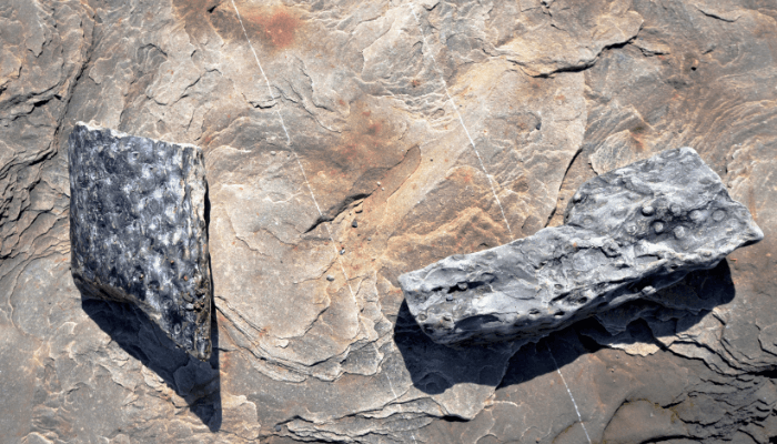
Canada’s earliest dinosaur fossil was discovered at Burntcoat Head. Fossils of reptiles and forest plants were found in the tree trunks. Many fossils of different dinosaurs were recovered from Wasson Buff, indicating the region was covered with thick forests sheltering the mightiest beasts in the Mesozoic Era.
UNESCO attempts to preserve the earth’s geological and historical heritage. Hence, the Bay of Fundy is a part of the organisation’s Global Geoparks Network.
6. Discovered by a Portuguese explorer in 1520
The Fundy Bay coast was once the home of the indigenous Mi’kmaq tribe, which relied on its waters for fishing. They lived in mud-hut villages for thousands of years before the arrival of Europeans. According to their traditions, one of their ancient gods, Glooscap, created high tides in the bay.
Portuguese navigator Joao Alvares Fagundes was the first European who arrived at the Fundy Bay coast in 1520. However, the region appeared on Portuguese maps much later, in 1559. After defeating the Portuguese, the French established the first colonial settlement on St Croix Island and Port Royal. A conquistador named Samuel de Champlain was the colony’s governor from 1605 and called it the French Bay.
Over 50 years, many crucial trading posts and military towns came up near the bay, such as Beaubassin. Colonial powers were involved in wars and skirmishes to control the strategic bay. After prolonged military attacks between the French and the British, the latter won and drove the indigenous Acadian tribe from their homes. It was a site of contention during the War of 1812 and even the American Revolution.
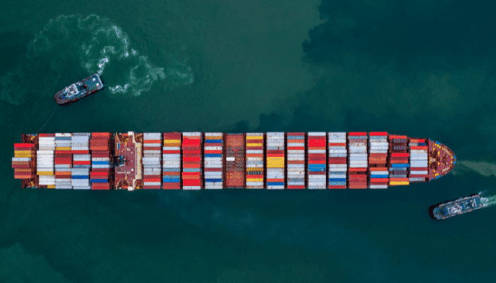
7. Promoted Shipbuilding activities
Shipping activities developed in the 19th century by constructing numerous deep-water ports along the Fundy Bay coast. Many shipbuilding enterprises were formed as ship construction became a lucrative business. Engineers like James Moran, William Lawrence and others became wealthy entrepreneurs. The deepsea harbours became world-famous after manufacturing the Marco Polo, the biggest wooden ship constructed in Canada.
The shipyards and ports suffered destruction from the 71 feet-high tides produced by the Saxby Gale, a tropical cyclone that struck its shores in 1869. High waves lashed the coast and broke through the dykes sheltering farmlands of the Minas region.
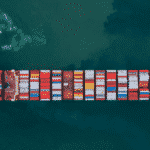
8. Lined with more than 40 ports and harbours
The Bay of Fundy coastline has several ports, the largest being the Port of St John and the Hantsport.
Situated on the eastern part of the Avalon peninsula, St John port is linked to the major shipping waterways of the North Atlantic. It is the easternmost port in Canada and remains ice-free throughout the year. A natural harbour, it acts as a distribution hub of cargo meant for the interior regions and serves the regional offshore oil industry. It contains numerous fishing berths capable of accommodating 150 vessels. The Trans-Canada highway network links the port with other states.
It has numerous terminals for handling seafood, canned fish, iron ores, wood, pulp, resin, paper, machinery and general cargo. St John harbour is visited by 1000 vessels and deals with 1,420,000 tonnes of cargo, 119,000 TEUs and 15,000 passengers annually.
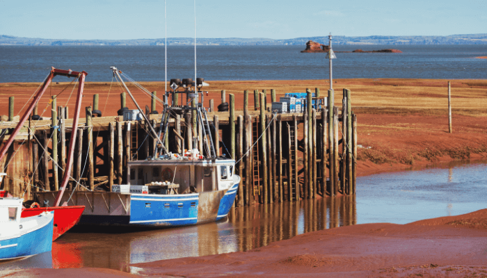
Hantsport lies on the western banks of Avon river near the mouth of Fundy Bay. It has two wharves for handling wood pulp and gypsum. It remains closed from January till March due to thick ice, making navigation difficult. It is a tidal port that receives over 100 ships carrying 1,500,000 tonnes of gypsum.
Located on the eastern coast of Fundy Bay in Nova Scotia, Digby harbour is divided into two operational areas. It has a ferry terminal and a fishing harbour. The former lies four kilometres north of the fishing wharves and operates a ferry service to St John in New Brunswick. The latter contains a T-shaped pier that receives small fishing vessels and a few cargo carriers.
Windsor is another Bay of Fundy port handling different kinds of cargo, including salt, construction material, timber, grains, iron and steel products, project cargo etc. It can accommodate the largest cargo ships on its eight multipurpose berths. Mortem Limited offers ship repair and bunkering services. Around 2,300 vessels, 5,150,500 tonnes of cargo and over 4000 passengers are handled at the port annually.
9. An intertidal region with a diverse ecosystem
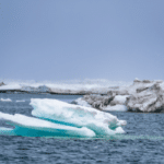
Local authorities and the New Brunswick Conservation council protect whales in the Bay of Fundy waters. To prevent collisions, ships cannot pass through the whale breeding areas near the bay’s entrance. Fundy Bay is home to twelve whale species such as fin whales, humpbacks, minke, blue and the majestic Atlantic white-sided dolphins. It also harbours porpoises, fish, seals and migratory birds.
Bay of Fundy tides forms coastal wetlands called mudflats or slobs near the Maringouin peninsula. Major ones are found in the southern part of Minas Bay. Turbulent waters deposit sediments and sand on the coast, ideal for the growth of green seaweeds, phytoplankton, moss, sea lettuce and green-blue algae.
Mudflats lying in upper areas span five kilometres and support the mud shrimp. Over two million sandpipers, comprising about 80 per cent of the world’s population, arrive at the Bay’s mudflats to devour the mud shrimp before continuing their 5000-kilometre-long journey to South America.
10. It Has many protected areas, national parks and wildlife reserves
Fundy National Park, Cape Chignecto Provincial Reserve and the Tintamarre wildlife region are some of the largest wildlife protection areas situated along the Bay of Fundy coast.
Fundy National Park is close to the Albert County of New Brunswick. It has five camping grounds and 25 hiking trails which pass through the pristine Acadian forests. The waters are perfect for kayaking, boating and fishing.
The port was opened in 1950 and refurbished several times. It has a golf course, swimming pool, beaches, seaside cabanas, and biking tracts. The park is less crowded during winter, and visitors can enjoy snowboarding and skiing.
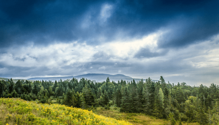
More than 600 plants, including bryophytes and lichens, are found in the forests. Common trees include red spruce, balsam fir, birch, red maple and wood fern.
Endangered fish species like salmon, martens, trout and eel are found in the Fundy Bay waters. The park also contains the famous flying squirrels, beavers, chipmunks, deer, racoons and over 100 bird species.
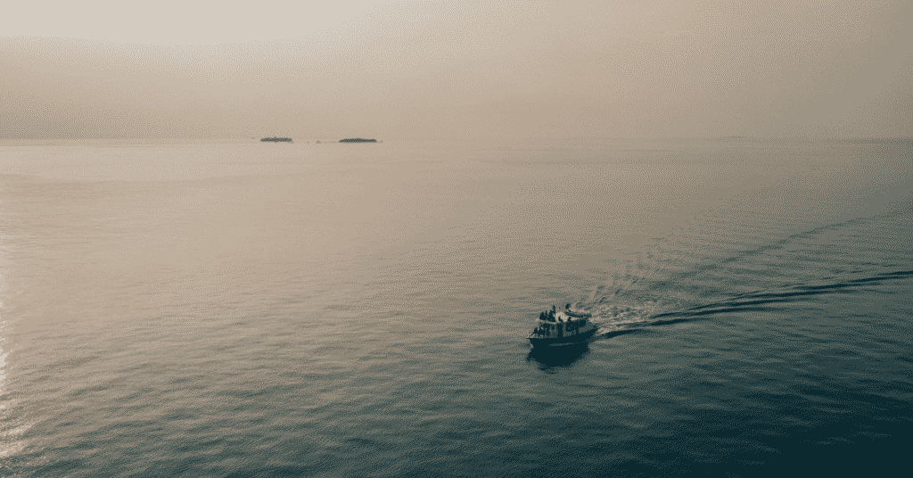
11. A popular tourist destination in the Atlantic
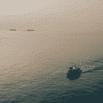
Fundy Bay has numerous places offering unforgettable experiences. Regular ferries ply from the coast to the nearby islands. The Grand Manan island is the largest, covering 35 kilometres of land. It is known for its quiet beaches, small fishing community and traditional way of life.
Hundreds of people visit the Bay in August for whale watching. Abundant krill and small fish attract whales to the mouth of Fundy Bay. These gigantic creatures can be seen from St Andrews Bay or Brier bay in Nova Scotia.
An 1838 iron-cast lighthouse stands atop the rocky coastline. One can also enjoy zip-lining, bungee-jumping and even rock climbing.
The small town of St. Martins leads to the Fundy trail overlooking the coast, mudflats and lofty hills. It is a perfect picnic spot for families. Many fun-filled activities can be enjoyed here, such as diving and exploring natural caves.
The best place to watch the high tides is the Reversing Falls Bridge. It has a transparent floor and an observation platform that offers a great view of the whirlpools formed in the Bay.
St. Andrews is famous for the Kingsbrae Garden, which displays native flowering plants. The Science Centre is a must-visit for children and adults alike. It has real-looking sculptures of marine animals, aquariums, and interactive technology.
Frequently Asked Questions
1. Where is the Bay of Fundy?
The Bay of Fundy is a funnel-shaped inlet of the Atlantic Ocean. It is sandwiched between the Canadian provinces of Nova Scotia and New Brunswick. A small portion of its vast coastline touches the State of Maine, a US state bordering Quebec.
2. What is the Bay of Fundy famous for?
Fundy Bay is famous for the highest tides in the world. This phenomenon is a consequence of numerous factors like its unique shape, resonance, the structure of the sea floor, river drainage etc. High-low tides in the delta-shaped bay are around 16.5 metres or 53 feet, higher than a four-storey construction.
3. Who was the first European to discover Fundy Bay?
Portuguese navigator Joao Alvares Fagundes was the first European who arrived at the Fundy Bay coast in 1520. However, the region appeared on Portuguese maps much later, in 1559. After defeating the Portuguese, the French established the first colonial settlement on St Croix Island and Port Royal.
4. Are whales found in the waters of the Bay?
Fundy Bay is home to twelve whale species such as fin whales, humpbacks, minke, blue and the majestic Atlantic white-sided dolphins. It also harbours porpoises, fish, seals and migratory birds.
5. How many ports and harbours are situated on Fundy Bay?
Fundy Bay has more than 40 ports and harbours, the largest being the Port of St John and the Hantsport. Windsor is another Bay of Fundy port handling different kinds of cargo, including salt, construction material, timber, grains, iron and steel products, project cargo etc.
You might also like to read:
- 10 Important Facts About The Cape Of Good Hope
- 8 Amazing Facts About The Black Sea
- 13 Important Bay Of Bengal Facts
- 10 Important Panama Canals Facts Everyone Should Know
- 9 Facts About Gulf of Panama
Disclaimer: The authors’ views expressed in this article do not necessarily reflect the views of Marine Insight. Data and charts, if used, in the article have been sourced from available information and have not been authenticated by any statutory authority. The author and Marine Insight do not claim it to be accurate nor accept any responsibility for the same. The views constitute only the opinions and do not constitute any guidelines or recommendations on any course of action to be followed by the reader.
The article or images cannot be reproduced, copied, shared, or used in any form without the permission of the author and Marine Insight.
Do you have info to share with us ? Suggest a correction
Latest Maritime Knowledge Articles You Would Like:


Subscribe To Our Newsletters
By subscribing, you agree to our Privacy Policy and may receive occasional deal communications; you can unsubscribe anytime.
Web Stories


About Author
Zahra is an alumna of Miranda House, University of Delhi. She is an avid writer, possessing immaculate research and editing skills. Author of several academic papers, she has also worked as a freelance writer, producing many technical, creative and marketing pieces. A true aesthete at heart, she loves books a little more than anything else.