What Actions Ship Must Take For Tropical Revolving Storm (TRS)?
All seafarers are well familiar with the term ‘TRS’ or Tropical Revolving Storm – an intense rotating depression (a region of low pressure at the surface) which develops over the tropical oceans. It consists of a rotating mass of warm and humid air and creates thunderstorms with strong winds, flooding rain, high waves, damaging storm surge etc. Convectional forces are involved, normally stretching from the surface of such a depression up to the tropopause.
Some of the important characteristics of a Tropical Revolving Storm (TRS) that are:
- They appear smaller size than temperate depressions
- They form near the Inter Tropical Convergence Zone, a zone of instability
- They have nearly circular isobars
- No fronts occur (a front is the boundary between two air masses, often distorted by warmer air bulging into the colder air)
- They result in a very steep pressure gradient
- They have great intensity
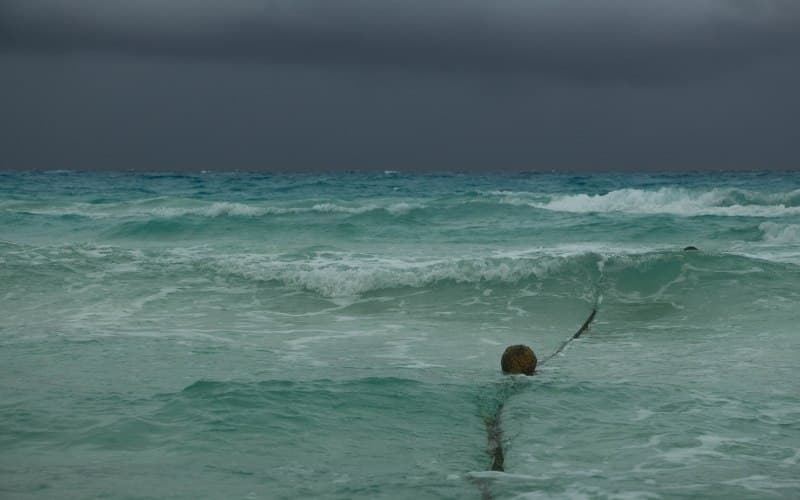
Know more about the photograph here.
However, as far as this article of information is concerned, let us look at the precursory signs of a TRS, so that a better appraisal of the actions to be taken can be formulated.
1. Warning and alerting messages
The Radio/Telex/NAVTEX and all other means at hand should be set on the right frequencies and monitored closely, for they broadcast comprehensive warnings with respect to known storms. Refer to the respective ALRS Volumes for more data and frequencies of radio stations in the vicinity. The Telex, although barely used, is also a very important tool that is high on accuracy.
All storms may not be detected by the coast meteorological stations, in which all shipboard equipment and observation is key in averting disaster.
2. Swell
When there is no sight of intervening land, the sea might generate swell within a TRS, indicating an early warning of the formation of the same. Normally, the swell approaches from the direction of the storm.
3. Atmospheric pressure
Monitor the barometer closely in case you are suspicious of a brewing storm. If the corrected barometer reading falls below 3 mb or more for the mean reading for that time of the year (check the Sailing Directions for accurate information of pressure readings), you can expect a (Tropical Revolving Storm) TRS. Note that the barometer used must be corrected for latitude, height, temperature etc. to achieve maximum possible accuracy and efficiency.
4. Wind
Wind direction and speed is generally fairly constant in the tropics.
Variation from the normal direction for the area and season, and increasing wind speed, are indications of the approach of a Tropical Revolving Storm, i.e., an appreciable change in the direction or strength of the wind indicates a Tropical Revolving Storm (TRS) in vicinity.
5. Clouds
A very candid and colorful sky at sunrise and sunset may be a sign of a brewing TRS. Presence of cirrus clouds is visible at a considerable distance of 300 to 600 miles from the TRS and as you approach the TRS, the clouds get lower and cover a bigger area (altostratus). Generally followed by cumulus clouds as you get closer to the Tropical Revolving Storm (TRS).
6. Visibility
Although it might sound like an oxymoron, exceptionally good visibility exists when a TRS is lurking in proximity!
7. Radar
The radar gives a fair warning of a Tropical Revolving Storm (TRS) about 100 miles prior to approaching the TRS. The eye may sometimes be seen on the screen. An area of rain surrounds the eye (the eye of the storm is the storm center) causing appreciable clutter on the radar screen. Remember that though the signs might be visible on the radar, by the time it does become visible on the radar, the vessel is probably already experiencing high seas and gale force winds and rough weather overall. Action is to be taken before such a situation arises.
Course of actions to be taken in case of a storm
Although it is unlikely to sail into a storm with all navigational aids and communication systems in place (shore based as well as ship based), shore personnel generally chalk out an alternate passage plan to avoid such a storm in good time (in liaison with the company and assigned route). However, in the event that the TRS is staring right in the face, it is probably entirely up to the mercy of the sea or maybe, it is not intense enough, and can be handled by the captain’s experience and knowledge. To avoid it altogether , the Officer should gather as much knowledge about the storm as practically possible. This may include the following:
- The bearing of the eye (storm center)
- The path that the storm is following
- When an observer faces the wind, the eye will be 100° to 125° on his right hand side (in the Northern hemisphere) when the storm is about 200 miles away
- It is assumed generally that the storm is not moving towards the equator and if in a latitude lower than 20 deg., it is likely to have an Eastern constituent
- A storm moving in an unusual or haphazard path is likely to move slowly
Avoiding actions may be as follows:
- Keep at least 50 miles off from the center of the storm. If possible, it is best to be at least 200 miles off to avoid any possibility of danger altogether
- Make good speed. A vessel speeding in the vicinity of 20 knots, following a course taking her away from the eye, can easily outstrip an approaching Tropical Revolving Storm (TRS). TRS move rather slow. This ought to be done before the wind increases to the point that her movement becomes restricted and speeding or any maneuver becomes cumbersome.
- As mentioned earlier, a swift fall in pressure indicates a brewing TRS. A vessel should continue on her course unless the barometer reading falls down by 5 mb or, by 3 mb in addition to high force wind.
- If the vessel is trailing the storm (behind the storm), i.e., in the navigable semicircle, there should be sufficient time and sea room to move away from the eye
Northern Hemisphere
- In case that the wind is veering, the vessel is likely to be in the dangerous semicircle. The vessel should proceed with maximum speed keeping the wind at 10° to 45°, on the starboard bow (depending on the speed). The vessel should turn to starboard as the wind veers.
- In case that the wind direction is steady or backs, such that the vessel is in the navigable semicircle, the wind must be brought well on the starboard quarter and vessel should proceed with maximum speed. Turn to port as the wind veers.
Southern Hemisphere
- In case the wind is backing, the vessel is likely to be in the dangerous semicircle. The vessel should proceed with maximum speed keeping the wind 10° to 45°, on the port bow (depending on the speed). The ship should turn to port as the wind backs.
- In case the wind direction is steady or backs, such that the vessel is in the navigable semicircle, the wind should be brought well on the port quarter and the vessel should proceed with maximum speed. Turn to starboard as the wind backs.
If the vessel in in port and a Tropical Revolving Storm (TRS) approaches, it is best to put out to sea. Staying put at the berth, especially with other vessels in proximity can be highly dangerous. With the best mooring practices put in position, it very doubtful that ship might be safe from the effects of the storm.
Do you know any other important points that should be added to this article?
Let’s know in the comments below.
You may also like to read – How Do Ships Survive Storms?
Do you have info to share with us ? Suggest a correction

About Author
Shilavadra Bhattacharjee is a shipbroker with a background in commercial operations after having sailed onboard as a Third Officer. His interests primarily lie in the energy sector, books and travelling.
Latest Marine Navigation Articles You Would Like:
Subscribe To Our Newsletters
By subscribing, you agree to our Privacy Policy and may receive occasional deal communications; you can unsubscribe anytime.







Hey….
Great work for seafarers…..
Thanks for the info…..
I’m a deck cadet and i found this knowledgeable.
D/C MAGUIZA, JASON
nice info…
this can save many lives..
It helps me a lot to clear 2nd mates exam
@Ebin: Glad it is useful.
Some of the points taken verbatim from Capt. Subramanian’s book….
Anyway good compilation.
Many thanks for information . Please could you add some photographs or video which will be further help to understand.
@Anuj: Thank you for your inputs. Will try to add more visual information.
Thanks for the info…very helpful
@Sam: Glad the info is useful ??
Mariner’s 1-2-3 Rule guidelines for avoiding Hurricanes at Sea
Mariner’s 1-2-3 rule, also known as the Danger Rule, is an guideline mariners should follow to avoid an tropical storm or hurricane’s path. In order to help account for the inherent errors in hurricane forecasting, a few guidelines should be used by the mariner in order to limit the potential of a close encounter between ship and storm. 34 Knots Rule 34 Knots is chosen as the critical value because as wind speed increases to this speed, sea state development approaches critical levels resulting in decreasing ship manoeuvrability. Also,the state of the sea outside of the radius of 34 KT winds can also be significant enough as to limit course and speed options available to the mariner and must also be considered when avoiding hurricanes. 1-2-3 Rule This is the single most important aid in accounting for hurricane forecast tract errors (FTE). Understanding and use of this rule should be mandatory for any vessel navigating near a hurricane. The rule is derived from the latest 10-year average FTE associated with hurricanes in North Atlantic. While this rule was derived in the North Atlantic, it is a good technique to use in any tropical cyclone basin.
The 1-2-3 rule establishes a minimum recommended distance to maintain from a hurricane in the Atlantic, as it was derived from Atlantic tropical cyclone date. Mariners in the Pacific can use this rule as a guide. Larger buffer zones should be established in situations with higher forecast uncertainly, limited crew experience, decreased vessel handling, or otherfactors set by the vessel master. The rule does not account for sudden and rapid intensification of hurricanes that could result in an outward expansion of the 34 KT wind field. Also,the rule does not account for the typical expansion of the wind field as a system transitions from hurricane to extratropical gale/ storm.
1-2-3 Thumb Rule
1 – 100 miles error radius for 24hrs forecast
2 – 200 miles error radius for 48hrs forecast
3 – 300 miles error radius for 72hrs forecast
How to use 1-2-3 Rule onboard
1. Plot the current and forecast 24 Hour storm position and forecast radius of 34 knots wind.
2. Using Compass extend the radius of the forecast 24 hours 34 knots wind area by 100 nm.
3. Draw tangents relative to the direction of the storm from the 34 knots radius of the current position of storm to the outermost radius at the 24 hour forecast position. The area between this is the Danger Area and is to be avoided.
4. Use the same procedure for 48 & 72 hours forecast position, however to draw the outermost circle use 200 nm and 300 nm as radius respectively.
Thank you for sharing “Goldmine” of information ??