

How To Use Parallel Indexing Techniques For Ship Navigation?
Position plotting is a vital element of passage planning and monitoring.
The safety of ship navigation depends on how accurately the position of the vessel has been ascertained.
While transiting open seas or coastal waters, narrow canals, river passages, or port and harbour approaches, the basic foundation of navigation lies in position fixing.
Various methods are available for position fixing, including visual bearings, radar fixes, terrestrial and celestial observations and GPS fixes.
Each of these methods can be used in combination or alone to verify against each other and ascertain the ship’s position with the required levels of precision and accuracy depending upon the vessel’s location.
For example, in open seas where traffic density is scarce, a celestial observation or GPS fix is an acceptable method for position fixing; however, in coastal congested water, traffic separation schemes, or narrow channels, canals, and river passages, radar, visual, or terrestrial bearings are more reliable than GPS fixes.
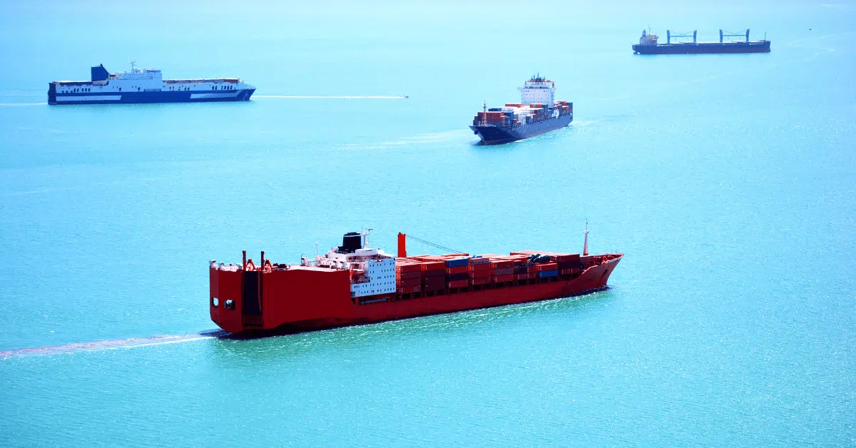
While transiting a traffic lane, following a traffic separation lane, or passing a shoreline/rock, a close-by vessel must be kept on the planned track. Thus, the cross-track distance should be zero or kept to a minimum as the available sea room is less to avoid a hazard or danger.
Parallel indexing is a technique used as a measure to monitor the progress of a vessel on the track to minimise the cross-track distance, and to keep the vessel at a safe distance from the shoreline or rock.
The basic principle of this method is that to maintain and follow a particular course – a bearing line drawn parallel to the original course with a known and fixed perpendicular distance between both lines is used as a reference.
The increase or decrease of the perpendicular distance between the bearing lines drawn parallel to course-line and the ship’s position at any time will indicate cross-track deviation from the initial planned course and thus advise a mariner if he/she is falling out of a traffic lane, entering a traffic separation zone or closing into a navigational danger.
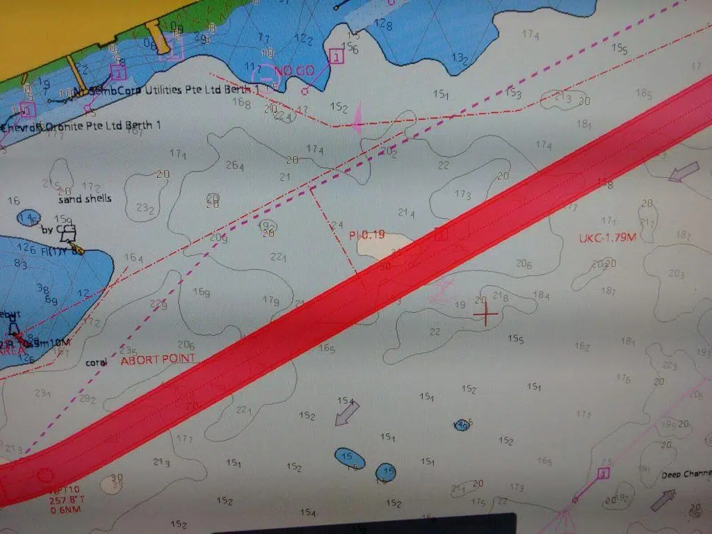
The reference point from which the bearing line parallel to the course line is drawn is taken as a fixed buoy, lighthouse, headland, jetty, fixed platform or fixed radar conspicuous object. Thus, the imaginary line drawn parallel to the course to steer from a fixed object is always at a fixed distance from it.
While a ship follows a course to steer, parallel indexing ensures it always remains at a fixed distance from a hazard. Thus, parallel indexing is a method to alert a mariner that he has come close to a navigational hazard.
Parallel indexing technique can be used as it is provided in the options menu of marine radar where distance between parallel lines can be fixed and it can also be set to maintain safe distance from two fixed objects simultaneously on either side of a vessel.
Upon selecting Parallel Index lines in the options menu – a set of floating lines parallel to each other appears on the screen. The orientation of these lines can be set by using the EBL marker and the distance between these lines adjusted by the VRM marker.
Another method is to use a floating EBL, which is to be offset and positioned at the hazard or object and aligned parallel to the course to steer.
A floating VRM circle of a fixed radius can be placed on the object so that the course to steer is a tangent to this range circle. As the ship comes inside, the VRM circle gives indication to mariners to alter course to stay at a safe distance from the danger.
Parallel indexing from floating objects cannot be accepted unless they have been first checked for a position. A floating object will not give an accurate position. As an essential part of the passage plan, Parallel indexing is a recommended feature to be incorporated into various legs of the passage.
Solas Ch. V reg. 34, IMP Res. A 893 and OCIMF Guidelines require prudent selection of fixed objects before using them for parallel indexing.
Over to you..
Do you have other important information on using Parallel Indexing technique for ship navigation?
Let’s know in the comments below.
Do you have info to share with us ? Suggest a correction

About Author
Abhishek Bhanawat is a chief officer who has worked on various types of tankers. He specializes in Crude Oil and Product Tankers. He is highly passionate about his work and loves to sail.
Latest Marine Navigation Articles You Would Like:


Subscribe To Our Newsletters
By subscribing, you agree to our Privacy Policy and may receive occasional deal communications; you can unsubscribe anytime.
Continue sending maritime tips,thank you.
1. @ Exodus: this is not tip, it is basic knowledge for nautical officers.
2. Parallel Indexing is a valuable tool to judge the drift but it should always be used together with bearings or other means of position fixing. In confined waters nobody should rely on the GPS only
Question: Does Parallel Indexing serves its purpose even when the distance is more than say 4 miles? does it have some standard or minimum distance requirement?
@Captain.IMR : Very rightly and aptly put up sir.
@Aschenvale : There aren’t any requirements I am aware of regarding this. However during some Oil major inspections it was pointed as an observation about using PI beyond 20 miles . Usually in coastal passages land is within 10-40 miles range and hence radars as general practice are used upto or less than 16 miles scale unless long range scanning is required or can be justified during a coastal passage where shallows and coastal traffic , fishing vessels are a concern. Hence it is most effective below 20 miles
thankyou sir. this is good material for me
This is an invaluable piece of material. Can you please explain further by using an example. I need to understand terms like:’No less than’, ‘No more than’, etc. Thanks.
Abhishek u are right concerned parallel index line.when am stilled onboard as 3rd officer,we normally use this method,why in nigeria coastal area,channels;not every ship have echo sounder,some admiralty navigation chat may dued and may not correspond to physical object arround also tide atimes risen and speed of current may be either +2 or -2 it depend.Meanwhile when two ships were in chennel(i.e one is coming out and one is proceed in)
Parallel indexing is indeed used to monitor cross track of the vessel and thereby to keep the vessel on track.
As in these days most of the vessels are paperless, ie, equipped with dual ECDIS, monitoring of the passage is made simpler and all the passage related information is available on screen.
But the relevance of parallel indexing is as follows
1) PI is independent of GPS or such GNSS. It uses RADAR range and bearing lines for track monitoring. That means, even with an ECDIS failure, OOW can still maintain the vessel on track; even though, may be for a short period.
2) As PI is effectively used during coastal passages, both track monitoring and traffic monitoring can be done from the same RADAR monitor.
I just thought of listing down the relevance of parallel indexing as many navigators could have the doubt as to why PI is still important when there are dual ECDIS with all most all voyage related information displayed on one screen.
H i,
Can you please advice how to verify the buoy position to use it for parallel indexing with regards to
“Parallel indexing from floating objects cannot be accepted unless they have been first checked for a position”
Do a radar overlsy to confirm the bouy is in the charted position.
Does it have no disadvantages !!
Question: Parallel Indexing, Why is it considered as the safest when doing coastal navigation.
Dear sir ,
Good day.
Does the ship can navigate in ocean passage by PI ?
Tks sir.
ABOUT the parallel index!!
I have got a little bunch of guys (in total some four or five) and they simply CAN’T understand the meaning of the parallel index system! So, I do tell them that the PI-system is a kind of a tool used to ease the stabilization of the course heading, amongst other things in order to prevent running aground! But the guys I’m refering to, seem to make it all sound like Greek, as they still don’t take the point!!
Many thanks for this web site 🙂 Regards, Jacob Hansen, Scandinavia.