

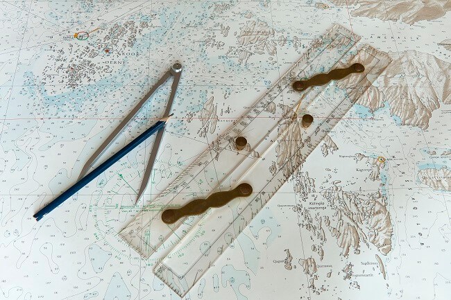
How Nautical Almanac Helps in Marine Navigation?
Nautical Almanac is a type of navigation aid, which describes the position of celestial bodies to assist navigators at sea to determine their ship’s position using celestial navigation.
The nautical almanac contains astronomical data for the entire year which assists the navigator in making astronomical calculations on ship. Reading the bullet points will be easier if one has the almanac open in front for easy reference.
A nautical almanac uses the time position as per the GMT (Greenwich Meridian Time) along with the position of the earth to calculate and predict the sea-routes. The position of the sun, the moon, the other planets and 57 main stars are also used along with the GMT and the earth’s position to calculate the potential navigational routes.
- The inside of the front cover has tables for the correction of altitudes of Sun, stars and planets. The page after that provides tables for low altitudes of observations for the same
- The next page has data about refractional corrections
- The following page has a list of contents of the almanac, a calendar of the phases of the Moon, the year’s calendar, maps and notes which give information about the occurrence of eclipses over the year
- Onto planet notes and diagram for the year that shows LMT of the meridian passage of the Sun and the planets Mercury, Venus, Mars, Jupiter and Saturn. The diagram indicates period when each planet is too close to the Sun for observation and when planets are visible. It also gives an indication of the position of the planets at twilight
- Then there is an ephemeris for the whole year calculated against GMT and dates. Each pair of facing pages contain info for three days regarding:
- ARIES: GHA for Aries given hourly and the GMT of its Greenwich merpass time for the middle day. GMT of Greenwich merpass for preceding and succeeding dates can be obtained by adding or subtracting respectively
- PLANETS: The GHA and declination of the planets Venus, Mars, Jupiter and Saturn are given hourly along with their magnitudes and their ‘v’ and ‘d’ corrections as applicable and their SHA at 0000 hours. GMT of the middle date and GMT of their Greenwich merpass on that date are given below the star tables.
- STARS: The SHAs and declination of 57 stars are provided (valid for all three days)
- SUN: GHA and declination given for each hour
- MOON: GHA, declination and ‘v’ and ‘d’ corrections and horizontal parallax values are provided for each hour
- Explanations are given that explain the arrangement and the principle behind the almanac along with examples to show the appropriate use of the information within the almanac. There are instructions given to explain the usage of the current year’s almanac for usage in the following year as well
- Tables are given to differentiate and understand GMT and the standard times across the world
- Star charts are provided for the identification of all the important stars with respect to navigation. Magnitude of the stars along with their constellations in which they belong along with SHAs, declination are given for each month
- The Polaris table give the a0, a1, a2 corrections to be applied to the true altitude of Polaris to obtain the latitude are laid out. There is also a table to obtain the Azimuth of Polaris. Clear explanations for the usage of these tables are laid out along with examples
- Table for the conversion of arc to time is also given
- Increment and correction tables are required to obtain the GHA of the Sun, Planets, Aries and Moon as well as the declinations of Sun, Moon and planets
- Interpolations tables are given for usage in calculating the LMT of sunrise, sunset, twilight, moonrise, moonset and Moon’s merpass for the required latitude. There are two tables the former is the abovementioned and the latter is for calculating the longitude
- The index to the 57 stars gives the number, magnitude, SHA and declination of these stars in the right order
- Altitude correction tables for the Moon have corrections to be applied to calculate observed altitudes of the Moon’s upper or lower limbs
Two of the most reliable and famous almanacs that are published until today are Great Britain’s The Nautical Almanac published by HMS Nautical Almanac Office since the 18th century and United States’ almanac published by US Naval Observatory since the 19th century.
Apart from these two almanacs, there are several other nautical almanacs published around the world. But only these two almanacs are referred as being official. The others are mostly known as almanacs that have business or commercial value. The earliest publication of these types of almanacs started around the late 19th century. Moreover, there are also smaller and abridged nautical almanacs that available but it is best if one invests in a bigger almanac. Among many other sources, a free almanac for celestial navigation can be found at https://www.thenauticalalmanac.com/. If one wishes to download a copy of the nautical almanac 2017 , they can get it here.

A device known as the sextant is used to find the location and position of a particular star or the moon or a planet in the visible skyline. With the help of a device known as the marine chronometer the time of the position of this particular star or the moon or a planet is found out. This noted time and the location are then found in the almanac to mark the sea-route to be followed. The value is always approximate because of the margin of errors while using the sextant and the chronometer.
A nautical almanac is not something that is known to every person. But in terms of marine travel, it is like the Bible. Nautical almanac has been used by sailors since ages and continues to do so even in this technologically advanced age.
All the information about the nautical almanac laid out in this article is not definitive for only indicative. Various books by the Admiralty or the Principles Of Navigation book by Capt. Joseph and Capt. Rewari are standard books to understand the almanac in detail.
Disclaimer: The authors’ views expressed in this article do not necessarily reflect the views of Marine Insight. Data and charts, if used, in the article have been sourced from available information and have not been authenticated by any statutory authority. The author and Marine Insight do not claim it to be accurate nor accept any responsibility for the same. The views constitute only the opinions and do not constitute any guidelines or recommendation on any course of action to be followed by the reader.
The article or images cannot be reproduced, copied, shared or used in any form without the permission of the author and Marine Insight.
Do you have info to share with us ? Suggest a correction

About Author
Shilavadra Bhattacharjee is a shipbroker with a background in commercial operations after having sailed onboard as a Third Officer. His interests primarily lie in the energy sector, books and travelling.
Latest Marine Navigation Articles You Would Like:


Subscribe To Our Newsletters
By subscribing, you agree to our Privacy Policy and may receive occasional deal communications; you can unsubscribe anytime.
is good and helpful
@Godfrey: Thank you ??. Please do share and support.